Randonnée V.T.T. Rivedoux-Plage - plage - Photo
 jef1956
jef1956

Utilisateur

© OpenStreetMap contributors
Longueur
Longueur
20 km
Altitude max
Altitude max
23 m
Dénivelé positif
Dénivelé positif
139 m
Km-Effort
Km-Effort  
22 km
Altitude min
Altitude min
3 m
Dénivelé négatif
Dénivelé négatif
140 m
Boucle
Boucle
Oui
Date de création :
2024-09-06 15:34:02.973
Dernière modification :
2024-09-06 17:38:30.816

(0 Avis)

V.T.T.
V.T.T.
2h03
Difficulté : Moyen

Scannez ce code QR pour ouvrir la randonnée dans l'application SityTrail

Application GPS de randonnée GRATUITE

Logo SityTrail SityTrail

IGN / Instituts géographiques

Télécharger SityTrail sur l'App Store Télécharger SityTrail sur Google Play

Logo SityTrail SityTrail World

Le monde est à vous

Télécharger SityTrail sur l'App Store Télécharger SityTrail sur Google Play Télécharger SityTrail sur Huawei AppGallery

À propos

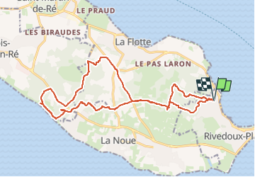
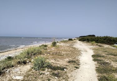
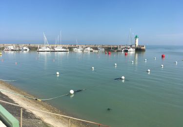
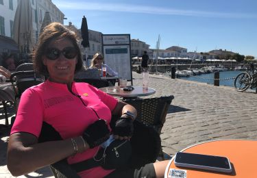
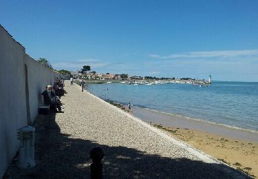
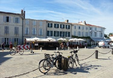
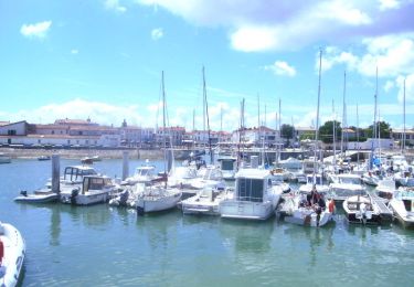
Randonnée V.T.T. de 20 km à découvrir à Nouvelle-Aquitaine, Charente-Maritime, Rivedoux-Plage. Cette randonnée est proposée par jef1956.

Profil altimétrique

Photos

Localisation

Pays :
France
Région :
Nouvelle-Aquitaine
Département/Province :
Charente-Maritime
Commune :
Rivedoux-Plage
Localité :
Unknown
Départ:(UTM)
632335 ; 5114208 (30T) N.

Randonnées à proximité

Randonnée Marche Rivedoux-Plage - Sentier du littoral - Rivedoux-Plage - Photo
Marche
tracegps

Marche

Moyen
(1)
Rivedoux-Plage, Nouvelle-Aquitaine, Charente-Maritime, France
10,8 km | 11,6 km-effort
2h 30min
Oui
Randonnée Marche Rivedoux-Plage - Les Gros Peux - Rivedoux - Photo
Marche
tracegps

Marche

Facile
(5)
Rivedoux-Plage, Nouvelle-Aquitaine, Charente-Maritime, France
6,4 km | 6,8 km-effort
1h 30min
Oui
Randonnée V.T.T. Sainte-Marie-de-Ré - 17-vtt-ste-marie-rivedoux-la-flotte-st-martin-39km - Photo
V.T.T.
SyMA

V.T.T.

Moyen
Sainte-Marie-de-Ré, Nouvelle-Aquitaine, Charente-Maritime, France
39 km | 42 km-effort
4h 50min
Oui
Randonnée Marche Rivedoux-Plage - Rivedoux plage - Photo
Marche
richardsimopons

Marche

Difficile
Rivedoux-Plage, Nouvelle-Aquitaine, Charente-Maritime, France
11,6 km | 12,3 km-effort
2h 51min
Oui
Randonnée A pied Rivedoux-Plage - Sentier du littoral - Photo
A pied
GUIDE+

A pied

Facile
Rivedoux-Plage, Nouvelle-Aquitaine, Charente-Maritime, France
10,6 km | 11,5 km-effort
2h 36min
Non
Randonnée V.T.C. Sainte-Marie-de-Ré - 20200908 île de Ré sud - Photo
V.T.C.
NanardPet

V.T.C.

Très facile
Sainte-Marie-de-Ré, Nouvelle-Aquitaine, Charente-Maritime, France
42 km | 44 km-effort
7h 20min
Oui
Randonnée Marche Rivedoux-Plage - Ile de Ré-La Flotte Rivedoux - Photo
Marche
Bobol

Marche

Facile
Rivedoux-Plage, Nouvelle-Aquitaine, Charente-Maritime, France
21 km | 23 km-effort
4h 24min
Non
Randonnée V.T.T. Sainte-Marie-de-Ré - IDR002-Île de Ré-Pont-Anse Aiguillon - Photo
V.T.T.
Polo-31

V.T.T.

Très facile
Sainte-Marie-de-Ré, Nouvelle-Aquitaine, Charente-Maritime, France
49 km | 52 km-effort
3h 29min
Non
Randonnée V.T.T. Sainte-Marie-de-Ré - Sainte Marie de Ré - Rivedoux Plage - La Flotte - Photo
V.T.T.
tracegps

V.T.T.

Moyen
Sainte-Marie-de-Ré, Nouvelle-Aquitaine, Charente-Maritime, France
15,5 km | 16,5 km-effort
1h 15min
Oui


Fermer
Mes abonnements