Randonnée Cyclotourisme Neuf-Brisach - ADN - Cesenatico Tronçon 6 - Photo

ADN - Cesenatico Tronçon 6

 m.devil
m.devil

Utilisateur

© OpenStreetMap contributors
Longueur
Longueur
96 km
Altitude max
Altitude max
740 m
Dénivelé positif
Dénivelé positif
1031 m
Km-Effort
Km-Effort  
109 km
Altitude min
Altitude min
188 m
Dénivelé négatif
Dénivelé négatif
521 m
Boucle
Boucle
Non
Date de création :
2024-08-21 09:00:34.377
Dernière modification :
2024-08-28 06:49:58.968

(0 Avis)

Cyclotourisme
Cyclotourisme
--
Difficulté : Très difficile

Scannez ce code QR pour ouvrir la randonnée dans l'application SityTrail

Application GPS de randonnée GRATUITE

Logo SityTrail SityTrail

IGN / Instituts géographiques

Télécharger SityTrail sur l'App Store Télécharger SityTrail sur Google Play

Logo SityTrail SityTrail World

Le monde est à vous

Télécharger SityTrail sur l'App Store Télécharger SityTrail sur Google Play Télécharger SityTrail sur Huawei AppGallery

À propos

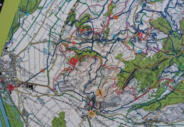
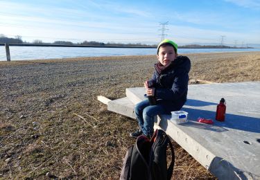
Randonnée Cyclotourisme de 96 km à découvrir à Grand Est, Haut-Rhin, Neuf-Brisach. Cette randonnée est proposée par m.devil.

Description

Projet

Profil altimétrique

Points d'intérêt

Point d'intérêt Neuf-Brisach - Camping Vauban - Neuf-Brisach - Photo
m.devil

Localisation

Pays :
France
Région :
Grand Est
Département/Province :
Haut-Rhin
Commune :
Neuf-Brisach
Localité :
Unknown
Départ:(UTM)
390794 ; 5319160 (32U) N.

Randonnées à proximité

Randonnée Marche Vogelgrun - vogel - Photo
Marche
Marcel Momi

Marche

Difficile
Vogelgrun, Grand Est, Haut-Rhin, France
15,7 km | 17,8 km-effort
20h 19min
Oui
Randonnée Course à pied Widensolen - Widensolen, un tracé 100% plaisir  - Photo
Course à pied
zazie

Course à pied

Très facile
Widensolen, Grand Est, Haut-Rhin, France
12,1 km | 12,9 km-effort
1h 1min
Oui
Randonnée Marche Vogelgrun - vogelgrun - Photo
Marche
Marcel Momi

Marche

Difficile
Vogelgrun, Grand Est, Haut-Rhin, France
15,5 km | 17,7 km-effort
4h 8min
Oui
Randonnée Cyclotourisme Biesheim - ELSASS BIKE 2020 - ETAPE 6 - Photo
Cyclotourisme
Christian Arnold

Cyclotourisme

Facile
Biesheim, Grand Est, Haut-Rhin, France
36 km | 38 km-effort
2h 38min
Non
Randonnée Marche Wolfgantzen - Markstein - Moorfeld - Photo
Marche
jmbilger

Marche

Très facile
Wolfgantzen, Grand Est, Haut-Rhin, France
43 km | 67 km-effort
2h 15min
Non
Randonnée Marche Vogelgrun - ile rhin - Photo
Marche
Hub6877

Marche

Moyen
Vogelgrun, Grand Est, Haut-Rhin, France
7,4 km | 8,3 km-effort
2h 27min
Oui
Randonnée Marche Vogelgrun - vogelgrun - Photo
Marche
Marcel Momi

Marche

Très difficile
Vogelgrun, Grand Est, Haut-Rhin, France
17,1 km | 19,4 km-effort
4h 59min
Oui
Randonnée Marche Vogelgrun - vog - Photo
Marche
Marcel Momi

Marche

Difficile
Vogelgrun, Grand Est, Haut-Rhin, France
16,2 km | 18,1 km-effort
3h 47min
Oui
Randonnée Marche Vogelgrun - vogelgrun - Photo
Marche
Marcel Momi

Marche

Difficile
Vogelgrun, Grand Est, Haut-Rhin, France
12,7 km | 14,5 km-effort
3h 9min
Oui


Fermer
Mes abonnements