![](/images/other/stat-length.png)
![Randonnée Marche Plœmeur - GR34 Kerroc'h (Ploemeur) au Pouldu (Kerrou) Réalisé 16 990m +132m - Photo](https://media.geolcdn.com/t/1900/400/ext.pjpeg?maxdim=2&url=https%3A%2F%2Fstatic1.geolcdn.com%2Fsiteimages%2Fupload%2Ffiles%2F1553511878bg_sport_marche.png)
GR34 Kerroc'h (Ploemeur) au Pouldu (Kerrou) Réalisé 16 990m +132m
DanielROLLET
Utilisateur
![Longueur](/images/other/stat-length.png)
Longueur
17 km
![Altitude max](https://static1.geolcdn.com/siteimages/upload/files/1508320355ic_sort_altitude_max_24dp.png)
Altitude max
21 m
![Dénivelé positif](https://static1.geolcdn.com/siteimages/upload/files/1508320355ic_sort_den_pos_24dp.png)
Dénivelé positif
132 m
![Km-Effort](/images/other/stat-length.png)
Km-Effort
18,7 km
![Altitude min](https://static1.geolcdn.com/siteimages/upload/files/1508320355ic_sort_altitude_min_24dp.png)
Altitude min
-2 m
![Dénivelé négatif](https://static1.geolcdn.com/siteimages/upload/files/1508320355ic_sort_den_neg_24dp.png)
Dénivelé négatif
129 m
![Boucle](https://static1.geolcdn.com/siteimages/upload/files/16400158638029165_repeat_loop_refresh_sync_direction_icon.png)
Boucle
Non
Date de création :
2024-08-15 08:29:01.743
Dernière modification :
2024-08-15 08:46:46.358
![Marche](https://static1.geolcdn.com/sitytour/trail-icons/101.png)
6h25
Difficulté : Moyen
![Scannez ce code QR pour ouvrir la randonnée dans l'application SityTrail](https://capi.geolives.com/qq0zvz2zws4bq2lad0pu/sitytour/trails/4155940/qr.png?size=200)
Application GPS de randonnée GRATUITE
À propos
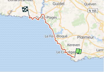
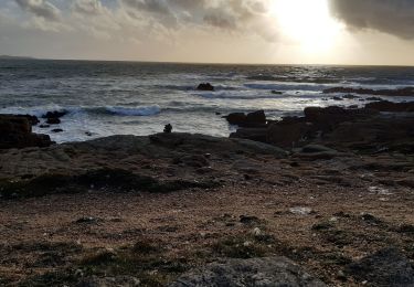
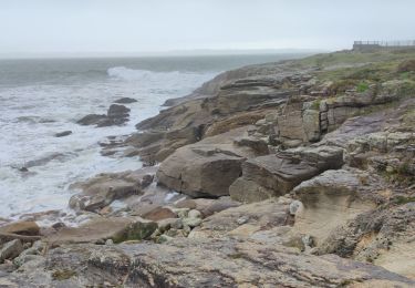
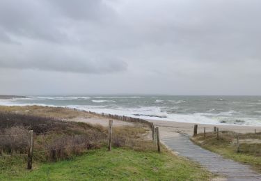
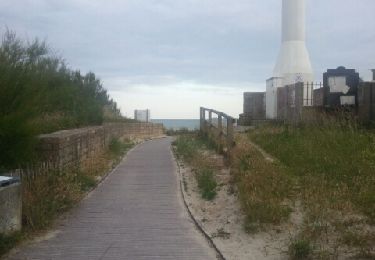
Randonnée Marche de 17 km à découvrir à Bretagne, Morbihan, Plœmeur. Cette randonnée est proposée par DanielROLLET.
Description
2024 08 05 - Beau temps chaud
Départ 8h00 studio Kerroc'h/arrivée 14h25 hôtel NAECO (soit 6h25)
Passage de la Laïta au Bas Pouldu avec le bac.
Bu un pot au Bas Pouldu
Ralenti par nombreuses petites "grimpettes" ma douleur au mollet récurrente
Localisation
Pays :
France
Région :
Bretagne
Département/Province :
Morbihan
Commune :
Plœmeur
Localité :
Unknown
Départ:(Dec)
Départ:(UTM)
466007 ; 5283332 (30T) N.
Commentaires
Randonnées à proximité
![Randonnée A pied Plœmeur - De la côte bleue aux collines blanches - Photo](https://media.geolcdn.com/t/375/260/b1cbbfe3-b17d-4626-90da-fc66faf0ad01.jpeg&format=jpg&maxdim=2)
![A pied A pied](https://static1.geolcdn.com/sitytour/trail-icons/100.png)
De la côte bleue aux collines blanches
A pied
Facile
Plœmeur,
Bretagne,
Morbihan,
France
![](/images/other/stat-length.png)
9,1 km | 10 km-effort
2h 16min
![](https://static1.geolcdn.com/siteimages/upload/files/16400158638029165_repeat_loop_refresh_sync_direction_icon.png)
Non
![Randonnée Marche Guidel - PR_56_Guidel_CA_03_Circuit3a_Autour-De-L-Etang-De-Lannenec_20240428 - Photo](https://media.geolcdn.com/t/375/260/6e0f082b-d9fc-4937-a2ef-b1992f251e56.jpg&format=jpg&maxdim=2)
![Marche Marche](https://static1.geolcdn.com/sitytour/trail-icons/101.png)
PR_56_Guidel_CA_03_Circuit3a_Autour-De-L-Etang-De-Lannenec_20240428
Marche
Facile
Guidel,
Bretagne,
Morbihan,
France
![](/images/other/stat-length.png)
10,2 km | 11,7 km-effort
2h 39min
![](https://static1.geolcdn.com/siteimages/upload/files/16400158638029165_repeat_loop_refresh_sync_direction_icon.png)
Non
![Randonnée Marche Plœmeur - PR_56_Ploemeur_AA_01_Circuit3a_Des-Sables_20240413 - Photo](https://media.geolcdn.com/t/375/260/098300ee-8857-4731-b3c5-e3bdc7128025.jpg&format=jpg&maxdim=2)
![Marche Marche](https://static1.geolcdn.com/sitytour/trail-icons/101.png)
PR_56_Ploemeur_AA_01_Circuit3a_Des-Sables_20240413
Marche
Difficile
Plœmeur,
Bretagne,
Morbihan,
France
![](/images/other/stat-length.png)
13,6 km | 14,9 km-effort
2h 53min
![](https://static1.geolcdn.com/siteimages/upload/files/16400158638029165_repeat_loop_refresh_sync_direction_icon.png)
Oui
![Randonnée Marche Larmor-Plage - LORIENT plage-rade - Photo](https://media.geolcdn.com/t/375/260/ext.jpg?maxdim=2&url=https%3A%2F%2Fstatic1.geolcdn.com%2Fsiteimages%2Fupload%2Ffiles%2F1553511878bg_sport_marche.png)
![Marche Marche](https://static1.geolcdn.com/sitytour/trail-icons/101.png)
LORIENT plage-rade
Marche
Moyen
(1)
Larmor-Plage,
Bretagne,
Morbihan,
France
![](/images/other/stat-length.png)
10,4 km | 11,4 km-effort
2h 36min
![](https://static1.geolcdn.com/siteimages/upload/files/16400158638029165_repeat_loop_refresh_sync_direction_icon.png)
Non
![Randonnée Marche Plœmeur - circuit des sables - Photo](https://media.geolcdn.com/t/375/260/9f31c0d5-bc1c-4279-9e36-8c2a982e291d.jpg&format=jpg&maxdim=2)
![Marche Marche](https://static1.geolcdn.com/sitytour/trail-icons/101.png)
circuit des sables
Marche
Moyen
Plœmeur,
Bretagne,
Morbihan,
France
![](/images/other/stat-length.png)
13,1 km | 14,4 km-effort
3h 23min
![](https://static1.geolcdn.com/siteimages/upload/files/16400158638029165_repeat_loop_refresh_sync_direction_icon.png)
Oui
![Randonnée Marche Plœmeur - Les rives du Ter - Photo](https://media.geolcdn.com/t/375/260/ab92fa16-d5e9-4f03-b5d2-7ef27a7bc822.jpg&format=jpg&maxdim=2)
![Marche Marche](https://static1.geolcdn.com/sitytour/trail-icons/101.png)
Les rives du Ter
Marche
Facile
Plœmeur,
Bretagne,
Morbihan,
France
![](/images/other/stat-length.png)
9,2 km | 10,5 km-effort
1h 34min
![](https://static1.geolcdn.com/siteimages/upload/files/16400158638029165_repeat_loop_refresh_sync_direction_icon.png)
Oui
![Randonnée Marche Plœmeur - Kerroc'h La pointe du Talud - Photo](https://media.geolcdn.com/t/375/260/b43d6783-ca16-4931-b6c6-8dca7d39be68.jpg&format=jpg&maxdim=2)
![Marche Marche](https://static1.geolcdn.com/sitytour/trail-icons/101.png)
Kerroc'h La pointe du Talud
Marche
Facile
Plœmeur,
Bretagne,
Morbihan,
France
![](/images/other/stat-length.png)
4,4 km | 4,8 km-effort
49min
![](https://static1.geolcdn.com/siteimages/upload/files/16400158638029165_repeat_loop_refresh_sync_direction_icon.png)
Oui
![Randonnée Marche Plœmeur - Saint Jude - Les Kaolins - Fort Bloqué - Photo](https://media.geolcdn.com/t/375/260/31519eb1-c94d-4494-8791-a7c97591c2f0.jpg&format=jpg&maxdim=2)
![Marche Marche](https://static1.geolcdn.com/sitytour/trail-icons/101.png)
Saint Jude - Les Kaolins - Fort Bloqué
Marche
Facile
(1)
Plœmeur,
Bretagne,
Morbihan,
France
![](/images/other/stat-length.png)
13,1 km | 14,6 km-effort
2h 21min
![](https://static1.geolcdn.com/siteimages/upload/files/16400158638029165_repeat_loop_refresh_sync_direction_icon.png)
Oui
![Randonnée Vélo Plœmeur - Chemin de Ploemeur vers la mer - Photo](https://media.geolcdn.com/t/375/260/ext.jpg?maxdim=2&url=https%3A%2F%2Fservices.sitytrail.com%2FGeolivesWS%2FDownloadMedia.ashx%3FTrailID%3D200606%26Media%3D20130625211439.jpeg)
![Vélo Vélo](https://static1.geolcdn.com/sitytour/trail-icons/200.png)
Chemin de Ploemeur vers la mer
Vélo
Facile
(1)
Plœmeur,
Bretagne,
Morbihan,
France
![](/images/other/stat-length.png)
3,9 km | 4,4 km-effort
15min
![](https://static1.geolcdn.com/siteimages/upload/files/16400158638029165_repeat_loop_refresh_sync_direction_icon.png)
Non