Randonnée  Marchastel - 2024-08-15_09h51m51_FFRandonnée-La_Motte_de_Marchastel - Photo

2024-08-15_09h51m51_FFRandonnée-La_Motte_de_Marchastel

 lavit.pascal
lavit.pascal

Utilisateur

© OpenStreetMap contributors
Longueur
Longueur
6 km
Altitude max
Altitude max
1239 m
Dénivelé positif
Dénivelé positif
118 m
Km-Effort
Km-Effort  
7,5 km
Altitude min
Altitude min
1151 m
Dénivelé négatif
Dénivelé négatif
113 m
Boucle
Boucle
Oui
Date de création :
2024-08-15 07:51:51.263
Dernière modification :
2024-08-15 07:51:50.946

(0 Avis)


Scannez ce code QR pour ouvrir la randonnée dans l'application SityTrail

Application GPS de randonnée GRATUITE

Logo SityTrail SityTrail

IGN / Instituts géographiques

Télécharger SityTrail sur l'App Store Télécharger SityTrail sur Google Play

Logo SityTrail SityTrail World

Le monde est à vous

Télécharger SityTrail sur l'App Store Télécharger SityTrail sur Google Play Télécharger SityTrail sur Huawei AppGallery

À propos

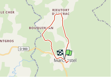
Randonnée de 6 km à découvrir à Occitanie, Lozère, Marchastel. Cette randonnée est proposée par lavit.pascal.

Description

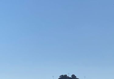
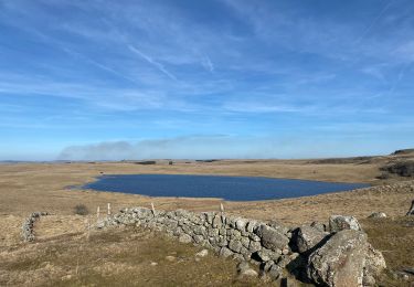
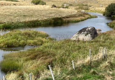
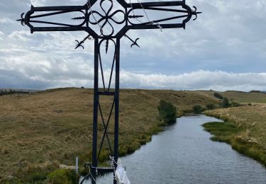
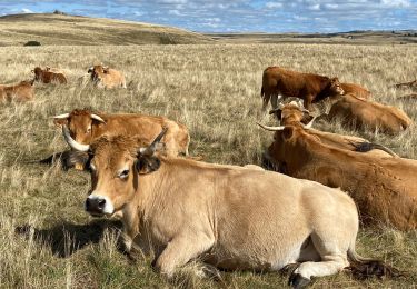
En quittant Marchastel, vous marcherez dans un paysage marqué par l'omniprésence de blocs erratiques. Ces blocs granitiques de tailles diverses ont été arrachés par la calotte glaciaire qui recouvrait l'Aubrac à l'ère Quaternaire. Lors de sa fonte, il y a environ 15 000 ans, ces blocs ont été abandonnés sur place. Vous terminerez en grimpant sur la Motte de Marchastel, piton volcanique qui offre une splendide vue panoramique.

Profil altimétrique

Localisation

Pays :
France
Région :
Occitanie
Département/Province :
Lozère
Commune :
Marchastel
Localité :
Unknown
Départ:(UTM)
508421 ; 4944153 (31T) N.

Randonnées à proximité

Randonnée Marche Prinsuéjols-Malbouzon - Prinsuejouls GR 65 - Photo
Marche
GUIDE
antignacs

Marche

Très facile
(1)
Prinsuéjols-Malbouzon, Occitanie, Lozère, France
15,3 km | 18,4 km-effort
3h 42min
Oui
Randonnée Marche Marchastel - Rieutort lac san andeol cascade deroc  - Photo
Marche
GUIDE
antignacs

Marche

Facile
(1)
Marchastel, Occitanie, Lozère, France
17,5 km | 20 km-effort
4h 52min
Oui
Randonnée Marche Nasbinals - Nasbinals Montorzier Aubrac GR65 - Photo
Marche
GUIDE
antignacs

Marche

Moyen
Nasbinals, Occitanie, Lozère, France
25 km | 31 km-effort
6h 28min
Oui
Randonnée Marche Nasbinals - Nasbinals - Photo
Marche
avdem

Marche

Très facile
Nasbinals, Occitanie, Lozère, France
5,8 km | 7,2 km-effort
2h 3min
Non
Randonnée sport Nasbinals - Nasbinal - Aubrac - Photo
sport
Lucile Duchamp

sport

Très facile
(1)
Nasbinals, Occitanie, Lozère, France
42 km | 50 km-effort
Inconnu
Non
Randonnée Marche Nasbinals - Tour des lacs - Photo
Marche
GUIDE
antignacs

Marche

Facile
Nasbinals, Occitanie, Lozère, France
21 km | 25 km-effort
5h 8min
Oui
Randonnée Marche Marchastel - Phot’Aubrac 2023 - Photo
Marche
GUIDE
antignacs

Marche

Très facile
Marchastel, Occitanie, Lozère, France
12,6 km | 14,6 km-effort
4h 0min
Oui
Randonnée Marche Marchastel - Le Bes Rieutord Montgros variante  - Photo
Marche
GUIDE
antignacs

Marche

Très facile
Marchastel, Occitanie, Lozère, France
11,6 km | 14,2 km-effort
2h 55min
Oui
Randonnée Marche Nasbinals - Nasbinals col d’Aubrac Montorzier - Photo
Marche
GUIDE
antignacs

Marche

Moyen
Nasbinals, Occitanie, Lozère, France
23 km | 28 km-effort
5h 51min
Oui


Fermer
Mes abonnements