Randonnée Vélo électrique Couladère - boucle cazeres version 13_8_2024 - Photo

boucle cazeres version 13_8_2024

 philbea31
philbea31

Utilisateur

© OpenStreetMap contributors
Longueur
Longueur
63 km
Altitude max
Altitude max
534 m
Dénivelé positif
Dénivelé positif
786 m
Km-Effort
Km-Effort  
74 km
Altitude min
Altitude min
234 m
Dénivelé négatif
Dénivelé négatif
791 m
Boucle
Boucle
Oui
Date de création :
2024-08-13 17:17:04.733
Dernière modification :
2024-08-13 17:17:42.443

(0 Avis)

Vélo électrique
Vélo électrique
4h00
Difficulté : Facile

Scannez ce code QR pour ouvrir la randonnée dans l'application SityTrail

Application GPS de randonnée GRATUITE

Logo SityTrail SityTrail

IGN / Instituts géographiques

Télécharger SityTrail sur l'App Store Télécharger SityTrail sur Google Play

Logo SityTrail SityTrail World

Le monde est à vous

Télécharger SityTrail sur l'App Store Télécharger SityTrail sur Google Play Télécharger SityTrail sur Huawei AppGallery

À propos

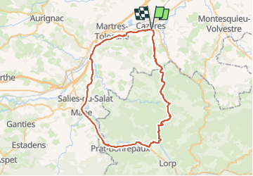
Randonnée Vélo électrique de 63 km à découvrir à Occitanie, Haute-Garonne, Couladère. Cette randonnée est proposée par philbea31.

Profil altimétrique

Localisation

Pays :
France
Région :
Occitanie
Département/Province :
Haute-Garonne
Commune :
Couladère
Localité :
Unknown
Départ:(UTM)
344727 ; 4784895 (31T) N.

Randonnées à proximité

Randonnée V.T.T. Cazères - Merde - Photo
V.T.T.
Franck Pineau

V.T.T.

Moyen
Cazères, Occitanie, Haute-Garonne, France
17,3 km | 21 km-effort
1h 39min
Oui
Randonnée Vélo de route Cazères - Autour de Cazeres 2 - Photo
Vélo de route
Gérard Crespo

Vélo de route

Très difficile
Cazères, Occitanie, Haute-Garonne, France
81 km | 91 km-effort
4h 20min
Oui
Randonnée Vélo de route Cazères - Autour de Cazères - Photo
Vélo de route
Gérard Crespo

Vélo de route

Très difficile
Cazères, Occitanie, Haute-Garonne, France
81 km | 90 km-effort
5h 21min
Oui
Randonnée Marche Saint-Christaud - st christaud- le plan- stchristaud - Photo
Marche
gerard.beyne

Marche

Facile
Saint-Christaud, Occitanie, Haute-Garonne, France
7,4 km | 9,7 km-effort
2h 1min
Oui
Randonnée V.T.T. Palaminy - Petites Pyrénées - Cazères Tounis - Photo
V.T.T.
tracegps

V.T.T.

Difficile
(1)
Palaminy, Occitanie, Haute-Garonne, France
24 km | 35 km-effort
2h 30min
Oui
Randonnée Vélo électrique Couladère - boucle cazeres 11 - Photo
Vélo électrique
philbea31

Vélo électrique

Facile
Couladère, Occitanie, Haute-Garonne, France
63 km | 74 km-effort
4h 0min
Oui
Randonnée Marche Mauran - mauran 9 300 fait 2024 - Photo
Marche
pidjam

Marche

Moyen
Mauran, Occitanie, Haute-Garonne, France
9,1 km | 13 km-effort
2h 12min
Oui
Randonnée Marche Mauran - Mauran l9d300 - Photo
Marche
pidjam

Marche

Difficile
Mauran, Occitanie, Haute-Garonne, France
8,9 km | 13 km-effort
2h 57min
Oui
Randonnée Marche Saint-Christaud - Gensac fait 2023 - Photo
Marche
pidjam

Marche

Facile
Saint-Christaud, Occitanie, Haute-Garonne, France
8,2 km | 0 m-effort
2h 8min
Oui


Fermer
Mes abonnements