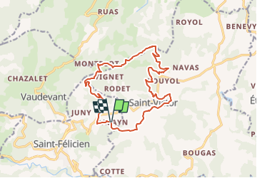
![](/images/other/stat-length.png)
![Randonnée Randonnée équestre Saint-Félicien - 07 - St Félicien : Balade de saint Victor 17 kms - Photo](https://media.geolcdn.com/t/1900/400/ext.pjpeg?maxdim=2&url=https%3A%2F%2Fstatic1.geolcdn.com%2Fsiteimages%2Fupload%2Ffiles%2F1524743154cheval.jpg)
07 - St Félicien : Balade de saint Victor 17 kms
KITTYPRUNE
Utilisateur
![Longueur](/images/other/stat-length.png)
![Altitude max](https://static1.geolcdn.com/siteimages/upload/files/1508320355ic_sort_altitude_max_24dp.png)
![Dénivelé positif](https://static1.geolcdn.com/siteimages/upload/files/1508320355ic_sort_den_pos_24dp.png)
![Km-Effort](/images/other/stat-length.png)
![Altitude min](https://static1.geolcdn.com/siteimages/upload/files/1508320355ic_sort_altitude_min_24dp.png)
![Dénivelé négatif](https://static1.geolcdn.com/siteimages/upload/files/1508320355ic_sort_den_neg_24dp.png)
![Boucle](https://static1.geolcdn.com/siteimages/upload/files/16400158638029165_repeat_loop_refresh_sync_direction_icon.png)
![Randonnée équestre](https://static1.geolcdn.com/sitytour/trail-icons/301.png)
3h12
Difficulté : Moyen
![Scannez ce code QR pour ouvrir la randonnée dans l'application SityTrail](https://capi.geolives.com/qq0zvz2zws4bq2lad0pu/sitytour/trails/4150832/qr.png?size=200)
Application GPS de randonnée GRATUITE
À propos
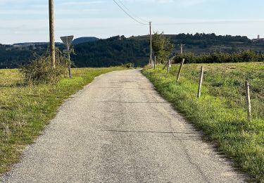
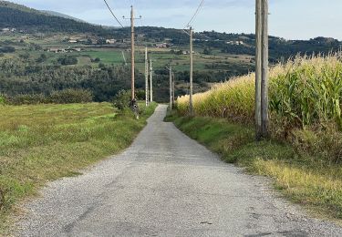
Randonnée Randonnée équestre de 16,4 km à découvrir à Auvergne-Rhône-Alpes, Ardèche, Saint-Félicien. Cette randonnée est proposée par KITTYPRUNE.
Description
Ces itinéraires font partie de la collection de EquiLiberté : www.equiliberte.org Ils sont proposés par 07410 L'Étape Cavalière du Balayn à St Félicien. http://etapecavalieredubalayn.fr/index.php/contact-reservation/ Circuits NON ACCESSIBLE aux attelages
Localisation
Commentaires
Randonnées à proximité
![Randonnée A pied Saint-Félicien - Randonnée : Raillon - Photo](https://media.geolcdn.com/t/375/260/51992f57-6b59-485f-b49c-078e1a2be3a8.jpeg&format=jpg&maxdim=2)
![A pied A pied](https://static1.geolcdn.com/sitytour/trail-icons/100.png)
A pied
![](/images/other/stat-length.png)
![](https://static1.geolcdn.com/siteimages/upload/files/16400158638029165_repeat_loop_refresh_sync_direction_icon.png)
![Randonnée A pied Saint-Victor - Randonnée : Montplot - Photo](https://media.geolcdn.com/t/375/260/3e3075bd-4ef8-4bf2-b291-1b8cf58ebaf6.jpeg&format=jpg&maxdim=2)
![A pied A pied](https://static1.geolcdn.com/sitytour/trail-icons/100.png)
A pied
![](/images/other/stat-length.png)
![](https://static1.geolcdn.com/siteimages/upload/files/16400158638029165_repeat_loop_refresh_sync_direction_icon.png)
![Randonnée A pied Saint-Félicien - Randonnée : Les Grands Massifs - Photo](https://media.geolcdn.com/t/375/260/130ea24b-c347-4848-82ee-ae7dd18548fd.jpeg&format=jpg&maxdim=2)
![A pied A pied](https://static1.geolcdn.com/sitytour/trail-icons/100.png)
A pied
![](/images/other/stat-length.png)
![](https://static1.geolcdn.com/siteimages/upload/files/16400158638029165_repeat_loop_refresh_sync_direction_icon.png)
![Randonnée A pied Saint-Félicien - Randonnée : Le Moulin des Gaillards - Photo](https://media.geolcdn.com/t/375/260/51992f57-6b59-485f-b49c-078e1a2be3a8.jpeg&format=jpg&maxdim=2)
![A pied A pied](https://static1.geolcdn.com/sitytour/trail-icons/100.png)
A pied
![](/images/other/stat-length.png)
![](https://static1.geolcdn.com/siteimages/upload/files/16400158638029165_repeat_loop_refresh_sync_direction_icon.png)
![Randonnée A pied Saint-Félicien - Randonnée : De Saint-Félicien à Vaudevant - Photo](https://media.geolcdn.com/t/375/260/51992f57-6b59-485f-b49c-078e1a2be3a8.jpeg&format=jpg&maxdim=2)
![A pied A pied](https://static1.geolcdn.com/sitytour/trail-icons/100.png)
A pied
![](/images/other/stat-length.png)
![](https://static1.geolcdn.com/siteimages/upload/files/16400158638029165_repeat_loop_refresh_sync_direction_icon.png)
![Randonnée A pied Saint-Victor - Randonnée : Tour du Pays de Saint-Félicien - Jour 3 - Photo](https://media.geolcdn.com/t/375/260/61d8ce39-87ac-4e46-bad7-109fc9caaec1.jpeg&format=jpg&maxdim=2)
![A pied A pied](https://static1.geolcdn.com/sitytour/trail-icons/100.png)
A pied
![](/images/other/stat-length.png)
![](https://static1.geolcdn.com/siteimages/upload/files/16400158638029165_repeat_loop_refresh_sync_direction_icon.png)
![Randonnée A pied Colombier-le-Vieux - Randonnée : Les Gorges de la Daronne - Photo](https://media.geolcdn.com/t/375/260/7d5bf8d7-536d-4ec6-b9e5-10c88c4ee681.jpeg&format=jpg&maxdim=2)
![A pied A pied](https://static1.geolcdn.com/sitytour/trail-icons/100.png)
A pied
![](/images/other/stat-length.png)
![](https://static1.geolcdn.com/siteimages/upload/files/16400158638029165_repeat_loop_refresh_sync_direction_icon.png)
![Randonnée A pied Saint-Félicien - Randonnée : Tour du Pays de Saint-Félicien - Photo](https://media.geolcdn.com/t/375/260/3e3075bd-4ef8-4bf2-b291-1b8cf58ebaf6.jpeg&format=jpg&maxdim=2)
![A pied A pied](https://static1.geolcdn.com/sitytour/trail-icons/100.png)
A pied
![](/images/other/stat-length.png)
![](https://static1.geolcdn.com/siteimages/upload/files/16400158638029165_repeat_loop_refresh_sync_direction_icon.png)
![Randonnée A pied Saint-Félicien - Randonnée : La Daronne - Photo](https://media.geolcdn.com/t/375/260/51992f57-6b59-485f-b49c-078e1a2be3a8.jpeg&format=jpg&maxdim=2)
![A pied A pied](https://static1.geolcdn.com/sitytour/trail-icons/100.png)
A pied
![](/images/other/stat-length.png)
![](https://static1.geolcdn.com/siteimages/upload/files/16400158638029165_repeat_loop_refresh_sync_direction_icon.png)