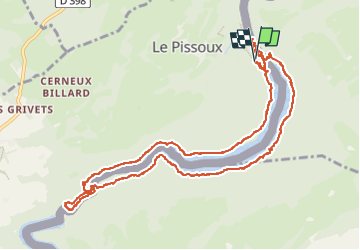
![](/images/other/stat-length.png)
![Randonnée Marche Villers-le-Lac - barrage chatelot saut du doubs le pissoux - Photo](https://media.geolcdn.com/t/1900/400/9ddc7c9d-2c55-4135-9d10-7ad8ed129ab8.jpg&format=pjpeg&maxdim=2)
barrage chatelot saut du doubs le pissoux
eltonnermou
Utilisateur
![Longueur](/images/other/stat-length.png)
![Altitude max](https://static1.geolcdn.com/siteimages/upload/files/1508320355ic_sort_altitude_max_24dp.png)
![Dénivelé positif](https://static1.geolcdn.com/siteimages/upload/files/1508320355ic_sort_den_pos_24dp.png)
![Km-Effort](/images/other/stat-length.png)
![Altitude min](https://static1.geolcdn.com/siteimages/upload/files/1508320355ic_sort_altitude_min_24dp.png)
![Dénivelé négatif](https://static1.geolcdn.com/siteimages/upload/files/1508320355ic_sort_den_neg_24dp.png)
![Boucle](https://static1.geolcdn.com/siteimages/upload/files/16400158638029165_repeat_loop_refresh_sync_direction_icon.png)
![Marche](https://static1.geolcdn.com/sitytour/trail-icons/101.png)
5h35
Difficulté : Facile
![Scannez ce code QR pour ouvrir la randonnée dans l'application SityTrail](https://capi.geolives.com/qq0zvz2zws4bq2lad0pu/sitytour/trails/4137874/qr.png?size=200)
Application GPS de randonnée GRATUITE
À propos
Randonnée Marche de 11,9 km à découvrir à Bourgogne-Franche-Comté, Doubs, Villers-le-Lac. Cette randonnée est proposée par eltonnermou.
Description
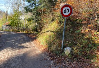
parking au barrage du chatelot, commune Le Pissoux
Attention, randonnée sur le territoire Helvétique, pensez à vos papiers d'identité.
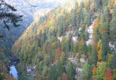
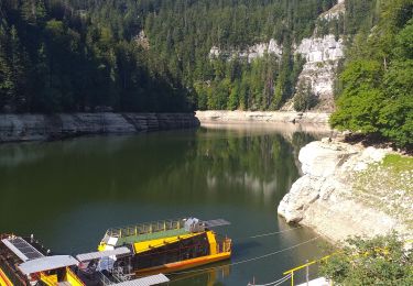
Très belle randonnée dans les massifs jurassiens. La vue sur le barrage montre la grandeur de cet ouvrage. La traversé du Doubs sur ces plotets "nénuphares" est ludique, attention pour les personnes sensibles au vertige.
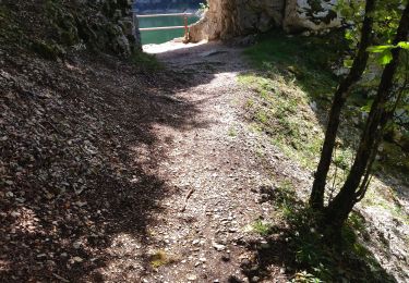
Le passage, des nombreux tunnels "naturels" en direction de Les Brenets, est très agréable. Prenez le temps d'admirer le saut du Doubs surtout s'il y a de l'eau ....
Le retour, une fois le barrage à nouveau atteint, se fait par la montée de plus de 250 marches.
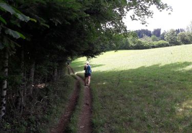
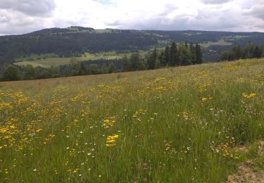
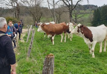
Vous traversez de nombreux espaces où vivent des animaux sauvages, profitez en.
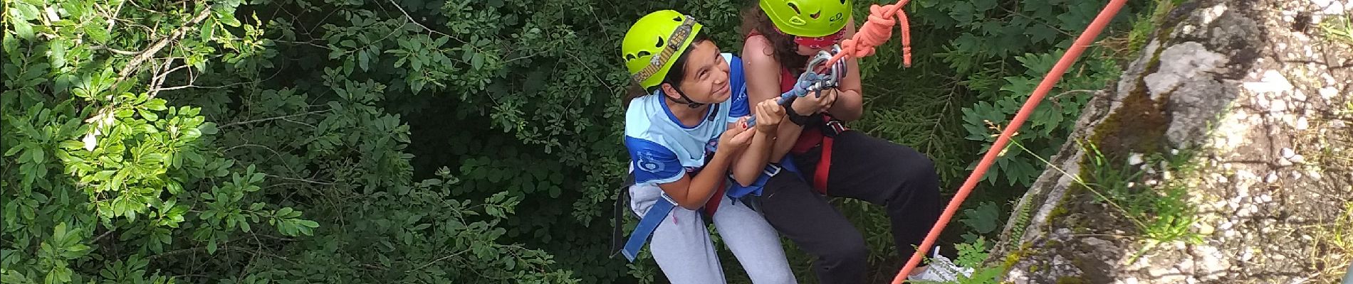
Localisation
Commentaires
Randonnées à proximité
![Randonnée Marche Villers-le-Lac - Le saut du Doubs et le Châtelard - Photo](https://media.geolcdn.com/t/375/260/ext.jpg?maxdim=2&url=https%3A%2F%2Fservices.sitytrail.com%2FGeolivesWS%2FDownloadMedia.ashx%3FTrailID%3D792633%26Media%3Dfix__20170717135052.jpg)
![Marche Marche](https://static1.geolcdn.com/sitytour/trail-icons/101.png)
Marche
![](/images/other/stat-length.png)
![](https://static1.geolcdn.com/siteimages/upload/files/16400158638029165_repeat_loop_refresh_sync_direction_icon.png)
![Randonnée A pied Le Locle - Hôtel du Saut du Doubs - Gare des Brenets - Photo](https://media.geolcdn.com/t/375/260/4e2b223b-5d1f-4722-b3d5-d37a87436a7c.jpeg&format=jpg&maxdim=2)
![A pied A pied](https://static1.geolcdn.com/sitytour/trail-icons/100.png)
A pied
![](/images/other/stat-length.png)
![](https://static1.geolcdn.com/siteimages/upload/files/16400158638029165_repeat_loop_refresh_sync_direction_icon.png)
![Randonnée A pied Le Locle - Les Frêtes - fixme - Photo](https://media.geolcdn.com/t/375/260/0dfa81c4-ea86-4670-a9e2-4edd9205728f.jpeg&format=jpg&maxdim=2)
![A pied A pied](https://static1.geolcdn.com/sitytour/trail-icons/100.png)
A pied
![](/images/other/stat-length.png)
![](https://static1.geolcdn.com/siteimages/upload/files/16400158638029165_repeat_loop_refresh_sync_direction_icon.png)
![Randonnée A pied Les Planchettes - Barrage du Châtelot - Saut du Doubs - Photo](https://media.geolcdn.com/t/375/260/c02ae770-bade-4d71-b842-d1ab9da9220c.jpeg&format=jpg&maxdim=2)
![A pied A pied](https://static1.geolcdn.com/sitytour/trail-icons/100.png)
A pied
![](/images/other/stat-length.png)
![](https://static1.geolcdn.com/siteimages/upload/files/16400158638029165_repeat_loop_refresh_sync_direction_icon.png)
![Randonnée Marche Villers-le-Lac - 25 saut du Doubs jura 08.08.24 - Photo](https://media.geolcdn.com/t/375/260/69ae39c7-0bce-4ef7-9703-c0fe844c8fa9.jpg&format=jpg&maxdim=2)
![Marche Marche](https://static1.geolcdn.com/sitytour/trail-icons/101.png)
Marche
![](/images/other/stat-length.png)
![](https://static1.geolcdn.com/siteimages/upload/files/16400158638029165_repeat_loop_refresh_sync_direction_icon.png)
![Randonnée Marche Villers-le-Lac - Le Pisoux - Photo](https://media.geolcdn.com/t/375/260/4a715c23-f970-4542-83cb-bb9163df6e0f.jpg&format=jpg&maxdim=2)
![Marche Marche](https://static1.geolcdn.com/sitytour/trail-icons/101.png)
Marche
![](/images/other/stat-length.png)
![](https://static1.geolcdn.com/siteimages/upload/files/16400158638029165_repeat_loop_refresh_sync_direction_icon.png)
![Randonnée Marche Villers-le-Lac - Saut du Doubs - Photo](https://media.geolcdn.com/t/375/260/5bf04ea4-00d2-4096-ab82-e6f5e7455237.jpg&format=jpg&maxdim=2)
![Marche Marche](https://static1.geolcdn.com/sitytour/trail-icons/101.png)
Marche
![](/images/other/stat-length.png)
![](https://static1.geolcdn.com/siteimages/upload/files/16400158638029165_repeat_loop_refresh_sync_direction_icon.png)
![Randonnée Marche Villers-le-Lac - les brenets - Photo](https://media.geolcdn.com/t/375/260/a20ac90c-06ca-4725-aa0c-13349df47b73.jpg&format=jpg&maxdim=2)
![Marche Marche](https://static1.geolcdn.com/sitytour/trail-icons/101.png)
Marche
![](/images/other/stat-length.png)
![](https://static1.geolcdn.com/siteimages/upload/files/16400158638029165_repeat_loop_refresh_sync_direction_icon.png)