17 km | 24 km-effort
montgolfiere
Michel BECKERS
Utilisateur
Longueur
18,6 km
Altitude max
502 m
Dénivelé positif
773 m
Km-Effort
29 km
Altitude min
244 m
Dénivelé négatif
709 m
Boucle
Non
Date de création :
2024-07-22 17:54:43.743
Dernière modification :
2024-07-22 19:32:45.083
1h37
Difficulté : Très facile
Application GPS de randonnée GRATUITE
À propos
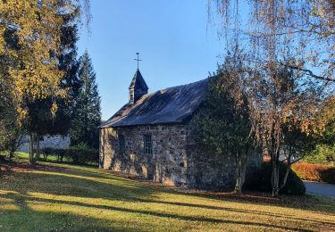
Randonnée Montgolfière de 18,6 km à découvrir à Wallonie, Liège, Trois-Ponts. Cette randonnée est proposée par Michel BECKERS.
Localisation
Pays :
Belgique
Région :
Wallonie
Département/Province :
Liège
Commune :
Trois-Ponts
Localité :
Unknown
Départ:(Dec)
Départ:(UTM)
698785 ; 5582513 (31U) N.
Commentaires
Randonnées à proximité
RB-Lg-14_Chevron_via-racc
Marche
Très difficile
(5)
Stoumont,
Wallonie,
Liège,
Belgique
5h 28min
Oui
RB-Lg-14_Chevron
Marche
Très difficile
(4)
Stoumont,
Wallonie,
Liège,
Belgique
22 km | 30 km-effort
6h 53min
Oui
rando reharmont 6/11/2020
Marche
Moyen
(3)
Lierneux,
Wallonie,
Liège,
Belgique
18,4 km | 25 km-effort
4h 34min
Oui
Monceau Cheneux barrage sup.Coo
Marche
Très facile
(3)
Stoumont,
Wallonie,
Liège,
Belgique
7 km | 10,7 km-effort
1h 51min
Oui
Rahier - Xhierfomont - Meuville
Marche
Très facile
(1)
Stoumont,
Wallonie,
Liège,
Belgique
7,6 km | 9,9 km-effort
Inconnu
Oui
Chevron - rectangles vert - 8,2 km
Marche
Très facile
(1)
Stoumont,
Wallonie,
Liège,
Belgique
8,2 km | 10,6 km-effort
Inconnu
Oui
3ponts
Marche
Très facile
(1)
Trois-Ponts,
Wallonie,
Liège,
Belgique
27 km | 38 km-effort
5h 30min
Non
haute bodeux . lac supérieur coo . ancienne barrière
Marche
Facile
Trois-Ponts,
Wallonie,
Liège,
Belgique
11,1 km | 14,1 km-effort
3h 25min
Oui
Promenade de Trou de Bra
Marche
Moyen
Lierneux,
Wallonie,
Liège,
Belgique
4 km | 6,5 km-effort
1h 28min
Oui