![](/images/other/stat-length.png)
![Randonnée Marche Condom - St Jacques Étape 26 réalisée - Photo](https://media.geolcdn.com/t/1900/400/ext.pjpeg?maxdim=2&url=https%3A%2F%2Fstatic1.geolcdn.com%2Fsiteimages%2Fupload%2Ffiles%2F1553511878bg_sport_marche.png)
St Jacques Étape 26 réalisée
Jean-MarieFaux
Utilisateur
![Longueur](/images/other/stat-length.png)
Longueur
19,4 km
![Altitude max](https://static1.geolcdn.com/siteimages/upload/files/1508320355ic_sort_altitude_max_24dp.png)
Altitude max
180 m
![Dénivelé positif](https://static1.geolcdn.com/siteimages/upload/files/1508320355ic_sort_den_pos_24dp.png)
Dénivelé positif
326 m
![Km-Effort](/images/other/stat-length.png)
Km-Effort
24 km
![Altitude min](https://static1.geolcdn.com/siteimages/upload/files/1508320355ic_sort_altitude_min_24dp.png)
Altitude min
72 m
![Dénivelé négatif](https://static1.geolcdn.com/siteimages/upload/files/1508320355ic_sort_den_neg_24dp.png)
Dénivelé négatif
283 m
![Boucle](https://static1.geolcdn.com/siteimages/upload/files/16400158638029165_repeat_loop_refresh_sync_direction_icon.png)
Boucle
Non
Date de création :
2016-03-28 00:00:00.0
Dernière modification :
2016-03-28 00:00:00.0
![Marche](https://static1.geolcdn.com/sitytour/trail-icons/101.png)
5h06
Difficulté : Moyen
![Scannez ce code QR pour ouvrir la randonnée dans l'application SityTrail](https://capi.geolives.com/qq0zvz2zws4bq2lad0pu/sitytour/trails/412886/qr.png?size=200)
Application GPS de randonnée GRATUITE
À propos
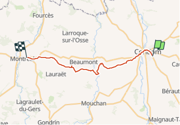
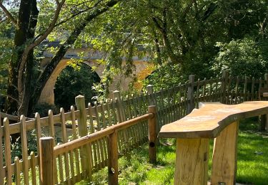
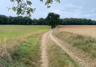
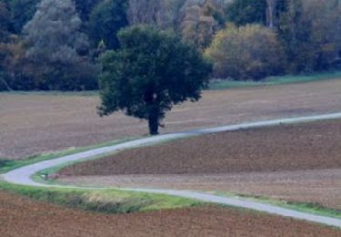
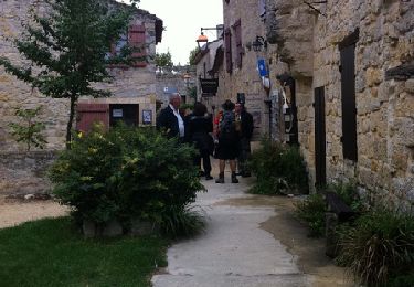
Randonnée Marche de 19,4 km à découvrir à Occitanie, Gers, Condom. Cette randonnée est proposée par Jean-MarieFaux.
Description
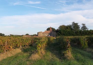
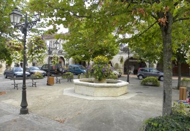
De Codom à Montréal du Gers à travers vignes et champs, avec visite du village fortifié de Larresingles le Carcassonne du Gers mais en très petit.
Localisation
Pays :
France
Région :
Occitanie
Département/Province :
Gers
Commune :
Condom
Localité :
Unknown
Départ:(Dec)
Départ:(UTM)
289861 ; 4869865 (31T) N.
Commentaires
Randonnées à proximité
![Randonnée Marche Condom - Graziac- Abbaye de Flaran -Valence sur Baise- Graziac - Photo](https://media.geolcdn.com/t/375/260/75f546cf-a09c-4959-82e7-3e7ab7fefc70.jpg&format=jpg&maxdim=2)
![Marche Marche](https://static1.geolcdn.com/sitytour/trail-icons/101.png)
Graziac- Abbaye de Flaran -Valence sur Baise- Graziac
Marche
Facile
Condom,
Occitanie,
Gers,
France
![](/images/other/stat-length.png)
8,8 km | 9,9 km-effort
2h 10min
![](https://static1.geolcdn.com/siteimages/upload/files/16400158638029165_repeat_loop_refresh_sync_direction_icon.png)
Oui
![Randonnée Marche Condom - Mon Compostelle onzième étape - Photo](https://media.geolcdn.com/t/375/260/ext.jpg?maxdim=2&url=https%3A%2F%2Fservices.sitytrail.com%2FGeolivesWS%2FDownloadMedia.ashx%3FTrailID%3D684885%26Media%3D8fb92e84-cadc-42d4-b2ff-39a15c5b7a5b.JPG)
![Marche Marche](https://static1.geolcdn.com/sitytour/trail-icons/101.png)
Mon Compostelle onzième étape
Marche
Moyen
Condom,
Occitanie,
Gers,
France
![](/images/other/stat-length.png)
47 km | 57 km-effort
10h 10min
![](https://static1.geolcdn.com/siteimages/upload/files/16400158638029165_repeat_loop_refresh_sync_direction_icon.png)
Non
![Randonnée Marche Condom - CONDOM - Photo](https://media.geolcdn.com/t/375/260/ext.jpg?maxdim=2&url=https%3A%2F%2Fservices.sitytrail.com%2FGeolivesWS%2FDownloadMedia.ashx%3FTrailID%3D151118%26Media%3D20120902135107.jpg)
![Marche Marche](https://static1.geolcdn.com/sitytour/trail-icons/101.png)
![Randonnée Marche Condom - Rando santé - Photo](https://media.geolcdn.com/t/375/260/b34f7946-1960-4e77-ad34-7c751e4abe48.jpg&format=jpg&maxdim=2)
![Marche Marche](https://static1.geolcdn.com/sitytour/trail-icons/101.png)
Rando santé
Marche
Très difficile
Condom,
Occitanie,
Gers,
France
![](/images/other/stat-length.png)
144 km | 173 km-effort
17h 3min
![](https://static1.geolcdn.com/siteimages/upload/files/16400158638029165_repeat_loop_refresh_sync_direction_icon.png)
Non
![Randonnée Marche Condom - GR 65 Condom > Montréal - Photo](https://media.geolcdn.com/t/375/260/16184925-109b-4dd6-a795-63f94ae4679b.jpg&format=jpg&maxdim=2)
![Marche Marche](https://static1.geolcdn.com/sitytour/trail-icons/101.png)
GR 65 Condom > Montréal
Marche
Facile
Condom,
Occitanie,
Gers,
France
![](/images/other/stat-length.png)
18,7 km | 23 km-effort
5h 37min
![](https://static1.geolcdn.com/siteimages/upload/files/16400158638029165_repeat_loop_refresh_sync_direction_icon.png)
Non
![Randonnée Marche Condom - 32-03-Au Cœur de Gascogne Auch-26km-102-5571- - Photo](https://media.geolcdn.com/t/375/260/02c91045-eedd-4462-b2fd-de5b499cb801.jpg&format=jpg&maxdim=2)
![Marche Marche](https://static1.geolcdn.com/sitytour/trail-icons/101.png)
32-03-Au Cœur de Gascogne Auch-26km-102-5571-
Marche
Très facile
Condom,
Occitanie,
Gers,
France
![](/images/other/stat-length.png)
26 km | 34 km-effort
6min
![](https://static1.geolcdn.com/siteimages/upload/files/16400158638029165_repeat_loop_refresh_sync_direction_icon.png)
Non
![Randonnée Marche Condom - Autour de Condom - Photo](https://media.geolcdn.com/t/375/260/ext.jpg?maxdim=2&url=https%3A%2F%2Fservices.sitytrail.com%2FGeolivesWS%2FDownloadMedia.ashx%3FTrailID%3D172674%26Media%3D14056_1.jpg)
![Marche Marche](https://static1.geolcdn.com/sitytour/trail-icons/101.png)
![Randonnée Marche Condom - De Condom à Larressingle - Photo](https://media.geolcdn.com/t/375/260/ext.jpg?maxdim=2&url=https%3A%2F%2Fservices.sitytrail.com%2FGeolivesWS%2FDownloadMedia.ashx%3FTrailID%3D107194%26Media%3D12048_1.jpg)
![Marche Marche](https://static1.geolcdn.com/sitytour/trail-icons/101.png)
De Condom à Larressingle
Marche
Difficile
Condom,
Occitanie,
Gers,
France
![](/images/other/stat-length.png)
16,2 km | 19,4 km-effort
3h 30min
![](https://static1.geolcdn.com/siteimages/upload/files/16400158638029165_repeat_loop_refresh_sync_direction_icon.png)
Oui
![Randonnée Marche Condom - 1 Condom - Photo](https://media.geolcdn.com/t/375/260/ext.jpg?maxdim=2&url=https%3A%2F%2Fstatic1.geolcdn.com%2Fsiteimages%2Fupload%2Ffiles%2F1553511878bg_sport_marche.png)
![Marche Marche](https://static1.geolcdn.com/sitytour/trail-icons/101.png)