Randonnée Marche Villanders - Villandro - Villanderer Alm - Stöfflhütte et prairies marécageuses - Photo

Villanderer Alm - Stöfflhütte et prairies marécageuses

 VacheKiri67
VacheKiri67

Utilisateur

© OpenStreetMap contributors
Longueur
Longueur
15,7 km
Altitude max
Altitude max
2125 m
Dénivelé positif
Dénivelé positif
469 m
Km-Effort
Km-Effort  
22 km
Altitude min
Altitude min
1750 m
Dénivelé négatif
Dénivelé négatif
470 m
Boucle
Boucle
Oui
Date de création :
2024-07-20 08:14:11.989
Dernière modification :
2024-08-01 13:16:05.38

(0 Avis)

Marche
Marche
5h03
Difficulté : Moyen

Scannez ce code QR pour ouvrir la randonnée dans l'application SityTrail

Application GPS de randonnée GRATUITE

Logo SityTrail SityTrail

IGN / Instituts géographiques

Télécharger SityTrail sur l'App Store Télécharger SityTrail sur Google Play

Logo SityTrail SityTrail World

Le monde est à vous

Télécharger SityTrail sur l'App Store Télécharger SityTrail sur Google Play Télécharger SityTrail sur Huawei AppGallery

À propos

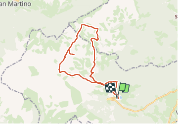
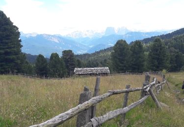
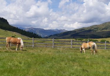
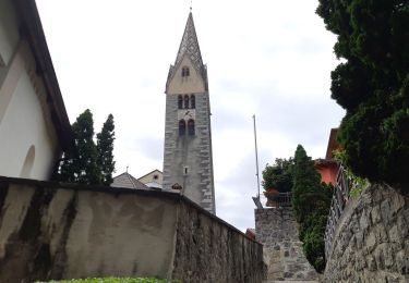
Randonnée Marche de 15,7 km à découvrir à Trentin-Haut-Adige, Haut-Adige, Villanders - Villandro. Cette randonnée est proposée par VacheKiri67.

Description

Faite le 20/07/2024.
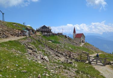
D'après "Wandern in Südtirol : Eisacktal, das Tal der Wege - 88 Zur Stöfflhütte auf der Villanderer Alm". Durée indiquée pour le circuit : 4h30. Parking payant à la Gasserhütte.
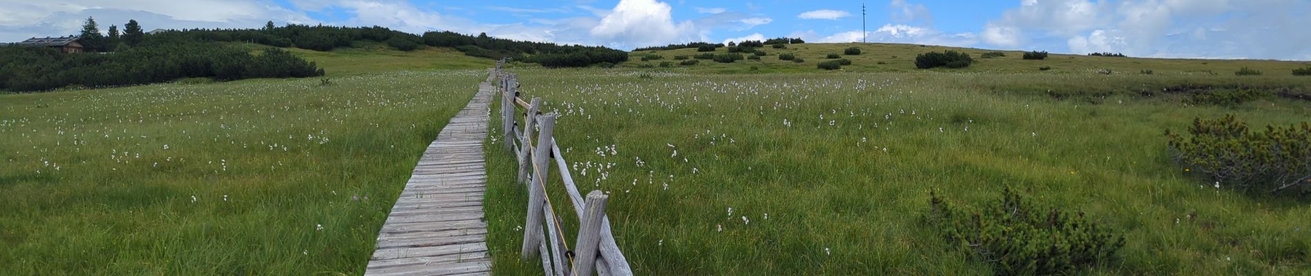
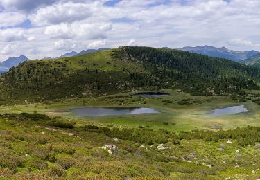
Le sentier 1 traverse des prairies marécageuses ! Il ne faut donc pas quitter le sentier. Parfois il y a des planches, parfois pas. Attendez vous à avoir les pieds mouillés.
Bonnes chaussures indispensables.

Profil altimétrique

Photos

51 photos au total. Cliquez sur une photo pour les afficher toutes dans la galerie.

Localisation

Pays :
Italie
Région :
Trentin-Haut-Adige
Département/Province :
Haut-Adige
Commune :
Villanders - Villandro
Localité :
Unknown
Départ:(UTM)
690504 ; 5168331 (32T) N.

Randonnées à proximité

Randonnée A pied Waidbruck - Ponte Gardena - IT-2 - Photo
A pied
PRO

A pied

Facile
Waidbruck - Ponte Gardena, Trentin-Haut-Adige, Haut-Adige, Italie
6,5 km | 14,5 km-effort
3h 17min
Non
Randonnée A pied Villanders - Villandro - AVS 3 - Sarnthein - Gasteiger Sattel - Photo
A pied
PRO

A pied

Facile
Villanders - Villandro, Trentin-Haut-Adige, Haut-Adige, Italie
10,9 km | 19,4 km-effort
4h 24min
Non
Randonnée A pied Villanders - Villandro - AVS 6 - Gasserhütte - Schloss Reinegg - Photo
A pied
PRO

A pied

Facile
Villanders - Villandro, Trentin-Haut-Adige, Haut-Adige, Italie
8,8 km | 14,9 km-effort
3h 23min
Non
Randonnée Marche Klausen - Chiusa - Latzfonser Kreuz - Photo
Marche
VacheKiri67

Marche

Difficile
Klausen - Chiusa, Trentin-Haut-Adige, Haut-Adige, Italie
14,8 km | 27 km-effort
6h 24min
Oui
Randonnée A pied Lajen - Laion - Vogelweider Rundweg - Photo
A pied
PRO

A pied

Facile
Lajen - Laion, Trentin-Haut-Adige, Haut-Adige, Italie
7,2 km | 12,6 km-effort
2h 52min
Oui
Randonnée A pied Waidbruck - Ponte Gardena - IT-35 - Photo
A pied
PRO

A pied

Très difficile
Waidbruck - Ponte Gardena, Trentin-Haut-Adige, Haut-Adige, Italie
39 km | 70 km-effort
15h 55min
Non
Randonnée Marche Villanders - Villandro - Villanderer Alm - Photo
Marche
VacheKiri67

Marche

Moyen
Villanders - Villandro, Trentin-Haut-Adige, Haut-Adige, Italie
13,7 km | 22 km-effort
4h 44min
Oui
Randonnée Marche Villanders - Villandro - villander - Photo
Marche
VacheKiri67

Marche

Moyen
Villanders - Villandro, Trentin-Haut-Adige, Haut-Adige, Italie
13 km | 0 m-effort
4h 42min
Oui
Randonnée Marche Barbian - Barbiano - barbian - Photo
Marche
VacheKiri67

Marche

Moyen
Barbian - Barbiano, Trentin-Haut-Adige, Haut-Adige, Italie
5,8 km | 11,6 km-effort
2h 43min
Oui


Fermer
Mes abonnements