


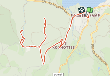

11,3 km | 16,2 km-effort

Utilisateur


Application GPS de randonnée GRATUITE
 SityTrail
IGN / Instituts géographiques
SityTrail World
Le monde est à vous
Randonnée Vélo électrique de 8 km à découvrir à Grand Est, Vosges, Gérardmer. Cette randonnée est proposée par yves62410.
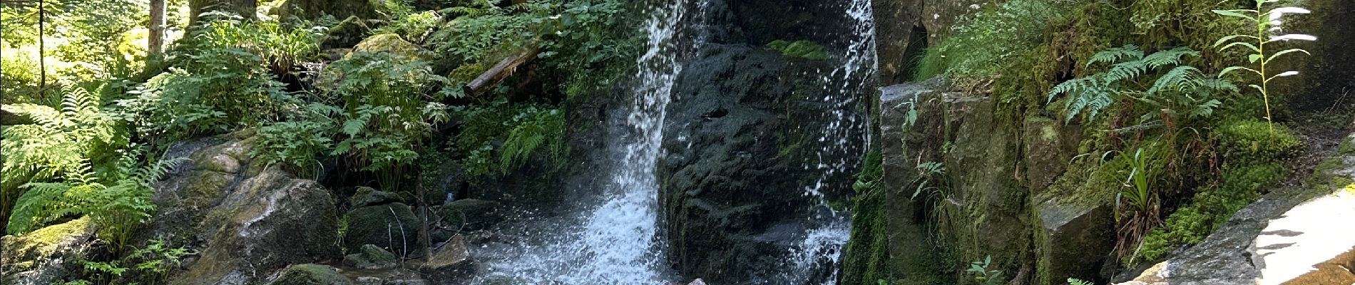
Vers la tour de Merel et la cascade de Merel approche en V. E. Puis marche à pied ne pas oublier les cadenas.
Attention la cascade de Merel nécessite des chaussures de marche.


Marche

Marche nordique

V.T.T.

Marche

Marche

Marche
V.T.T.
Marche