![](/images/other/stat-length.png)
![Randonnée Cyclotourisme Unknown - Descente Danube - Linz à Grein - Photo](https://media.geolcdn.com/t/1900/400/ext.pjpeg?maxdim=2&url=https%3A%2F%2Fstatic1.geolcdn.com%2Fsiteimages%2Fupload%2Ffiles%2F1524743154velo.jpg)
Descente Danube - Linz à Grein
s0c7
Utilisateur
![Longueur](/images/other/stat-length.png)
Longueur
72 km
![Altitude max](https://static1.geolcdn.com/siteimages/upload/files/1508320355ic_sort_altitude_max_24dp.png)
Altitude max
352 m
![Dénivelé positif](https://static1.geolcdn.com/siteimages/upload/files/1508320355ic_sort_den_pos_24dp.png)
Dénivelé positif
519 m
![Km-Effort](/images/other/stat-length.png)
Km-Effort
79 km
![Altitude min](https://static1.geolcdn.com/siteimages/upload/files/1508320355ic_sort_altitude_min_24dp.png)
Altitude min
225 m
![Dénivelé négatif](https://static1.geolcdn.com/siteimages/upload/files/1508320355ic_sort_den_neg_24dp.png)
Dénivelé négatif
549 m
![Boucle](https://static1.geolcdn.com/siteimages/upload/files/16400158638029165_repeat_loop_refresh_sync_direction_icon.png)
Boucle
Non
Date de création :
2024-07-19 07:29:46.408
Dernière modification :
2024-07-19 19:42:03.745
![Cyclotourisme](https://static1.geolcdn.com/sitytour/trail-icons/204.png)
6h32
Difficulté : Facile
![Scannez ce code QR pour ouvrir la randonnée dans l'application SityTrail](https://capi.geolives.com/qq0zvz2zws4bq2lad0pu/sitytour/trails/4127560/qr.png?size=200)
Application GPS de randonnée GRATUITE
À propos
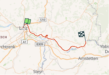
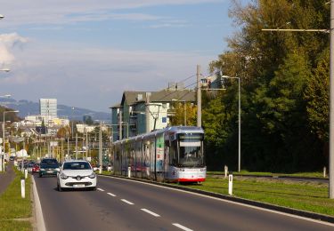
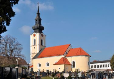
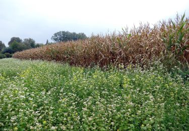
Randonnée Cyclotourisme de 72 km à découvrir à Haute-Autriche, Linz. Cette randonnée est proposée par s0c7.
Description
Parcours facile sur routes bitumées. Très beaux paysages. Détour par Mauthahausen par un trajet alternatif moins direct, mais moins pentu que la montée raide indiquée par la route
Localisation
Pays :
Autriche
Région :
Haute-Autriche
Département/Province :
Linz
Commune :
Unknown
Localité :
Unknown
Départ:(Dec)
Départ:(UTM)
447319 ; 5350455 (33U) N.
Commentaires
Randonnées à proximité
![Randonnée A pied Steyregg - AV 50 Daxleitner - Photo](https://media.geolcdn.com/t/375/260/ac8aab2e-87f4-4c25-ae1f-c0ffc1bf5d02.jpeg&format=jpg&maxdim=2)
![A pied A pied](https://static1.geolcdn.com/sitytour/trail-icons/100.png)
AV 50 Daxleitner
A pied
Facile
Steyregg,
Haute-Autriche,
Bezirk Urfahr-Umgebung,
Autriche
![](/images/other/stat-length.png)
4,7 km | 8 km-effort
1h 49min
![](https://static1.geolcdn.com/siteimages/upload/files/16400158638029165_repeat_loop_refresh_sync_direction_icon.png)
Non
![Randonnée A pied - Treppelweg - Photo](https://media.geolcdn.com/t/375/260/f52d64c4-80b0-469f-9cf8-2227055028ed.jpeg&format=jpg&maxdim=2)
![A pied A pied](https://static1.geolcdn.com/sitytour/trail-icons/100.png)
![Randonnée A pied - Altenberg-Auhof - Photo](https://media.geolcdn.com/t/375/260/4c757075-6574-4a1d-905a-4024b18f0607.jpeg&format=jpg&maxdim=2)
![A pied A pied](https://static1.geolcdn.com/sitytour/trail-icons/100.png)
![Randonnée A pied Leonding - Zaubertalrunde - Photo](https://media.geolcdn.com/t/375/260/362dfadb-f1f7-45fc-9bd6-a2aa5cac1847.jpeg&format=jpg&maxdim=2)
![A pied A pied](https://static1.geolcdn.com/sitytour/trail-icons/100.png)
Zaubertalrunde
A pied
Facile
Leonding,
Haute-Autriche,
Bezirk Linz-Land,
Autriche
![](/images/other/stat-length.png)
12,5 km | 15,7 km-effort
3h 34min
![](https://static1.geolcdn.com/siteimages/upload/files/16400158638029165_repeat_loop_refresh_sync_direction_icon.png)
Oui
![Randonnée A pied Leonding - Stadtwanderweg Leonding - Photo](https://media.geolcdn.com/t/375/260/f189d68d-38ea-4941-8054-2e2b8cf0c43d.jpeg&format=jpg&maxdim=2)
![A pied A pied](https://static1.geolcdn.com/sitytour/trail-icons/100.png)
Stadtwanderweg Leonding
A pied
Facile
Leonding,
Haute-Autriche,
Bezirk Linz-Land,
Autriche
![](/images/other/stat-length.png)
3,2 km | 3,8 km-effort
52min
![](https://static1.geolcdn.com/siteimages/upload/files/16400158638029165_repeat_loop_refresh_sync_direction_icon.png)
Oui
![Randonnée A pied Leonding - Kürnbergrunde - Photo](https://media.geolcdn.com/t/375/260/04a4a75c-6b8b-4c91-8f6b-0acbe9b667e6.jpeg&format=jpg&maxdim=2)
![A pied A pied](https://static1.geolcdn.com/sitytour/trail-icons/100.png)
Kürnbergrunde
A pied
Facile
Leonding,
Haute-Autriche,
Bezirk Linz-Land,
Autriche
![](/images/other/stat-length.png)
8,1 km | 9,1 km-effort
2h 4min
![](https://static1.geolcdn.com/siteimages/upload/files/16400158638029165_repeat_loop_refresh_sync_direction_icon.png)
Non
![Randonnée A pied Leonding - Staudacherrunde - Photo](https://media.geolcdn.com/t/375/260/b885cb65-5f79-4b28-b4a0-37349ff05ef9.jpeg&format=jpg&maxdim=2)
![A pied A pied](https://static1.geolcdn.com/sitytour/trail-icons/100.png)
Staudacherrunde
A pied
Facile
Leonding,
Haute-Autriche,
Bezirk Linz-Land,
Autriche
![](/images/other/stat-length.png)
6,6 km | 7,3 km-effort
1h 39min
![](https://static1.geolcdn.com/siteimages/upload/files/16400158638029165_repeat_loop_refresh_sync_direction_icon.png)
Non
![Randonnée A pied Puchenau - Puchenau-Ottensheim - Photo](https://media.geolcdn.com/t/375/260/4b75b8fa-cf2f-4307-929c-22b5577c599a.jpeg&format=jpg&maxdim=2)
![A pied A pied](https://static1.geolcdn.com/sitytour/trail-icons/100.png)
Puchenau-Ottensheim
A pied
Facile
Puchenau,
Haute-Autriche,
Bezirk Urfahr-Umgebung,
Autriche
![](/images/other/stat-length.png)
5,4 km | 7,6 km-effort
1h 44min
![](https://static1.geolcdn.com/siteimages/upload/files/16400158638029165_repeat_loop_refresh_sync_direction_icon.png)
Non
![Randonnée A pied Steyregg - Stadtwanderweg Pfenningberg - Photo](https://media.geolcdn.com/t/375/260/ac8aab2e-87f4-4c25-ae1f-c0ffc1bf5d02.jpeg&format=jpg&maxdim=2)
![A pied A pied](https://static1.geolcdn.com/sitytour/trail-icons/100.png)
Stadtwanderweg Pfenningberg
A pied
Facile
Steyregg,
Haute-Autriche,
Bezirk Urfahr-Umgebung,
Autriche
![](/images/other/stat-length.png)
6,6 km | 10,4 km-effort
2h 22min
![](https://static1.geolcdn.com/siteimages/upload/files/16400158638029165_repeat_loop_refresh_sync_direction_icon.png)
Non