![](/images/other/stat-length.png)
![Randonnée Marche Crozon - Boucle 18 km Morgat Pointe de Dinan - Photo](https://media.geolcdn.com/t/1900/400/906c7f38-c7ac-4a9a-92a6-7db29e8ec6c3.jpg&format=pjpeg&maxdim=2)
Boucle 18 km Morgat Pointe de Dinan
chessyca
Utilisateur GUIDE
![Longueur](/images/other/stat-length.png)
Longueur
18,1 km
![Altitude max](https://static1.geolcdn.com/siteimages/upload/files/1508320355ic_sort_altitude_max_24dp.png)
Altitude max
69 m
![Dénivelé positif](https://static1.geolcdn.com/siteimages/upload/files/1508320355ic_sort_den_pos_24dp.png)
Dénivelé positif
332 m
![Km-Effort](/images/other/stat-length.png)
Km-Effort
23 km
![Altitude min](https://static1.geolcdn.com/siteimages/upload/files/1508320355ic_sort_altitude_min_24dp.png)
Altitude min
0 m
![Dénivelé négatif](https://static1.geolcdn.com/siteimages/upload/files/1508320355ic_sort_den_neg_24dp.png)
Dénivelé négatif
340 m
![Boucle](https://static1.geolcdn.com/siteimages/upload/files/16400158638029165_repeat_loop_refresh_sync_direction_icon.png)
Boucle
Non
Date de création :
2024-07-16 08:25:34.167
Dernière modification :
2024-07-16 16:10:28.644
![Marche](https://static1.geolcdn.com/sitytour/trail-icons/101.png)
4h29
Difficulté : Facile
![Scannez ce code QR pour ouvrir la randonnée dans l'application SityTrail](https://capi.geolives.com/qq0zvz2zws4bq2lad0pu/sitytour/trails/4124069/qr.png?size=200)
Application GPS de randonnée GRATUITE
À propos
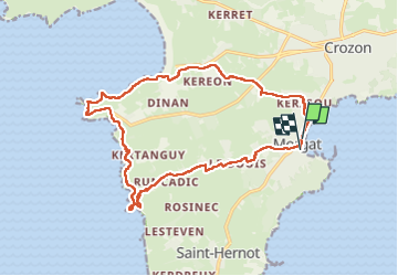
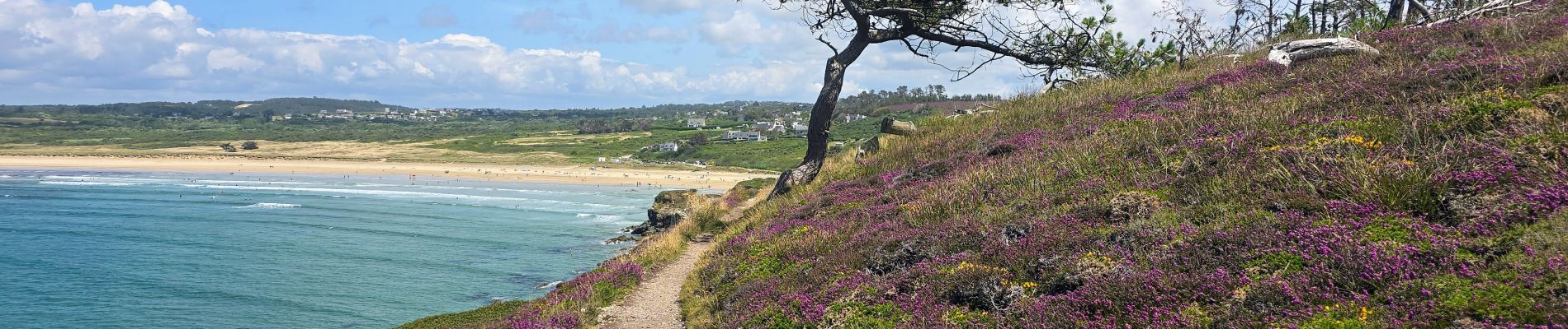
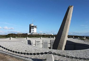
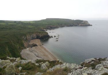
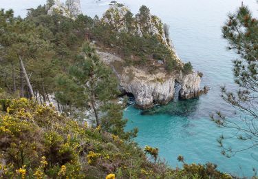
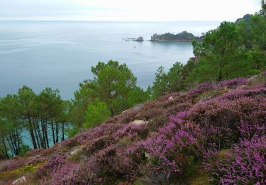
Randonnée Marche de 18,1 km à découvrir à Bretagne, Finistère, Crozon. Cette randonnée est proposée par chessyca.
Description
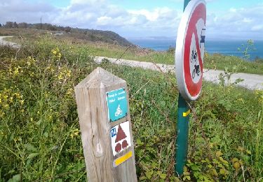
Parcours relativement facile et pas trop accidenté
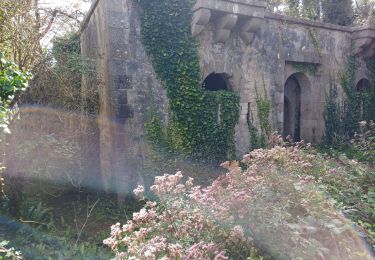
Attention vers le km 15 le passage en sous bois est presque impraticable en raison de la végétation (chemin menesvret)
Localisation
Pays :
France
Région :
Bretagne
Département/Province :
Finistère
Commune :
Crozon
Localité :
Unknown
Départ:(Dec)
Départ:(UTM)
388308 ; 5342650 (30U) N.
Commentaires
Randonnées à proximité
![Randonnée Marche Crozon - Cap de La Chèvre - Morgat - Photo](https://media.geolcdn.com/t/375/260/ext.jpg?maxdim=2&url=https%3A%2F%2Fservices.sitytrail.com%2FGeolivesWS%2FDownloadMedia.ashx%3FTrailID%3D214931%26Media%3D15502_6.jpg)
![Marche Marche](https://static1.geolcdn.com/sitytour/trail-icons/101.png)
Cap de La Chèvre - Morgat
Marche
Difficile
(2)
Crozon,
Bretagne,
Finistère,
France
![](/images/other/stat-length.png)
24 km | 32 km-effort
8h 0min
![](https://static1.geolcdn.com/siteimages/upload/files/16400158638029165_repeat_loop_refresh_sync_direction_icon.png)
Oui
![Randonnée Marche Crozon - Plage de Goulien - Château de Dinan - Photo](https://media.geolcdn.com/t/375/260/a821a59d-1597-4c11-b324-eb8b31b346e3.jpg&format=jpg&maxdim=2)
![Marche Marche](https://static1.geolcdn.com/sitytour/trail-icons/101.png)
Plage de Goulien - Château de Dinan
Marche
Moyen
(1)
Crozon,
Bretagne,
Finistère,
France
![](/images/other/stat-length.png)
16,7 km | 21 km-effort
4h 36min
![](https://static1.geolcdn.com/siteimages/upload/files/16400158638029165_repeat_loop_refresh_sync_direction_icon.png)
Oui
![Randonnée Marche Crozon - cap de la chevre - Photo](https://media.geolcdn.com/t/375/260/ext.jpg?maxdim=2&url=https%3A%2F%2Fservices.sitytrail.com%2FGeolivesWS%2FDownloadMedia.ashx%3FTrailID%3D272619%26Media%3Dfix__20140501171602.jpg)
![Marche Marche](https://static1.geolcdn.com/sitytour/trail-icons/101.png)
cap de la chevre
Marche
Facile
(2)
Crozon,
Bretagne,
Finistère,
France
![](/images/other/stat-length.png)
5,5 km | 7,6 km-effort
1h 49min
![](https://static1.geolcdn.com/siteimages/upload/files/16400158638029165_repeat_loop_refresh_sync_direction_icon.png)
Oui
![Randonnée Marche Crozon - GR34 Morgat. -- Pentrez (St Nic) - Photo](https://media.geolcdn.com/t/375/260/9884770b-e302-44c0-98c0-95603b21b679.jpg&format=jpg&maxdim=2)
![Marche Marche](https://static1.geolcdn.com/sitytour/trail-icons/101.png)
GR34 Morgat. -- Pentrez (St Nic)
Marche
Très difficile
Crozon,
Bretagne,
Finistère,
France
![](/images/other/stat-length.png)
25 km | 32 km-effort
7h 11min
![](https://static1.geolcdn.com/siteimages/upload/files/16400158638029165_repeat_loop_refresh_sync_direction_icon.png)
Non
![Randonnée Marche Crozon - Boucle Crozon Morgat Cap de la chèvre 22 km - Photo](https://media.geolcdn.com/t/375/260/57409a5b-a25e-4728-8198-0ff202646598.jpg&format=jpg&maxdim=2)
![Marche Marche](https://static1.geolcdn.com/sitytour/trail-icons/101.png)
Boucle Crozon Morgat Cap de la chèvre 22 km
Marche
Très difficile
Crozon,
Bretagne,
Finistère,
France
![](/images/other/stat-length.png)
22 km | 29 km-effort
6h 39min
![](https://static1.geolcdn.com/siteimages/upload/files/16400158638029165_repeat_loop_refresh_sync_direction_icon.png)
Oui
![Randonnée A pied Crozon - Balade Sonore de l'Île Vierge - Photo](https://media.geolcdn.com/t/375/260/ac2c991a-5f82-4371-a8f3-9daafa6d6f4f.jpeg&format=jpg&maxdim=2)
![A pied A pied](https://static1.geolcdn.com/sitytour/trail-icons/100.png)
Balade Sonore de l'Île Vierge
A pied
Facile
Crozon,
Bretagne,
Finistère,
France
![](/images/other/stat-length.png)
3,4 km | 4,6 km-effort
1h 2min
![](https://static1.geolcdn.com/siteimages/upload/files/16400158638029165_repeat_loop_refresh_sync_direction_icon.png)
Non
![Randonnée Marche Crozon - Pointe de Morgat - Cap de la Chèvre Boucle GR34 - 19.7km 500m 6h00 - 2019 09 13 - Photo](https://media.geolcdn.com/t/375/260/d3296e61-dbfe-4a93-8009-ac34d44b4d59.jpg&format=jpg&maxdim=2)
![Marche Marche](https://static1.geolcdn.com/sitytour/trail-icons/101.png)
Pointe de Morgat - Cap de la Chèvre Boucle GR34 - 19.7km 500m 6h00 - 2019 09 13
Marche
Difficile
Crozon,
Bretagne,
Finistère,
France
![](/images/other/stat-length.png)
19,7 km | 26 km-effort
6h 0min
![](https://static1.geolcdn.com/siteimages/upload/files/16400158638029165_repeat_loop_refresh_sync_direction_icon.png)
Oui
![Randonnée Marche Crozon - cap de la chèvre - Photo](https://media.geolcdn.com/t/375/260/ext.jpg?maxdim=2&url=https%3A%2F%2Fstatic1.geolcdn.com%2Fsiteimages%2Fupload%2Ffiles%2F1553511878bg_sport_marche.png)
![Marche Marche](https://static1.geolcdn.com/sitytour/trail-icons/101.png)
cap de la chèvre
Marche
Moyen
(2)
Crozon,
Bretagne,
Finistère,
France
![](/images/other/stat-length.png)
13,2 km | 17,5 km-effort
2h 54min
![](https://static1.geolcdn.com/siteimages/upload/files/16400158638029165_repeat_loop_refresh_sync_direction_icon.png)
Non
![Randonnée Marche Crozon - GR34 Morgat - Morgat (Cap de la Chèvre) - Photo](https://media.geolcdn.com/t/375/260/ccf01d36-e4fa-4251-899f-4fade315ace8.jpg&format=jpg&maxdim=2)
![Marche Marche](https://static1.geolcdn.com/sitytour/trail-icons/101.png)
GR34 Morgat - Morgat (Cap de la Chèvre)
Marche
Très difficile
Crozon,
Bretagne,
Finistère,
France
![](/images/other/stat-length.png)
22 km | 30 km-effort
6h 43min
![](https://static1.geolcdn.com/siteimages/upload/files/16400158638029165_repeat_loop_refresh_sync_direction_icon.png)
Oui