![](/images/other/stat-length.png)
![Randonnée Marche Aerschot - S-GR Hageland: Aarschot - Kortrijk-Dutsel - Photo](https://media.geolcdn.com/t/1900/400/daa61efd-734b-467a-883e-c0aeca7e1e57.jpeg&format=pjpeg&maxdim=2)
S-GR Hageland: Aarschot - Kortrijk-Dutsel
dauzata
Utilisateur
![Longueur](/images/other/stat-length.png)
Longueur
23 km
![Altitude max](https://static1.geolcdn.com/siteimages/upload/files/1508320355ic_sort_altitude_max_24dp.png)
Altitude max
73 m
![Dénivelé positif](https://static1.geolcdn.com/siteimages/upload/files/1508320355ic_sort_den_pos_24dp.png)
Dénivelé positif
342 m
![Km-Effort](/images/other/stat-length.png)
Km-Effort
27 km
![Altitude min](https://static1.geolcdn.com/siteimages/upload/files/1508320355ic_sort_altitude_min_24dp.png)
Altitude min
11 m
![Dénivelé négatif](https://static1.geolcdn.com/siteimages/upload/files/1508320355ic_sort_den_neg_24dp.png)
Dénivelé négatif
322 m
![Boucle](https://static1.geolcdn.com/siteimages/upload/files/16400158638029165_repeat_loop_refresh_sync_direction_icon.png)
Boucle
Non
Date de création :
2024-06-29 08:19:47.0
Dernière modification :
2024-07-13 19:57:50.014
![Marche](https://static1.geolcdn.com/sitytour/trail-icons/101.png)
6h09
Difficulté : Moyen
![Scannez ce code QR pour ouvrir la randonnée dans l'application SityTrail](https://capi.geolives.com/qq0zvz2zws4bq2lad0pu/sitytour/trails/4106431/qr.png?size=200)
Application GPS de randonnée GRATUITE
À propos
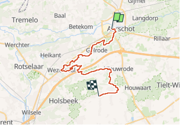
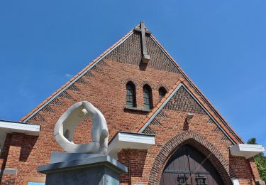
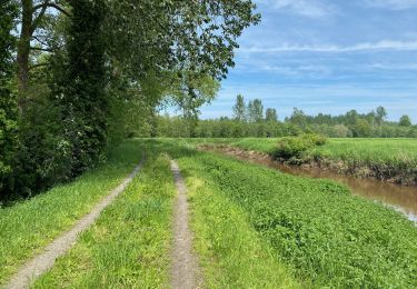
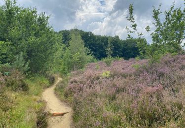
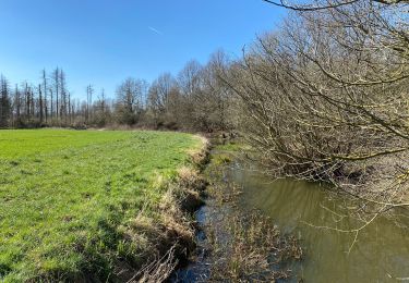
Randonnée Marche de 23 km à découvrir à Flandre, Brabant flamand, Aerschot. Cette randonnée est proposée par dauzata.
Description
Départ: Gare d'Aarschot
Arrivée: Arrêt de bus "Kortrijk-Dutsel Gemeentehuis" de la ligne 310 (Aarschot Gare - Leuven Gare)
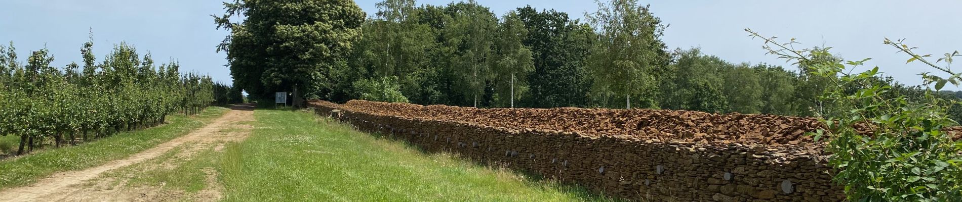
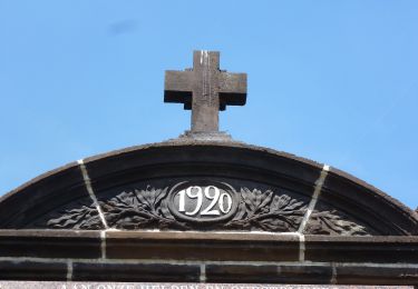
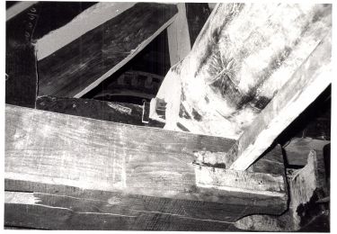
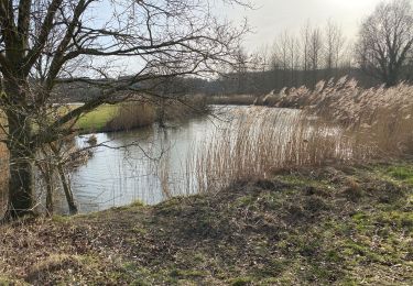
Localisation
Pays :
Belgique
Région :
Flandre
Département/Province :
Brabant flamand
Commune :
Aerschot
Localité :
Aerschot
Départ:(Dec)
Départ:(UTM)
628030 ; 5649639 (31U) N.
Commentaires
Randonnées à proximité
![Randonnée A pied Aerschot - Kloesebos Rode driehoek - Photo](https://media.geolcdn.com/t/375/260/f4a0c03f-0ec6-441f-abfb-a6b5b510b476.jpeg&format=jpg&maxdim=2)
![A pied A pied](https://static1.geolcdn.com/sitytour/trail-icons/100.png)
Kloesebos Rode driehoek
A pied
Facile
Aerschot,
Flandre,
Brabant flamand,
Belgique
![](/images/other/stat-length.png)
9,8 km | 11,7 km-effort
2h 39min
![](https://static1.geolcdn.com/siteimages/upload/files/16400158638029165_repeat_loop_refresh_sync_direction_icon.png)
Oui
![Randonnée A pied Aerschot - Kloesebos Blauwe ruit - Photo](https://media.geolcdn.com/t/375/260/66cc2f8c-dfb7-4bf1-9239-18bc78c78aaf.jpeg&format=jpg&maxdim=2)
![A pied A pied](https://static1.geolcdn.com/sitytour/trail-icons/100.png)
Kloesebos Blauwe ruit
A pied
Facile
Aerschot,
Flandre,
Brabant flamand,
Belgique
![](/images/other/stat-length.png)
3 km | 3,6 km-effort
49min
![](https://static1.geolcdn.com/siteimages/upload/files/16400158638029165_repeat_loop_refresh_sync_direction_icon.png)
Oui
![Randonnée A pied Aerschot - Rillaarse Heuvelswandeling - Photo](https://media.geolcdn.com/t/375/260/2883ed0c-1972-44a3-9264-788ac17d3bac.jpeg&format=jpg&maxdim=2)
![A pied A pied](https://static1.geolcdn.com/sitytour/trail-icons/100.png)
Rillaarse Heuvelswandeling
A pied
Facile
Aerschot,
Flandre,
Brabant flamand,
Belgique
![](/images/other/stat-length.png)
12,2 km | 14,6 km-effort
3h 18min
![](https://static1.geolcdn.com/siteimages/upload/files/16400158638029165_repeat_loop_refresh_sync_direction_icon.png)
Oui
![Randonnée Marche Begijnendijk - Betekom Arrschot Beemden Wandeling - 10 km RT - Photo](https://media.geolcdn.com/t/375/260/ext.jpg?maxdim=2&url=https%3A%2F%2Fstatic1.geolcdn.com%2Fsiteimages%2Fupload%2Ffiles%2F1553511878bg_sport_marche.png)
![Marche Marche](https://static1.geolcdn.com/sitytour/trail-icons/101.png)
Betekom Arrschot Beemden Wandeling - 10 km RT
Marche
Très facile
(1)
Begijnendijk,
Flandre,
Brabant flamand,
Belgique
![](/images/other/stat-length.png)
9,5 km | 10,3 km-effort
Inconnu
![](https://static1.geolcdn.com/siteimages/upload/files/16400158638029165_repeat_loop_refresh_sync_direction_icon.png)
Oui
![Randonnée Marche Aerschot - Le long du Démer de Langdorp à Testelt - Photo](https://media.geolcdn.com/t/375/260/3ef3860a-670d-485e-846a-14ba86eef2f3.jpeg&format=jpg&maxdim=2)
![Marche Marche](https://static1.geolcdn.com/sitytour/trail-icons/101.png)
Le long du Démer de Langdorp à Testelt
Marche
Moyen
Aerschot,
Flandre,
Brabant flamand,
Belgique
![](/images/other/stat-length.png)
12,2 km | 14 km-effort
3h 11min
![](https://static1.geolcdn.com/siteimages/upload/files/16400158638029165_repeat_loop_refresh_sync_direction_icon.png)
Non
![Randonnée Marche Aerschot - SGR Hageland: d'Aarschot à Wezemaal - Photo](https://media.geolcdn.com/t/375/260/589e36b9-24cd-45ab-b0f3-7629f63764a9.jpeg&format=jpg&maxdim=2)
![Marche Marche](https://static1.geolcdn.com/sitytour/trail-icons/101.png)
SGR Hageland: d'Aarschot à Wezemaal
Marche
Facile
Aerschot,
Flandre,
Brabant flamand,
Belgique
![](/images/other/stat-length.png)
10,9 km | 13,4 km-effort
3h 2min
![](https://static1.geolcdn.com/siteimages/upload/files/16400158638029165_repeat_loop_refresh_sync_direction_icon.png)
Non
![Randonnée Marche Aerschot - Gelrode 14,7 km - Photo](https://media.geolcdn.com/t/375/260/82b7f051-104b-40d6-8589-4a41f1c67f17.jpg&format=jpg&maxdim=2)
![Marche Marche](https://static1.geolcdn.com/sitytour/trail-icons/101.png)
Gelrode 14,7 km
Marche
Facile
Aerschot,
Flandre,
Brabant flamand,
Belgique
![](/images/other/stat-length.png)
14,7 km | 15,8 km-effort
3h 55min
![](https://static1.geolcdn.com/siteimages/upload/files/16400158638029165_repeat_loop_refresh_sync_direction_icon.png)
Oui
![Randonnée Marche Aerschot - Aarschot 20,5 km - Photo](https://media.geolcdn.com/t/375/260/70b55967-6233-4d74-905b-dcc126469651.jpg&format=jpg&maxdim=2)
![Marche Marche](https://static1.geolcdn.com/sitytour/trail-icons/101.png)
Aarschot 20,5 km
Marche
Facile
Aerschot,
Flandre,
Brabant flamand,
Belgique
![](/images/other/stat-length.png)
20 km | 24 km-effort
5h 16min
![](https://static1.geolcdn.com/siteimages/upload/files/16400158638029165_repeat_loop_refresh_sync_direction_icon.png)
Oui
![Randonnée Marche Aerschot - Langdorp - Photo](https://media.geolcdn.com/t/375/260/ext.jpg?maxdim=2&url=https%3A%2F%2Fstatic1.geolcdn.com%2Fsiteimages%2Fupload%2Ffiles%2F1553511878bg_sport_marche.png)
![Marche Marche](https://static1.geolcdn.com/sitytour/trail-icons/101.png)
Langdorp
Marche
Facile
(1)
Aerschot,
Flandre,
Brabant flamand,
Belgique
![](/images/other/stat-length.png)
15 km | 17,6 km-effort
3h 32min
![](https://static1.geolcdn.com/siteimages/upload/files/16400158638029165_repeat_loop_refresh_sync_direction_icon.png)
Non