![](/images/other/stat-length.png)
Boucle De Surzur à Ambon
EricVIBERT
Utilisateur
![Longueur](/images/other/stat-length.png)
Longueur
16 km
![Altitude max](https://static1.geolcdn.com/siteimages/upload/files/1508320355ic_sort_altitude_max_24dp.png)
Altitude max
27 m
![Dénivelé positif](https://static1.geolcdn.com/siteimages/upload/files/1508320355ic_sort_den_pos_24dp.png)
Dénivelé positif
122 m
![Km-Effort](/images/other/stat-length.png)
Km-Effort
17,6 km
![Altitude min](https://static1.geolcdn.com/siteimages/upload/files/1508320355ic_sort_altitude_min_24dp.png)
Altitude min
-1 m
![Dénivelé négatif](https://static1.geolcdn.com/siteimages/upload/files/1508320355ic_sort_den_neg_24dp.png)
Dénivelé négatif
121 m
![Boucle](https://static1.geolcdn.com/siteimages/upload/files/16400158638029165_repeat_loop_refresh_sync_direction_icon.png)
Boucle
Oui
Date de création :
2024-06-25 08:08:44.127
Dernière modification :
2024-06-25 11:19:33.689
![Vélo électrique](https://static1.geolcdn.com/sitytour/trail-icons/205.png)
1h15
Difficulté : Moyen
![Scannez ce code QR pour ouvrir la randonnée dans l'application SityTrail](https://capi.geolives.com/qq0zvz2zws4bq2lad0pu/sitytour/trails/4102219/qr.png?size=200)
Application GPS de randonnée GRATUITE
À propos
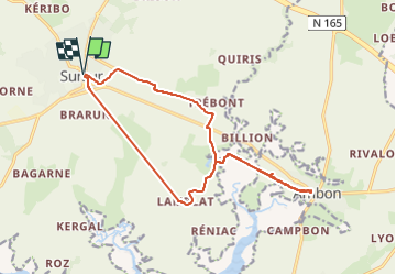
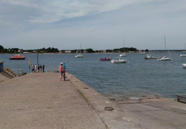
Randonnée Vélo électrique de 16 km à découvrir à Bretagne, Morbihan, Surzur. Cette randonnée est proposée par EricVIBERT.
Description
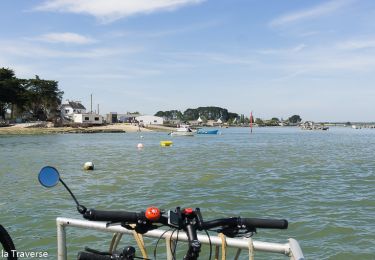
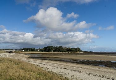
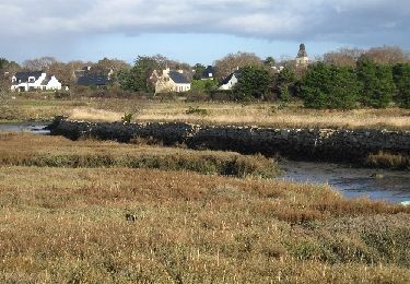
Voie verte suivant le GR34 entre Surzur et Ambon.
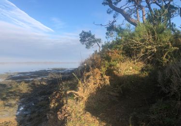
Passage difficile au niveau du pont de fer (piste défoncée)
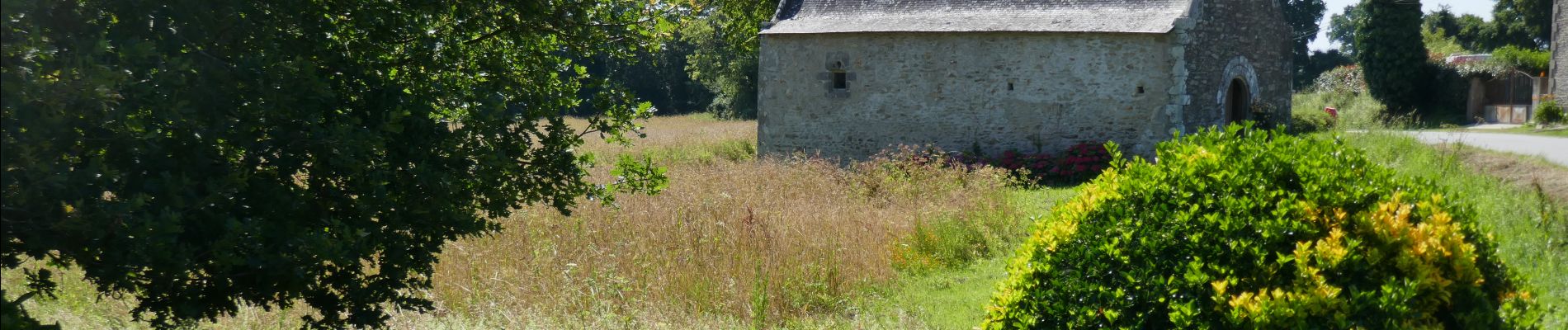
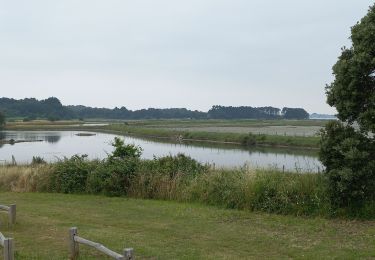
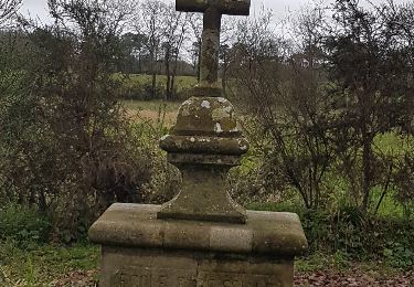
retour par les chapelles de Tremoyec et St Hélène.
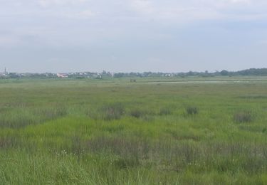
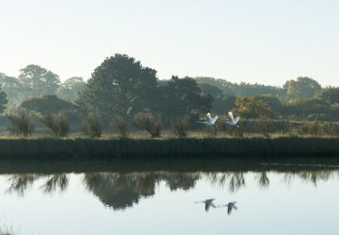
Belles vues sur les étiers.
Localisation
Pays :
France
Région :
Bretagne
Département/Province :
Morbihan
Commune :
Surzur
Localité :
Unknown
Départ:(Dec)
Départ:(UTM)
527859 ; 5269632 (30T) N.
Commentaires
Randonnées à proximité
![Randonnée Marche Surzur - PR_56_Surzur_AA_01_Circuit1b_Des-Landes-De-Lamblat_20240512 - Photo](https://media.geolcdn.com/t/375/260/ext.jpg?maxdim=2&url=https%3A%2F%2Fmedia.geolcdn.com%2Ff%2F5ff28a2f-62b0-45ee-97d6-ed0038e729e6.jpg)
![Marche Marche](https://static1.geolcdn.com/sitytour/trail-icons/101.png)
PR_56_Surzur_AA_01_Circuit1b_Des-Landes-De-Lamblat_20240512
Marche
Moyen
Surzur,
Bretagne,
Morbihan,
France
![](/images/other/stat-length.png)
8,6 km | 9,6 km-effort
2h 0min
![](https://static1.geolcdn.com/siteimages/upload/files/16400158638029165_repeat_loop_refresh_sync_direction_icon.png)
Oui
![Randonnée Cyclotourisme Theix-Noyalo - De Noyalo à Pénerf - Photo](https://media.geolcdn.com/t/375/260/ext.jpg?maxdim=2&url=https%3A%2F%2Fmedia.geolcdn.com%2Ff%2Fdb4e9402-8188-4614-9f55-6ee537cd6b8a.jpg)
![Cyclotourisme Cyclotourisme](https://static1.geolcdn.com/sitytour/trail-icons/204.png)
De Noyalo à Pénerf
Cyclotourisme
Très difficile
Theix-Noyalo,
Bretagne,
Morbihan,
France
![](/images/other/stat-length.png)
46 km | 50 km-effort
Inconnu
![](https://static1.geolcdn.com/siteimages/upload/files/16400158638029165_repeat_loop_refresh_sync_direction_icon.png)
Oui
![Randonnée Cyclotourisme Theix-Noyalo - De Noyalo à Penvins - Photo](https://media.geolcdn.com/t/375/260/ext.jpg?maxdim=2&url=https%3A%2F%2Fmedia.geolcdn.com%2Ff%2Fd59253ae-c905-4d67-b3c5-f2806b38f29f.jpg)
![Cyclotourisme Cyclotourisme](https://static1.geolcdn.com/sitytour/trail-icons/204.png)
De Noyalo à Penvins
Cyclotourisme
Moyen
Theix-Noyalo,
Bretagne,
Morbihan,
France
![](/images/other/stat-length.png)
37 km | 40 km-effort
2h 28min
![](https://static1.geolcdn.com/siteimages/upload/files/16400158638029165_repeat_loop_refresh_sync_direction_icon.png)
Oui
![Randonnée Marche Theix-Noyalo - Bourgerelle hezo - Photo](https://media.geolcdn.com/t/375/260/ext.jpg?maxdim=2&url=https%3A%2F%2Fmedia.geolcdn.com%2Ff%2F0066e332-8b46-4562-aad7-29710b4025a9.jpg)
![Marche Marche](https://static1.geolcdn.com/sitytour/trail-icons/101.png)
Bourgerelle hezo
Marche
Facile
Theix-Noyalo,
Bretagne,
Morbihan,
France
![](/images/other/stat-length.png)
3,6 km | 3,9 km-effort
50min
![](https://static1.geolcdn.com/siteimages/upload/files/16400158638029165_repeat_loop_refresh_sync_direction_icon.png)
Non
![Randonnée Cyclotourisme Theix-Noyalo - Theix-Noyalo - Suscinio - Photo](https://media.geolcdn.com/t/375/260/ext.jpg?maxdim=2&url=https%3A%2F%2Fmedia.geolcdn.com%2Ff%2F1b4eeb14-0cae-4ea7-8eb0-ef958c56f227.jpg)
![Cyclotourisme Cyclotourisme](https://static1.geolcdn.com/sitytour/trail-icons/204.png)
Theix-Noyalo - Suscinio
Cyclotourisme
Facile
Theix-Noyalo,
Bretagne,
Morbihan,
France
![](/images/other/stat-length.png)
39 km | 42 km-effort
3h 58min
![](https://static1.geolcdn.com/siteimages/upload/files/16400158638029165_repeat_loop_refresh_sync_direction_icon.png)
Oui
![Randonnée V.T.C. Theix-Noyalo - Boucle Noyalo-Damgan - Photo](https://media.geolcdn.com/t/375/260/ext.jpg?maxdim=2&url=https%3A%2F%2Fmedia.geolcdn.com%2Ff%2F5c3b5310-fa44-4152-9274-434fabcac185.jpg)
![V.T.C. V.T.C.](https://static1.geolcdn.com/sitytour/trail-icons/203.png)
Boucle Noyalo-Damgan
V.T.C.
Facile
Theix-Noyalo,
Bretagne,
Morbihan,
France
![](/images/other/stat-length.png)
48 km | 51 km-effort
4h 44min
![](https://static1.geolcdn.com/siteimages/upload/files/16400158638029165_repeat_loop_refresh_sync_direction_icon.png)
Oui
![Randonnée Marche Theix-Noyalo - Marais de Noyalo - Photo](https://media.geolcdn.com/t/375/260/ext.jpg?maxdim=2&url=https%3A%2F%2Fmedia.geolcdn.com%2Ff%2F90338ff7-3b59-4c9d-84d6-eaf4261e4f43.jpg)
![Marche Marche](https://static1.geolcdn.com/sitytour/trail-icons/101.png)
Marais de Noyalo
Marche
Très facile
Theix-Noyalo,
Bretagne,
Morbihan,
France
![](/images/other/stat-length.png)
6,2 km | 6,8 km-effort
1h 9min
![](https://static1.geolcdn.com/siteimages/upload/files/16400158638029165_repeat_loop_refresh_sync_direction_icon.png)
Oui
![Randonnée V.T.C. Theix-Noyalo - Marais de Saint Armel - Photo](https://media.geolcdn.com/t/375/260/ext.jpg?maxdim=2&url=https%3A%2F%2Fmedia.geolcdn.com%2Ff%2F8f6edbf7-636e-4be5-908c-ff04cacfcbf2.JPG)
![V.T.C. V.T.C.](https://static1.geolcdn.com/sitytour/trail-icons/203.png)
Marais de Saint Armel
V.T.C.
Très facile
(1)
Theix-Noyalo,
Bretagne,
Morbihan,
France
![](/images/other/stat-length.png)
17,2 km | 18,4 km-effort
Inconnu
![](https://static1.geolcdn.com/siteimages/upload/files/16400158638029165_repeat_loop_refresh_sync_direction_icon.png)
Oui
![Randonnée Marche Surzur - circuit de Pemboulzo - Photo](https://media.geolcdn.com/t/375/260/ext.jpg?maxdim=2&url=https%3A%2F%2Fservices.sitytrail.com%2FGeolivesWS%2FDownloadMedia.ashx%3FTrailID%3D895863%26Media%3Dfix__20180129153211.jpg)
![Marche Marche](https://static1.geolcdn.com/sitytour/trail-icons/101.png)
circuit de Pemboulzo
Marche
Moyen
Surzur,
Bretagne,
Morbihan,
France
![](/images/other/stat-length.png)
10,8 km | 12 km-effort
2h 40min
![](https://static1.geolcdn.com/siteimages/upload/files/16400158638029165_repeat_loop_refresh_sync_direction_icon.png)
Oui