![](/images/other/stat-length.png)
![Randonnée Marche Montner - Montner Força Réal et château de Caladroy - Photo](https://media.geolcdn.com/t/1900/400/00644a8b-4507-46ff-9b0c-bf2cb54055bf.jpg&format=pjpeg&maxdim=2)
Montner Força Réal et château de Caladroy
francineposkin
Utilisateur
![Longueur](/images/other/stat-length.png)
Longueur
18,4 km
![Altitude max](https://static1.geolcdn.com/siteimages/upload/files/1508320355ic_sort_altitude_max_24dp.png)
Altitude max
493 m
![Dénivelé positif](https://static1.geolcdn.com/siteimages/upload/files/1508320355ic_sort_den_pos_24dp.png)
Dénivelé positif
540 m
![Km-Effort](/images/other/stat-length.png)
Km-Effort
26 km
![Altitude min](https://static1.geolcdn.com/siteimages/upload/files/1508320355ic_sort_altitude_min_24dp.png)
Altitude min
129 m
![Dénivelé négatif](https://static1.geolcdn.com/siteimages/upload/files/1508320355ic_sort_den_neg_24dp.png)
Dénivelé négatif
534 m
![Boucle](https://static1.geolcdn.com/siteimages/upload/files/16400158638029165_repeat_loop_refresh_sync_direction_icon.png)
Boucle
Oui
Date de création :
2024-06-24 06:34:00.0
Dernière modification :
2024-06-24 12:58:02.674
![Marche](https://static1.geolcdn.com/sitytour/trail-icons/101.png)
5h43
Difficulté : Difficile
![Scannez ce code QR pour ouvrir la randonnée dans l'application SityTrail](https://capi.geolives.com/qq0zvz2zws4bq2lad0pu/sitytour/trails/4101314/qr.png?size=200)
Application GPS de randonnée GRATUITE
À propos
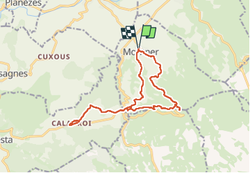
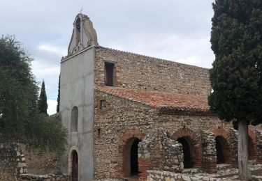
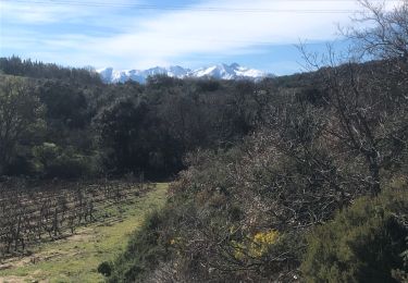
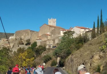
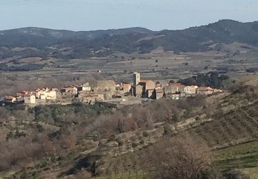
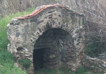
Randonnée Marche de 18,4 km à découvrir à Occitanie, Pyrénées-Orientales, Montner. Cette randonnée est proposée par francineposkin.
Description
Superbe randonnée mais un peu de route 4 km… et peu ombragé
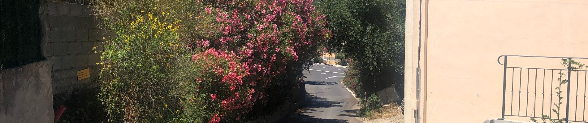
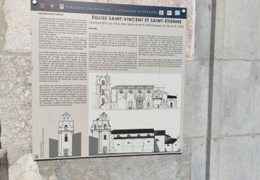
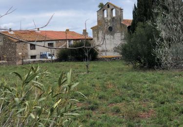
Localisation
Pays :
France
Région :
Occitanie
Département/Province :
Pyrénées-Orientales
Commune :
Montner
Localité :
Unknown
Départ:(Dec)
Départ:(UTM)
473580 ; 4733103 (31T) N.
Commentaires
Randonnées à proximité
![Randonnée A pied Corneilla-la-Rivière - Sentier Lambert Narach - Photo](https://media.geolcdn.com/t/375/260/60aa864b-1f67-4c4d-a42f-3e8c5d1f7ee0.jpeg&format=jpg&maxdim=2)
![A pied A pied](https://static1.geolcdn.com/sitytour/trail-icons/100.png)
Sentier Lambert Narach
A pied
Facile
Corneilla-la-Rivière,
Occitanie,
Pyrénées-Orientales,
France
![](/images/other/stat-length.png)
6,7 km | 11,4 km-effort
2h 35min
![](https://static1.geolcdn.com/siteimages/upload/files/16400158638029165_repeat_loop_refresh_sync_direction_icon.png)
Non
![Randonnée Marche Estagel - ESTAGEL Chapelle St Laurent MARDI FAIT - Photo](https://media.geolcdn.com/t/375/260/14957312-1764-401b-980d-e06b9de6af18.jpg&format=jpg&maxdim=2)
![Marche Marche](https://static1.geolcdn.com/sitytour/trail-icons/101.png)
ESTAGEL Chapelle St Laurent MARDI FAIT
Marche
Moyen
(1)
Estagel,
Occitanie,
Pyrénées-Orientales,
France
![](/images/other/stat-length.png)
12,2 km | 16,9 km-effort
3h 26min
![](https://static1.geolcdn.com/siteimages/upload/files/16400158638029165_repeat_loop_refresh_sync_direction_icon.png)
Oui
![Randonnée Marche Latour-de-France - Latour de France 08/12/2021 - Photo](https://media.geolcdn.com/t/375/260/645a3cd7-e5af-42b0-b7e0-83164582f13a.jpg&format=jpg&maxdim=2)
![Marche Marche](https://static1.geolcdn.com/sitytour/trail-icons/101.png)
Latour de France 08/12/2021
Marche
Moyen
Latour-de-France,
Occitanie,
Pyrénées-Orientales,
France
![](/images/other/stat-length.png)
12,4 km | 16,2 km-effort
3h 12min
![](https://static1.geolcdn.com/siteimages/upload/files/16400158638029165_repeat_loop_refresh_sync_direction_icon.png)
Oui
![Randonnée Marche Estagel - 20201216 Estagel - Calce - Photo](https://media.geolcdn.com/t/375/260/37828b1c-a727-4fa4-95e5-15b013f51adc.jpg&format=jpg&maxdim=2)
![Marche Marche](https://static1.geolcdn.com/sitytour/trail-icons/101.png)
20201216 Estagel - Calce
Marche
Moyen
Estagel,
Occitanie,
Pyrénées-Orientales,
France
![](/images/other/stat-length.png)
15,8 km | 22 km-effort
3h 36min
![](https://static1.geolcdn.com/siteimages/upload/files/16400158638029165_repeat_loop_refresh_sync_direction_icon.png)
Oui
![Randonnée Marche Bélesta - Caladroy - Photo](https://media.geolcdn.com/t/375/260/8ef2b4c1-f11f-4bde-8e07-508777dae174.jpg&format=jpg&maxdim=2)
![Marche Marche](https://static1.geolcdn.com/sitytour/trail-icons/101.png)
Caladroy
Marche
Moyen
Bélesta,
Occitanie,
Pyrénées-Orientales,
France
![](/images/other/stat-length.png)
15,9 km | 22 km-effort
4h 20min
![](https://static1.geolcdn.com/siteimages/upload/files/16400158638029165_repeat_loop_refresh_sync_direction_icon.png)
Oui
![Randonnée Marche Latour-de-France - 66 LATOUR-DE-FRANCE, visite du village, massif de Tourèze et vallée de l'Agly - Photo](https://media.geolcdn.com/t/375/260/ext.jpg?maxdim=2&url=https%3A%2F%2Fservices.sitytrail.com%2FGeolivesWS%2FDownloadMedia.ashx%3FTrailID%3D485378%26Media%3D20151023161024.jpg)
![Marche Marche](https://static1.geolcdn.com/sitytour/trail-icons/101.png)
66 LATOUR-DE-FRANCE, visite du village, massif de Tourèze et vallée de l'Agly
Marche
Moyen
Latour-de-France,
Occitanie,
Pyrénées-Orientales,
France
![](/images/other/stat-length.png)
8,3 km | 11 km-effort
1h 47min
![](https://static1.geolcdn.com/siteimages/upload/files/16400158638029165_repeat_loop_refresh_sync_direction_icon.png)
Oui
![Randonnée Marche Planèzes - PLANÈZES (10/10/2017) - Photo](https://media.geolcdn.com/t/375/260/ext.jpg?maxdim=2&url=https%3A%2F%2Fservices.sitytrail.com%2FGeolivesWS%2FDownloadMedia.ashx%3FTrailID%3D843322%26Media%3Dfix__20171010162217.jpg)
![Marche Marche](https://static1.geolcdn.com/sitytour/trail-icons/101.png)
PLANÈZES (10/10/2017)
Marche
Facile
Planèzes,
Occitanie,
Pyrénées-Orientales,
France
![](/images/other/stat-length.png)
9,9 km | 13,6 km-effort
3h 0min
![](https://static1.geolcdn.com/siteimages/upload/files/16400158638029165_repeat_loop_refresh_sync_direction_icon.png)
Oui
![Randonnée Marche Latour-de-France - au départ de la Tour de France - Photo](https://media.geolcdn.com/t/375/260/ext.jpg?maxdim=2&url=https%3A%2F%2Fservices.sitytrail.com%2FGeolivesWS%2FDownloadMedia.ashx%3FTrailID%3D707498%26Media%3D20170302150910.jpg)
![Marche Marche](https://static1.geolcdn.com/sitytour/trail-icons/101.png)
au départ de la Tour de France
Marche
Facile
Latour-de-France,
Occitanie,
Pyrénées-Orientales,
France
![](/images/other/stat-length.png)
19,9 km | 27 km-effort
4h 57min
![](https://static1.geolcdn.com/siteimages/upload/files/16400158638029165_repeat_loop_refresh_sync_direction_icon.png)
Oui
![Randonnée Marche Montner - autour de Montner - Photo](https://media.geolcdn.com/t/375/260/ext.jpg?maxdim=2&url=https%3A%2F%2Fservices.sitytrail.com%2FGeolivesWS%2FDownloadMedia.ashx%3FTrailID%3D705991%26Media%3D20170227150647.jpg)
![Marche Marche](https://static1.geolcdn.com/sitytour/trail-icons/101.png)
autour de Montner
Marche
Facile
Montner,
Occitanie,
Pyrénées-Orientales,
France
![](/images/other/stat-length.png)
18,5 km | 24 km-effort
4h 36min
![](https://static1.geolcdn.com/siteimages/upload/files/16400158638029165_repeat_loop_refresh_sync_direction_icon.png)
Oui