Randonnée Marche Berrien - BERRIEN  - Photo
 RonanDAGORN
RonanDAGORN

Utilisateur

© OpenStreetMap contributors
Longueur
Longueur
21 km
Altitude max
Altitude max
314 m
Dénivelé positif
Dénivelé positif
347 m
Km-Effort
Km-Effort  
26 km
Altitude min
Altitude min
158 m
Dénivelé négatif
Dénivelé négatif
330 m
Boucle
Boucle
Non
Date de création :
2024-06-23 08:31:16.412
Dernière modification :
2024-06-23 18:25:25.976

(0 Avis)

Marche
Marche
6h31
Difficulté : Moyen

Scannez ce code QR pour ouvrir la randonnée dans l'application SityTrail

Application GPS de randonnée GRATUITE

Logo SityTrail SityTrail

IGN / Instituts géographiques

Télécharger SityTrail sur l'App Store Télécharger SityTrail sur Google Play

Logo SityTrail SityTrail World

Le monde est à vous

Télécharger SityTrail sur l'App Store Télécharger SityTrail sur Google Play Télécharger SityTrail sur Huawei AppGallery

À propos

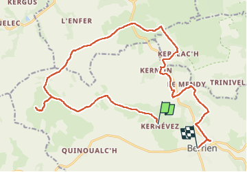
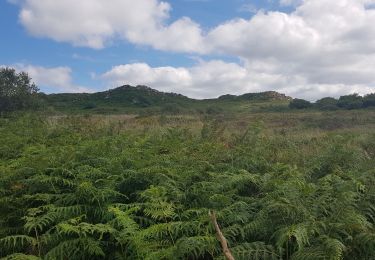
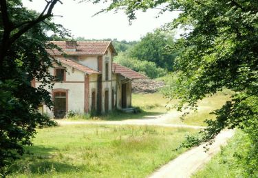
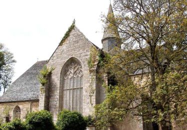
Randonnée Marche de 21 km à découvrir à Bretagne, Finistère, Berrien. Cette randonnée est proposée par RonanDAGORN.

Description

4h47 de marche effective

Profil altimétrique

Photos

Localisation

Pays :
France
Région :
Bretagne
Département/Province :
Finistère
Commune :
Berrien
Localité :
Unknown
Départ:(UTM)
442880 ; 5362354 (30U) N.

Randonnées à proximité

Randonnée V.T.T. Plounéour-Ménez - Espace VTT-FFC Morlaix Monts d'Arrée, circuit n°7 - Le Cloitre - Photo
V.T.T.
tracegps

V.T.T.

Très difficile
(1)
Plounéour-Ménez, Bretagne, Finistère, France
32 km | 39 km-effort
2h 30min
Oui
Randonnée Marche Huelgoat - Huelgoat - Photo
Marche
dudu42

Marche

Très facile
(1)
Huelgoat, Bretagne, Finistère, France
4,5 km | 5,9 km-effort
1h 7min
Oui
Randonnée Marche Plounéour-Ménez - PLONÉOUR MENEZ - Photo
Marche
RonanDAGORN

Marche

Difficile
Plounéour-Ménez, Bretagne, Finistère, France
22 km | 28 km-effort
5h 5min
Oui
Randonnée Marche Berrien - Circuit du menhir - Berrien - Photo
Marche
tracegps

Marche

Moyen
Berrien, Bretagne, Finistère, France
11 km | 13,3 km-effort
3h 30min
Oui
Randonnée A pied Berrien - Circuit de l'abbaye du Relec - Photo
A pied
PRO

A pied

Facile
Berrien, Bretagne, Finistère, France
12,6 km | 15,9 km-effort
3h 36min
Oui
Randonnée Marche Plounéour-Ménez - Balade de l'abbaye de Relecq - Photo
Marche
neleda

Marche

Très facile
(1)
Plounéour-Ménez, Bretagne, Finistère, France
13,2 km | 16,5 km-effort
3h 14min
Oui
Randonnée Marche Plounéour-Ménez - Espace VTT-FFC Morlaix Monts d'Arrée, circuit n°7 - Le Cloitre - Photo
Marche
tracegps

Marche

Très difficile
Plounéour-Ménez, Bretagne, Finistère, France
32 km | 39 km-effort
6h 0min
Oui
Randonnée V.T.T. Plounéour-Ménez - Espace VTT-FFC Morlaix Monts d'Arrée, circuit n°6 - Le Relec - Photo
V.T.T.
tracegps

V.T.T.

Très difficile
Plounéour-Ménez, Bretagne, Finistère, France
18,1 km | 22 km-effort
1h 30min
Oui
Randonnée Marche Plounéour-Ménez - Espace VTT-FFC Morlaix Monts d'Arrée, circuit n°6 - Le Relec - Photo
Marche
tracegps

Marche

Très difficile
Plounéour-Ménez, Bretagne, Finistère, France
18,1 km | 22 km-effort
3h 0min
Oui


Fermer
Mes abonnements