![](/images/other/stat-length.png)
![Randonnée Marche Lacoste - Lacoste - St-Pantaléon, étape 2/4 Sur les Pas des Huguenots et des Vaudois - Photo](https://media.geolcdn.com/t/1900/400/5e474cb3-dd96-4285-9b62-2515274245d8.jpg&format=pjpeg&maxdim=2)
Lacoste - St-Pantaléon, étape 2/4 Sur les Pas des Huguenots et des Vaudois
SPHV84
Utilisateur
![Longueur](/images/other/stat-length.png)
![Altitude max](https://static1.geolcdn.com/siteimages/upload/files/1508320355ic_sort_altitude_max_24dp.png)
![Dénivelé positif](https://static1.geolcdn.com/siteimages/upload/files/1508320355ic_sort_den_pos_24dp.png)
![Km-Effort](/images/other/stat-length.png)
![Altitude min](https://static1.geolcdn.com/siteimages/upload/files/1508320355ic_sort_altitude_min_24dp.png)
![Dénivelé négatif](https://static1.geolcdn.com/siteimages/upload/files/1508320355ic_sort_den_neg_24dp.png)
![Boucle](https://static1.geolcdn.com/siteimages/upload/files/16400158638029165_repeat_loop_refresh_sync_direction_icon.png)
![Marche](https://static1.geolcdn.com/sitytour/trail-icons/101.png)
3h35
Difficulté : Moyen
![Scannez ce code QR pour ouvrir la randonnée dans l'application SityTrail](https://capi.geolives.com/qq0zvz2zws4bq2lad0pu/sitytour/trails/4099451/qr.png?size=200)
Application GPS de randonnée GRATUITE
À propos
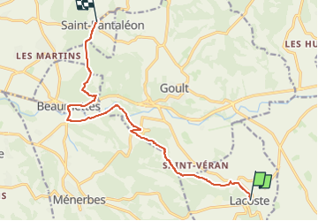
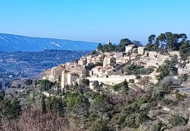
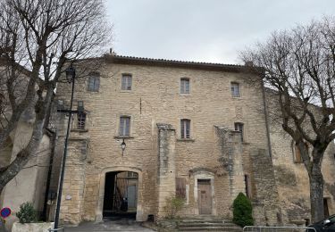
Randonnée Marche de 12,6 km à découvrir à Provence-Alpes-Côte d'Azur, Vaucluse, Lacoste. Cette randonnée est proposée par SPHV84.
Description
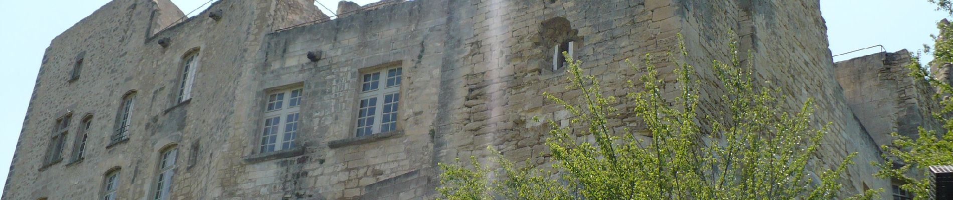
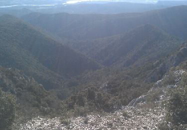
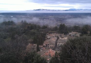
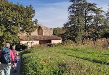
Traversée de la plaine du Calavon en partant du magnifique village de Lacoste, puis en empruntant en partie la via Domitia avec l’habitat troglodytique aux Beaumettes et les constructions de pierres sèches. Ce parcours est l'une des 4 étapes de l'Itinéraire culturel européen "Sur les Pas des Huguenots et des Vaudois". Il traverse le territoire du Parc Naturel Régional du Luberon, de Mérindol à Saint-Hubert (Monieux).
Localisation
Commentaires
Randonnées à proximité
![Randonnée Marche Ménerbes - tt - Photo](https://media.geolcdn.com/t/375/260/ext.jpg?maxdim=2&url=https%3A%2F%2Fservices.sitytrail.com%2FGeolivesWS%2FDownloadMedia.ashx%3FTrailID%3D252059%26Media%3Dfix__20140223153309.jpg)
![Marche Marche](https://static1.geolcdn.com/sitytour/trail-icons/101.png)
Marche
![](/images/other/stat-length.png)
![](https://static1.geolcdn.com/siteimages/upload/files/16400158638029165_repeat_loop_refresh_sync_direction_icon.png)
![Randonnée Marche Ménerbes - Gde rando Ménerbes-Oppède-Les hautes Plaines-Abbayes de saint hillaire - Photo](https://media.geolcdn.com/t/375/260/ext.jpg?maxdim=2&url=https%3A%2F%2Fservices.sitytrail.com%2FGeolivesWS%2FDownloadMedia.ashx%3FTrailID%3D250145%26Media%3Dfix__20140216113833.jpg)
![Marche Marche](https://static1.geolcdn.com/sitytour/trail-icons/101.png)
Marche
![](/images/other/stat-length.png)
![](https://static1.geolcdn.com/siteimages/upload/files/16400158638029165_repeat_loop_refresh_sync_direction_icon.png)
![Randonnée Marche Bonnieux - Forêt de Cêdre - Roque des Bancs - Baume Rousse - Grottes de Font Scure et des Vaudois - Le Portalas - Photo](https://media.geolcdn.com/t/375/260/ext.jpg?maxdim=2&url=https%3A%2F%2Fservices.sitytrail.com%2FGeolivesWS%2FDownloadMedia.ashx%3FTrailID%3D103432%26Media%3D5548_1.jpg)
![Marche Marche](https://static1.geolcdn.com/sitytour/trail-icons/101.png)
Marche
![](/images/other/stat-length.png)
![](https://static1.geolcdn.com/siteimages/upload/files/16400158638029165_repeat_loop_refresh_sync_direction_icon.png)
![Randonnée A pied Bonnieux - foret-des-cedres-bonnieux-Portalas - Photo](https://media.geolcdn.com/t/375/260/ext.jpg?maxdim=2&url=https%3A%2F%2Fstatic1.geolcdn.com%2Fsiteimages%2Fupload%2Ffiles%2F1545311037marcheuse_200dpi.jpg)
![A pied A pied](https://static1.geolcdn.com/sitytour/trail-icons/100.png)
A pied
![](/images/other/stat-length.png)
![](https://static1.geolcdn.com/siteimages/upload/files/16400158638029165_repeat_loop_refresh_sync_direction_icon.png)
![Marche Marche](https://static1.geolcdn.com/sitytour/trail-icons/101.png)
Marche
![](/images/other/stat-length.png)
![](https://static1.geolcdn.com/siteimages/upload/files/16400158638029165_repeat_loop_refresh_sync_direction_icon.png)
![Randonnée Marche Bonnieux - Bonnieux ➡️ Lacoste - Photo](https://media.geolcdn.com/t/375/260/3f9a12ad-17d9-4e59-ad48-88f0c26392cc.jpg&format=jpg&maxdim=2)
![Marche Marche](https://static1.geolcdn.com/sitytour/trail-icons/101.png)
Marche
![](/images/other/stat-length.png)
![](https://static1.geolcdn.com/siteimages/upload/files/16400158638029165_repeat_loop_refresh_sync_direction_icon.png)
![Randonnée Marche Bonnieux - Autour de Bonnieux - Photo](https://media.geolcdn.com/t/375/260/9b40f727-765c-4520-9e6b-2957cc005302.jpg&format=jpg&maxdim=2)
![Marche Marche](https://static1.geolcdn.com/sitytour/trail-icons/101.png)
Marche
![](/images/other/stat-length.png)
![](https://static1.geolcdn.com/siteimages/upload/files/16400158638029165_repeat_loop_refresh_sync_direction_icon.png)
![Randonnée Marche Lacoste - LACOSTE , Vaucluse, la forêt des cèdres o - Photo](https://media.geolcdn.com/t/375/260/8cea2549-30ed-4986-8205-efdbec82ae2e.jpg&format=jpg&maxdim=2)
![Marche Marche](https://static1.geolcdn.com/sitytour/trail-icons/101.png)
Marche
![](/images/other/stat-length.png)
![](https://static1.geolcdn.com/siteimages/upload/files/16400158638029165_repeat_loop_refresh_sync_direction_icon.png)
![Randonnée Marche Goult - PF-Goult - Beaumettes - Lumières - 15.03.2022 - Photo](https://media.geolcdn.com/t/375/260/4c927e97-dbf8-4901-ab27-568f32baec87.jpg&format=jpg&maxdim=2)
![Marche Marche](https://static1.geolcdn.com/sitytour/trail-icons/101.png)
Marche
![](/images/other/stat-length.png)
![](https://static1.geolcdn.com/siteimages/upload/files/16400158638029165_repeat_loop_refresh_sync_direction_icon.png)