Nebelhorn
Geert H.
Utilisateur
Longueur
12,6 km
Altitude max
2210 m
Dénivelé positif
217 m
Km-Effort
20 km
Altitude min
812 m
Dénivelé négatif
1586 m
Boucle
Non
Date de création :
2024-06-18 10:43:26.572
Dernière modification :
2024-06-22 07:46:24.39
2h18
Difficulté : Moyen
Application GPS de randonnée GRATUITE
À propos
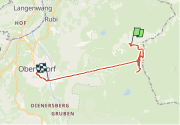
Randonnée Marche de 12,6 km à découvrir à Bavière, Landkreis Oberallgäu, Oberstdorf. Cette randonnée est proposée par Geert H..
Description
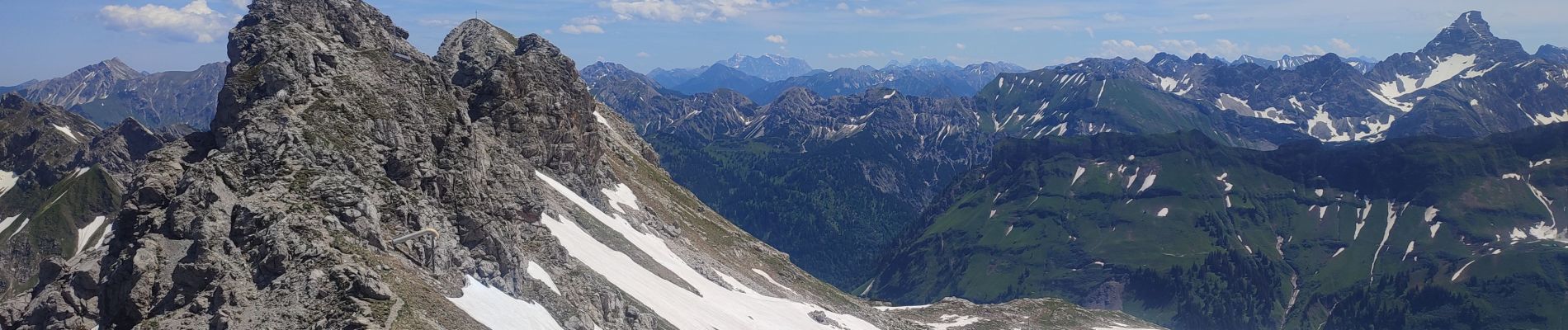
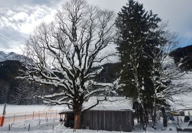
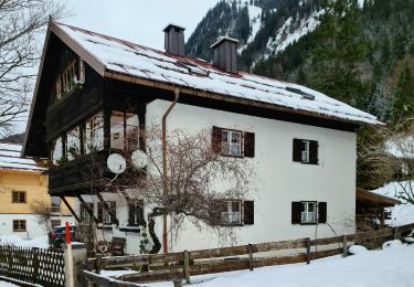
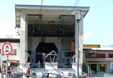
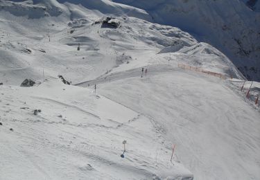
Went up to the top of the Nebelhorn by cable car and came back on foot to the Höfatsblick mountain station. Walke around and back down to Oberstdorf to see a little bit of the town.
Localisation
Pays :
Allemagne
Région :
Bavière
Département/Province :
Landkreis Oberallgäu
Commune :
Oberstdorf
Localité :
Unknown
Départ:(Dec)
Départ:(UTM)
601282 ; 5252933 (32T) N.
Commentaires
Randonnées à proximité
B - Winterwanderung ins Stillachtal
A pied
Facile
Oberstdorf,
Bavière,
Landkreis Oberallgäu,
Allemagne
4,4 km | 6,2 km-effort
1h 24min
Non
D - Gerstruben - ein Bergdorf im Winter
A pied
Facile
Oberstdorf,
Bavière,
Landkreis Oberallgäu,
Allemagne
3,2 km | 3,9 km-effort
52min
Non
O - Winterwanderung ins Oytal
A pied
Facile
Oberstdorf,
Bavière,
Landkreis Oberallgäu,
Allemagne
4,9 km | 5,7 km-effort
1h 17min
Non
G - Winterwanderung zur Gaisalpe
A pied
Facile
Oberstdorf,
Bavière,
Landkreis Oberallgäu,
Allemagne
4,6 km | 6,2 km-effort
1h 24min
Non
Ru - Im Winter zur Schöllanger Burgkirche
A pied
Facile
Oberstdorf,
Bavière,
Landkreis Oberallgäu,
Allemagne
3,6 km | 4,4 km-effort
59min
Non
Hindelanger Klettersteig
A pied
Facile
Oberstdorf,
Bavière,
Landkreis Oberallgäu,
Allemagne
6,7 km | 13,1 km-effort
2h 58min
Non
M - Über den Moorweiher ins Trettachtal
A pied
Facile
Oberstdorf,
Bavière,
Landkreis Oberallgäu,
Allemagne
6,7 km | 8,4 km-effort
1h 54min
Non
H - Vom Schönblick nach Hochleite
A pied
Facile
Oberstdorf,
Bavière,
Landkreis Oberallgäu,
Allemagne
9,5 km | 17,2 km-effort
3h 54min
Non
f-duitsland-trettachtal-langs-de-iller
Vélo
Très facile
Fischen im Allgäu,
Bavière,
Landkreis Oberallgäu,
Allemagne
30 km | 35 km-effort
Inconnu
Oui