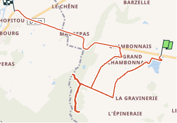
10,8 km | 12,1 km-effort
bouges
2433e59
Utilisateur
Longueur
11 km
Altitude max
144 m
Dénivelé positif
86 m
Km-Effort
12,2 km
Altitude min
112 m
Dénivelé négatif
93 m
Boucle
Non
Date de création :
2024-05-26 12:08:48.208
Dernière modification :
2024-05-26 14:13:51.85
2h04
Difficulté : Très facile
Application GPS de randonnée GRATUITE
À propos
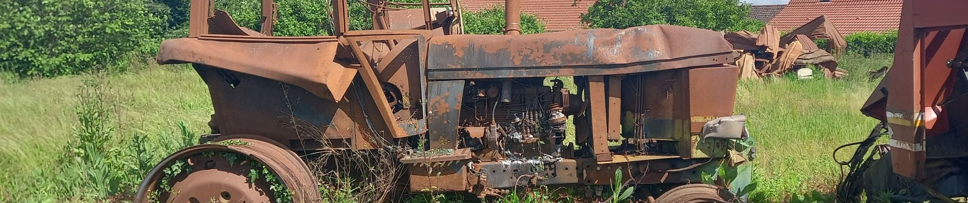
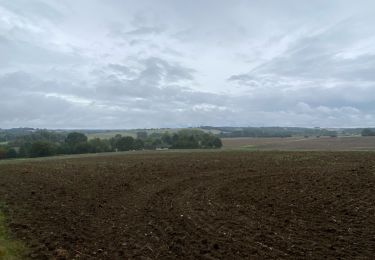
Randonnée Marche de 11 km à découvrir à Centre-Val de Loire, Indre, Poulaines. Cette randonnée est proposée par 2433e59.
Localisation
Pays :
France
Région :
Centre-Val de Loire
Département/Province :
Indre
Commune :
Poulaines
Localité :
Unknown
Départ:(Dec)
Départ:(UTM)
396496 ; 5223360 (31T) N.
Commentaires
Randonnées à proximité
Entre forêt et manoirs, sur le chemin des Barres
Marche
Facile
(2)
Mennetou-sur-Cher,
Centre-Val de Loire,
Loir-et-Cher,
France
2h 42min
Oui
Seigy - GR41 Saint-Aignan - 15.3km 250m 3h50 - 2022 08 27
Marche
Facile
Seigy,
Centre-Val de Loire,
Loir-et-Cher,
France
15,3 km | 18,7 km-effort
3h 50min
Oui
Saint-Aignan - Centre-ville Château Zoo - 13km 175m 4h00 - 2015 12 27
Marche
Très facile
Saint-Aignan,
Centre-Val de Loire,
Loir-et-Cher,
France
13 km | 15,4 km-effort
4h 0min
Oui
Mehers 8 août 2021
A pied
Facile
Méhers,
Centre-Val de Loire,
Loir-et-Cher,
France
10,9 km | 11,7 km-effort
2h 39min
Oui
anjouin
Marche
Très facile
Anjouin,
Centre-Val de Loire,
Indre,
France
19,6 km | 23 km-effort
3h 57min
Oui
villentrois 2019
Marche
Très facile
Villentrois-Faverolles-en-Berry,
Centre-Val de Loire,
Indre,
France
17,8 km | 20 km-effort
3h 13min
Non
À côté du GR41 depuis le camping St. Aignan
Marche
Très facile
Seigy,
Centre-Val de Loire,
Loir-et-Cher,
France
10,8 km | 12,7 km-effort
5h 50min
Non
Chemin du Briou - Mennetou-sur-Cher
Marche
Facile
Mennetou-sur-Cher,
Centre-Val de Loire,
Loir-et-Cher,
France
7,7 km | 8,7 km-effort
2h 0min
Oui
Viocq , Valancey
Marche
Très facile
Vicq-sur-Nahon,
Centre-Val de Loire,
Indre,
France
12,5 km | 14,4 km-effort
3h 19min
Non