


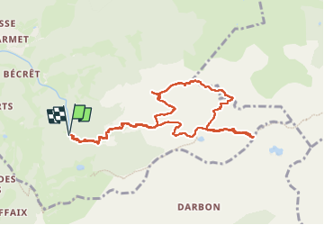


9,2 km | 22 km-effort

Utilisateur


Application GPS de randonnée GRATUITE
 SityTrail
IGN / Instituts géographiques
SityTrail World
Le monde est à vous
Randonnée Marche de 10,5 km à découvrir à Auvergne-Rhône-Alpes, Haute-Savoie, Bernex. Cette randonnée est proposée par djeepee74.
Très belle rando quand les nuages s'écartent 😝
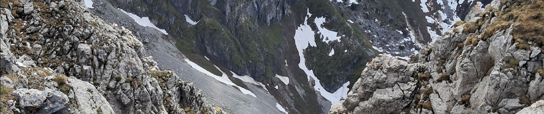
Passages avec chaînes et descente raide... trop de neige pour descendre jusqu'au lac !
Boucle live de Karine le 20240525.


21 photos au total. Cliquez sur une photo pour les afficher toutes dans la galerie.

Marche

Marche

Marche

Marche

Marche

Marche

Marche

Marche

Marche