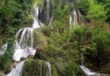
14,8 km | 23 km-effort
21-Sources de la Loue
ABR GV La Tronche
Convivialité Montagne Santé
Longueur
6,5 km
Altitude max
607 m
Dénivelé positif
351 m
Km-Effort
10,6 km
Altitude min
377 m
Dénivelé négatif
185 m
Boucle
Non
Date de création :
2024-05-23 13:10:57.659
Dernière modification :
2024-05-23 13:14:03.263
2h24
Difficulté : Facile
Application GPS de randonnée GRATUITE
À propos
Randonnée A pied de 6,5 km à découvrir à Bourgogne-Franche-Comté, Doubs, Mouthier-Haute-Pierre. Cette randonnée est proposée par ABR GV La Tronche.
Localisation
Pays :
France
Région :
Bourgogne-Franche-Comté
Département/Province :
Doubs
Commune :
Mouthier-Haute-Pierre
Localité :
Unknown
Départ:(Dec)
Départ:(UTM)
293251 ; 5213174 (32T) N.
Commentaires
Randonnées à proximité
gorges de noailles
Marche
Très difficile
(2)
Mouthier-Haute-Pierre,
Bourgogne-Franche-Comté,
Doubs,
France
5h 13min
Oui
la source de la loue
Marche
Moyen
(1)
Ouhans,
Bourgogne-Franche-Comté,
Doubs,
France
16,1 km | 25 km-effort
4h 21min
Oui
Source de la Loue - Mouthier Haute Pierre
Marche
Moyen
(1)
Mouthier-Haute-Pierre,
Bourgogne-Franche-Comté,
Doubs,
France
10,6 km | 16,5 km-effort
2h 19min
Oui
Autour de Vuillafans
Marche
Difficile
(1)
Vuillafans,
Bourgogne-Franche-Comté,
Doubs,
France
11 km | 17,8 km-effort
4h 0min
Oui
Roche de Hautepierre (881 m)
Marche
Difficile
(1)
Mouthier-Haute-Pierre,
Bourgogne-Franche-Comté,
Doubs,
France
11,6 km | 19,1 km-effort
4h 30min
Oui
Mouthier Haute Pierre
A pied
Moyen
(1)
Mouthier-Haute-Pierre,
Bourgogne-Franche-Comté,
Doubs,
France
14,1 km | 23 km-effort
5h 11min
Oui
la roche Hautepierre. Lods
Marche
Moyen
(1)
Lods,
Bourgogne-Franche-Comté,
Doubs,
France
13,1 km | 21 km-effort
2h 15min
Oui
Gorges de Nouailles - Source de la Loue
Marche
Facile
Mouthier-Haute-Pierre,
Bourgogne-Franche-Comté,
Doubs,
France
11,6 km | 17,6 km-effort
4h 7min
Oui
boucle de la source de la loue
Marche
Moyen
Ouhans,
Bourgogne-Franche-Comté,
Doubs,
France
16,5 km | 25 km-effort
4h 21min
Oui