


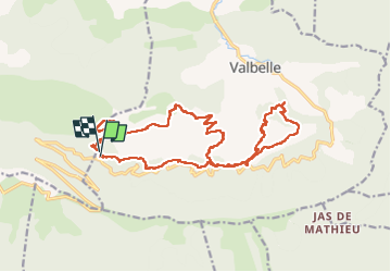

13,2 km | 19,7 km-effort

Utilisateur GUIDE


Application GPS de randonnée GRATUITE
 SityTrail
IGN / Instituts géographiques
SityTrail World
Le monde est à vous
Randonnée Marche de 21 km à découvrir à Provence-Alpes-Côte d'Azur, Alpes-de-Haute-Provence, Valbelle. Cette randonnée est proposée par nadd73.
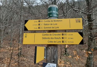
Le passage après la chapelle est équipé de cordes, et de marches en fer. Avoir le pied sûr et ne pas avoir le vertige. . Sinon on est souvent dans la forêt.


Marche

Marche

Marche

A pied

Marche

A pied

Marche
Marche
Marche