Randonnée Marche Strasbourg - La ceinture verte de Strasbourg - Photo

La ceinture verte de Strasbourg

 VacheKiri67
VacheKiri67

Utilisateur

© OpenStreetMap contributors
Longueur
Longueur
19,8 km
Altitude max
Altitude max
155 m
Dénivelé positif
Dénivelé positif
197 m
Km-Effort
Km-Effort  
22 km
Altitude min
Altitude min
125 m
Dénivelé négatif
Dénivelé négatif
197 m
Boucle
Boucle
Oui
Date de création :
2024-05-20 08:19:16.539
Dernière modification :
2024-05-21 16:05:30.892

(0 Avis)

Marche
Marche
4h06
Difficulté : Moyen

Scannez ce code QR pour ouvrir la randonnée dans l'application SityTrail

Application GPS de randonnée GRATUITE

Logo SityTrail SityTrail

IGN / Instituts géographiques

Télécharger SityTrail sur l'App Store Télécharger SityTrail sur Google Play

Logo SityTrail SityTrail World

Le monde est à vous

Télécharger SityTrail sur l'App Store Télécharger SityTrail sur Google Play Télécharger SityTrail sur Huawei AppGallery

À propos

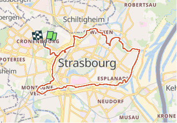
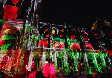
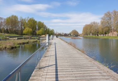
Randonnée Marche de 19,8 km à découvrir à Grand Est, Bas-Rhin, Strasbourg. Cette randonnée est proposée par VacheKiri67.

Description

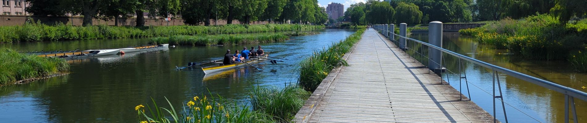
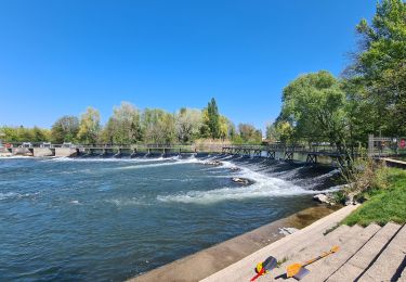
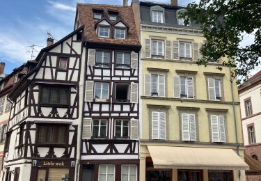
Faite le 20/05/2024. Ce sentier circulaire passe en milieu urbain et permet de découvrir un aspect insolite de Strasbourg en utilisant les espaces verts et les chemins longeant les voies d'eau. Balisage = anneau rouge.

Profil altimétrique

Photos

56 photos au total. Cliquez sur une photo pour les afficher toutes dans la galerie.

Localisation

Pays :
France
Région :
Grand Est
Département/Province :
Bas-Rhin
Commune :
Strasbourg
Localité :
Unknown
Départ:(Dec)
Départ:(UTM)
405702 ; 5382890 (32U) N.

Randonnées à proximité

Randonnée Marche Strasbourg - Strasbourg - Centre historique  - Photo
Marche
phil88

Marche

Facile
(3)
Strasbourg, Grand Est, Bas-Rhin, France
8 km | 9,2 km-effort
2h 11min
Non
Randonnée Marche Strasbourg - Histoires d'eaux.... et de forêts au nord de Strasbourg - Photo
Marche
Claudele

Marche

Difficile
(1)
Strasbourg, Grand Est, Bas-Rhin, France
26 km | 28 km-effort
5h 57min
Oui
Randonnée Marche Strasbourg - Untitled - Photo
Marche
EricMathieu

Marche

Très facile
(1)
Strasbourg, Grand Est, Bas-Rhin, France
6,1 km | 7 km-effort
1h 42min
Oui
Randonnée Marche Bischheim - marchepop bischheim 10km 2021 - Photo
Marche
banitz

Marche

Très facile
(1)
Bischheim, Grand Est, Bas-Rhin, France
10,7 km | 11,8 km-effort
2h 31min
Oui
Randonnée Marche Strasbourg - Strasbourg - Obernay 2024 - Photo
Marche
Joseph Mertens

Marche

Moyen
(2)
Strasbourg, Grand Est, Bas-Rhin, France
7 km | 8,4 km-effort
1h 53min
Non
Randonnée Marche Strasbourg - La ceinture verte de Strasbourg - Photo
Marche
VacheKiri67

Marche

Difficile
Strasbourg, Grand Est, Bas-Rhin, France
20 km | 23 km-effort
3h 53min
Oui
Randonnée Marche Strasbourg - Forêt de la Robertsau et Rhin - Photo
Marche
Claudele

Marche

Facile
(1)
Strasbourg, Grand Est, Bas-Rhin, France
17,9 km | 20 km-effort
5h 13min
Oui
Randonnée Marche Strasbourg - Strasbourg Impérial  - Photo
Marche
phil88

Marche

Facile
Strasbourg, Grand Est, Bas-Rhin, France
11,6 km | 13,2 km-effort
3h 40min
Oui
Randonnée Marche Strasbourg - La ceinture verte de Strasbourg - Photo
Marche
VacheKiri67

Marche

Difficile
(1)
Strasbourg, Grand Est, Bas-Rhin, France
21 km | 23 km-effort
5h 21min
Non


Fermer
Mes abonnements