![](/images/other/stat-length.png)
![Randonnée Marche Roppeviller - Roppeviller Rocher de Diane - Altschlossfelsen - Photo](https://media.geolcdn.com/t/1900/400/ext.pjpeg?maxdim=2&url=https%3A%2F%2Fstatic1.geolcdn.com%2Fsiteimages%2Fupload%2Ffiles%2F1553511878bg_sport_marche.png)
Roppeviller Rocher de Diane - Altschlossfelsen
noelphil
Utilisateur
![Longueur](/images/other/stat-length.png)
![Altitude max](https://static1.geolcdn.com/siteimages/upload/files/1508320355ic_sort_altitude_max_24dp.png)
![Dénivelé positif](https://static1.geolcdn.com/siteimages/upload/files/1508320355ic_sort_den_pos_24dp.png)
![Km-Effort](/images/other/stat-length.png)
![Altitude min](https://static1.geolcdn.com/siteimages/upload/files/1508320355ic_sort_altitude_min_24dp.png)
![Dénivelé négatif](https://static1.geolcdn.com/siteimages/upload/files/1508320355ic_sort_den_neg_24dp.png)
![Boucle](https://static1.geolcdn.com/siteimages/upload/files/16400158638029165_repeat_loop_refresh_sync_direction_icon.png)
![Marche](https://static1.geolcdn.com/sitytour/trail-icons/101.png)
2h09
Difficulté : Moyen
![Scannez ce code QR pour ouvrir la randonnée dans l'application SityTrail](https://capi.geolives.com/qq0zvz2zws4bq2lad0pu/sitytour/trails/4051117/qr.png?size=200)
Application GPS de randonnée GRATUITE
À propos
Randonnée Marche de 6,9 km à découvrir à Grand Est, Moselle, Roppeviller. Cette randonnée est proposée par noelphil.
Description
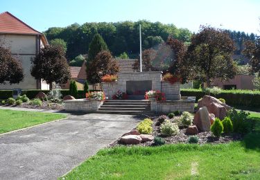
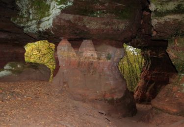
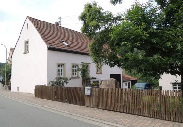
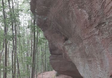
Laisser les voitures au parking près de l’église de Roppeviller. Se diriger vers la rue Principale et tourner à droite sur balisage croix jaune. Après 100m, monter à gauche sur la route puis le chemin qui vous mènera jusqu’à la frontière allemande, à 1,2km, non balisé. Tourner à droite sur balisage rectangle blanc et bleu et descendre vers les trois sculptures gallo romaines du Rocher de Diane (Diana Bild) sur le rocher de Lauerstein (voir aussi le polissoir). Continuer à longer la frontière en suivant le balisage rectangle blanc et bleu. Le camp militaire de Bitche vient jusque là, sur la droite du chemin. Longer les falaises du Altschloßfelsen, sur 1,3 km, balisage rectangle blanc et bleu. Arrivé à un carrefour, tourner à gauche sur un bon chemin, 1 km non balisé, pour revenir à la frontière que l’on franchit pour continuer vers Roppeviller, balisage croix jaune. D’abord sur un chemin avec pavés en grès (voie gallo romaine ?), puis sur la rue Principale du village et retour au parking.
Localisation
Commentaires
Randonnées à proximité
![Randonnée Marche Roppeviller - Le rocher de l'Altschlossfelsen - Photo](https://media.geolcdn.com/t/375/260/ext.jpg?maxdim=2&url=https%3A%2F%2Fservices.sitytrail.com%2FGeolivesWS%2FDownloadMedia.ashx%3FTrailID%3D507904%26Media%3Dfix__20151230144825.jpg)
![Marche Marche](https://static1.geolcdn.com/sitytour/trail-icons/101.png)
Marche
![](/images/other/stat-length.png)
![](https://static1.geolcdn.com/siteimages/upload/files/16400158638029165_repeat_loop_refresh_sync_direction_icon.png)
![Randonnée A pied Roppeviller - Circuit du rocher de l'Altschlossfelsen - Photo](https://media.geolcdn.com/t/375/260/e479e6c8-b176-4dba-ba62-ac01003618c1.jpeg&format=jpg&maxdim=2)
![A pied A pied](https://static1.geolcdn.com/sitytour/trail-icons/100.png)
A pied
![](/images/other/stat-length.png)
![](https://static1.geolcdn.com/siteimages/upload/files/16400158638029165_repeat_loop_refresh_sync_direction_icon.png)
![Randonnée A pied Schweix - Anneau rouge - Photo](https://media.geolcdn.com/t/375/260/5ef45392-b749-445c-a602-485042878f58.jpeg&format=jpg&maxdim=2)
![A pied A pied](https://static1.geolcdn.com/sitytour/trail-icons/100.png)
A pied
![](/images/other/stat-length.png)
![](https://static1.geolcdn.com/siteimages/upload/files/16400158638029165_repeat_loop_refresh_sync_direction_icon.png)
![Randonnée A pied Eppenbrunn - Rundwanderweg Eppenbrunn 4 - Photo](https://media.geolcdn.com/t/375/260/d76b12f8-9b11-4fdc-b6fb-e06d26791a08.jpeg&format=jpg&maxdim=2)
![A pied A pied](https://static1.geolcdn.com/sitytour/trail-icons/100.png)
A pied
![](/images/other/stat-length.png)
![](https://static1.geolcdn.com/siteimages/upload/files/16400158638029165_repeat_loop_refresh_sync_direction_icon.png)
![Randonnée A pied Eppenbrunn - Rundwanderweg Eppenbrunn 3 - Photo](https://media.geolcdn.com/t/375/260/8b8b2093-265c-4b8e-94ca-9cb59e68b168.jpeg&format=jpg&maxdim=2)
![A pied A pied](https://static1.geolcdn.com/sitytour/trail-icons/100.png)
A pied
![](/images/other/stat-length.png)
![](https://static1.geolcdn.com/siteimages/upload/files/16400158638029165_repeat_loop_refresh_sync_direction_icon.png)
![Randonnée A pied Eppenbrunn - Grenzweg - Photo](https://media.geolcdn.com/t/375/260/e479e6c8-b176-4dba-ba62-ac01003618c1.jpeg&format=jpg&maxdim=2)
![A pied A pied](https://static1.geolcdn.com/sitytour/trail-icons/100.png)
A pied
![](/images/other/stat-length.png)
![](https://static1.geolcdn.com/siteimages/upload/files/16400158638029165_repeat_loop_refresh_sync_direction_icon.png)
![Randonnée A pied Eppenbrunn - Altschloßpfad - Photo](https://media.geolcdn.com/t/375/260/a5395986-09d3-4d9b-b349-30e698a212eb.jpeg&format=jpg&maxdim=2)
![A pied A pied](https://static1.geolcdn.com/sitytour/trail-icons/100.png)
A pied
![](/images/other/stat-length.png)
![](https://static1.geolcdn.com/siteimages/upload/files/16400158638029165_repeat_loop_refresh_sync_direction_icon.png)
![Randonnée A pied Eppenbrunn - Disque rouge - Photo](https://media.geolcdn.com/t/375/260/d76b12f8-9b11-4fdc-b6fb-e06d26791a08.jpeg&format=jpg&maxdim=2)
![A pied A pied](https://static1.geolcdn.com/sitytour/trail-icons/100.png)
A pied
![](/images/other/stat-length.png)
![](https://static1.geolcdn.com/siteimages/upload/files/16400158638029165_repeat_loop_refresh_sync_direction_icon.png)
![Randonnée Marche Roppeviller - Roppeviller - Photo](https://media.geolcdn.com/t/375/260/66cfb538-0dd2-4437-b13a-aee3911265be.jpg&format=jpg&maxdim=2)
![Marche Marche](https://static1.geolcdn.com/sitytour/trail-icons/101.png)
Marche
![](/images/other/stat-length.png)
![](https://static1.geolcdn.com/siteimages/upload/files/16400158638029165_repeat_loop_refresh_sync_direction_icon.png)