![](/images/other/stat-length.png)
![Randonnée Marche Maisons - Les Contreforts du Mont Tauch - Photo](https://media.geolcdn.com/t/1900/400/ext.pjpeg?maxdim=2&url=https%3A%2F%2Fstatic1.geolcdn.com%2Fsiteimages%2Fupload%2Ffiles%2F1553511878bg_sport_marche.png)
Les Contreforts du Mont Tauch
cappelle
Utilisateur
![Longueur](/images/other/stat-length.png)
Longueur
12,4 km
![Altitude max](https://static1.geolcdn.com/siteimages/upload/files/1508320355ic_sort_altitude_max_24dp.png)
Altitude max
627 m
![Dénivelé positif](https://static1.geolcdn.com/siteimages/upload/files/1508320355ic_sort_den_pos_24dp.png)
Dénivelé positif
477 m
![Km-Effort](/images/other/stat-length.png)
Km-Effort
18,7 km
![Altitude min](https://static1.geolcdn.com/siteimages/upload/files/1508320355ic_sort_altitude_min_24dp.png)
Altitude min
301 m
![Dénivelé négatif](https://static1.geolcdn.com/siteimages/upload/files/1508320355ic_sort_den_neg_24dp.png)
Dénivelé négatif
474 m
![Boucle](https://static1.geolcdn.com/siteimages/upload/files/16400158638029165_repeat_loop_refresh_sync_direction_icon.png)
Boucle
Oui
Date de création :
2024-04-26 06:14:41.413
Dernière modification :
2024-04-26 06:42:41.558
![Marche](https://static1.geolcdn.com/sitytour/trail-icons/101.png)
4h15
Difficulté : Difficile
![Scannez ce code QR pour ouvrir la randonnée dans l'application SityTrail](https://capi.geolives.com/qq0zvz2zws4bq2lad0pu/sitytour/trails/4029938/qr.png?size=200)
Application GPS de randonnée GRATUITE
À propos
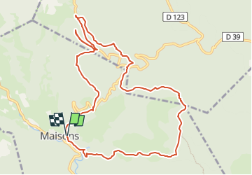
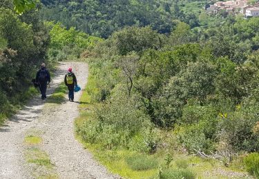
Randonnée Marche de 12,4 km à découvrir à Occitanie, Aude, Maisons. Cette randonnée est proposée par cappelle.
Description
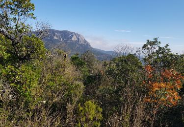
belle rando , vue sur les pyrénées , quelques grimpettes et descentes , prudence , a faire par temps sec .
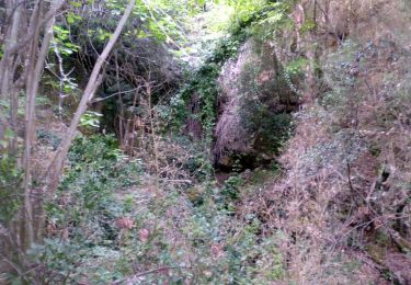
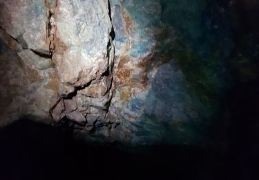
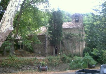
sur le chemin anciennes mines km 9
Se garer au cimetière de Maisons ( chemin menant au lac impraticable en voiture )
Points d'intérêt
Localisation
Pays :
France
Région :
Occitanie
Département/Province :
Aude
Commune :
Maisons
Localité :
Unknown
Départ:(Dec)
Départ:(UTM)
470224 ; 4752793 (31T) N.
Commentaires
Randonnées à proximité
![Randonnée Marche Davejean - DAVEJEAN - Les petits chemins de Davejean - Photo](https://media.geolcdn.com/t/375/260/badd948f-60b6-4449-ae7e-ae4e5eeb8a04.jpg&format=jpg&maxdim=2)
![Marche Marche](https://static1.geolcdn.com/sitytour/trail-icons/101.png)
DAVEJEAN - Les petits chemins de Davejean
Marche
Moyen
Davejean,
Occitanie,
Aude,
France
![](/images/other/stat-length.png)
7,1 km | 9,9 km-effort
1h 46min
![](https://static1.geolcdn.com/siteimages/upload/files/16400158638029165_repeat_loop_refresh_sync_direction_icon.png)
Oui
![Randonnée Marche Padern - Mines de Montgaillard ( entrée 2 tunnels ) - Photo](https://media.geolcdn.com/t/375/260/8620a95b-e8ba-4be7-9fb2-f82887b6957e.jpg&format=jpg&maxdim=2)
![Marche Marche](https://static1.geolcdn.com/sitytour/trail-icons/101.png)
Mines de Montgaillard ( entrée 2 tunnels )
Marche
Très facile
Padern,
Occitanie,
Aude,
France
![](/images/other/stat-length.png)
8 km | 11,8 km-effort
3h 42min
![](https://static1.geolcdn.com/siteimages/upload/files/16400158638029165_repeat_loop_refresh_sync_direction_icon.png)
Non
![Randonnée Marche Montgaillard - Mines de Montgaillard Aude - Photo](https://media.geolcdn.com/t/375/260/e3ee3ef4-e79e-4873-b9c8-b362ace221a2.jpg&format=jpg&maxdim=2)
![Marche Marche](https://static1.geolcdn.com/sitytour/trail-icons/101.png)
Mines de Montgaillard Aude
Marche
Très facile
Montgaillard,
Occitanie,
Aude,
France
![](/images/other/stat-length.png)
10,8 km | 15,6 km-effort
4h 20min
![](https://static1.geolcdn.com/siteimages/upload/files/16400158638029165_repeat_loop_refresh_sync_direction_icon.png)
Oui
![Randonnée Marche Maisons - 11-Maisons-Mont Tauch-5-05-2019 - Photo](https://media.geolcdn.com/t/375/260/a149389f-8d4b-48c9-8aba-d567a35b7ee1.jpg&format=jpg&maxdim=2)
![Marche Marche](https://static1.geolcdn.com/sitytour/trail-icons/101.png)
11-Maisons-Mont Tauch-5-05-2019
Marche
Moyen
Maisons,
Occitanie,
Aude,
France
![](/images/other/stat-length.png)
15 km | 24 km-effort
4h 38min
![](https://static1.geolcdn.com/siteimages/upload/files/16400158638029165_repeat_loop_refresh_sync_direction_icon.png)
Oui
![Randonnée A pied Palairac - Le Prat de Labat - Photo](https://media.geolcdn.com/t/375/260/df4bdfd1-aba8-4ae0-9fe6-309f91c16069.jpeg&format=jpg&maxdim=2)
![A pied A pied](https://static1.geolcdn.com/sitytour/trail-icons/100.png)
![Randonnée Marche Maisons - M'ont Tauch Roger - Photo](https://media.geolcdn.com/t/375/260/ext.jpg?maxdim=2&url=https%3A%2F%2Fstatic1.geolcdn.com%2Fsiteimages%2Fupload%2Ffiles%2F1553511878bg_sport_marche.png)
![Marche Marche](https://static1.geolcdn.com/sitytour/trail-icons/101.png)
![Randonnée Marche Palairac - Palairac randonnée - Photo](https://media.geolcdn.com/t/375/260/ext.jpg?maxdim=2&url=https%3A%2F%2Fstatic1.geolcdn.com%2Fsiteimages%2Fupload%2Ffiles%2F1553511878bg_sport_marche.png)
![Marche Marche](https://static1.geolcdn.com/sitytour/trail-icons/101.png)
Palairac randonnée
Marche
Moyen
Palairac,
Occitanie,
Aude,
France
![](/images/other/stat-length.png)
18,4 km | 27 km-effort
4h 23min
![](https://static1.geolcdn.com/siteimages/upload/files/16400158638029165_repeat_loop_refresh_sync_direction_icon.png)
Non
![Randonnée Vélo Dernacueillette - autour de chez Pô - Photo](https://media.geolcdn.com/t/375/260/ext.jpg?maxdim=2&url=https%3A%2F%2Fservices.sitytrail.com%2FGeolivesWS%2FDownloadMedia.ashx%3FTrailID%3D1009773%26Media%3Dfix__20180724093957.jpg)
![Vélo Vélo](https://static1.geolcdn.com/sitytour/trail-icons/200.png)
autour de chez Pô
Vélo
Très facile
Dernacueillette,
Occitanie,
Aude,
France
![](/images/other/stat-length.png)
50 km | 61 km-effort
3h 20min
![](https://static1.geolcdn.com/siteimages/upload/files/16400158638029165_repeat_loop_refresh_sync_direction_icon.png)
Oui
![Randonnée Marche Palairac - palairac - Photo](https://media.geolcdn.com/t/375/260/ext.jpg?maxdim=2&url=https%3A%2F%2Fstatic1.geolcdn.com%2Fsiteimages%2Fupload%2Ffiles%2F1553511878bg_sport_marche.png)
![Marche Marche](https://static1.geolcdn.com/sitytour/trail-icons/101.png)