


12,2 km | 13,1 km-effort

RCM ... l'esprit rando à vélo et à pied !


Application GPS de randonnée GRATUITE
 SityTrail
IGN / Instituts géographiques
SityTrail World
Le monde est à vous
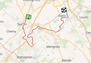
Randonnée Marche de 24 km à découvrir à Hauts-de-France, Nord, Seclin. Cette randonnée est proposée par Randonneur Club Marcquois.
Le chemin inverse de ce que nous avons déjà fait mais avec correctif en fonction des pluies et inondations ... d'où 24/25 km en souplesse dans la Pévèle Carembault proche de Lille (accès : gare de Seclin, billet dans le Pass MEL et Fretin, idem), en option on peut raccourcir en coupant vers le km 7 donc un petit 17 km, sinon le plus utile à connaitre est la restauration à environ 9 km de Fretin : deux solutions le café rando (à peu près, il accepte le repas du sac) : L'Incontournable à Avelin T : 0613537601, ou alors le restau mais bien (du local, local ! même si le nom)... le Ch'ti Boucanier à 200 m T: 032058762, Mme Boutemy, menu à 23 € (3 services , boisson, café en salle ou terrasse, super plein de place)... donc la rando au départ de Seclin c'est 17 ou 23 km et on peut choisir le sens car les trains sont assez disponibles à chaque gares ... et il y a de quoi se restaurer en route et boire une bonne bière à l'arrivée... en cherchant un peu dans les villages. Bonne rando !

Marche
Marche

Marche

Marche

Marche

Marche
Marche
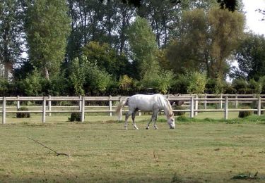
Cheval