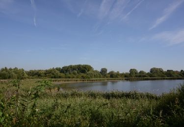
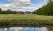
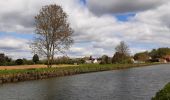
Randonnée Marche Belœil - Le long du canal Ath-Blaton - Photo

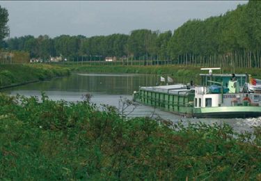
Le long du canal Ath-Blaton

 Greg813
Greg813

Utilisateur

© OpenStreetMap contributors
Longueur
Longueur
22 km
Altitude max
Altitude max
99 m
Dénivelé positif
Dénivelé positif
206 m
Km-Effort
Km-Effort  
25 km
Altitude min
Altitude min
52 m
Dénivelé négatif
Dénivelé négatif
209 m
Boucle
Boucle
Oui
Date de création :
2024-04-21 07:33:31.187
Dernière modification :
2024-05-11 15:29:38.995

(0 Avis)

Marche
Marche
5h39
Difficulté : Moyen

Scannez ce code QR pour ouvrir la randonnée dans l'application SityTrail

Application GPS de randonnée GRATUITE

Logo SityTrail SityTrail

IGN / Instituts géographiques

Télécharger SityTrail sur l'App Store Télécharger SityTrail sur Google Play

Logo SityTrail SityTrail World

Le monde est à vous

Télécharger SityTrail sur l'App Store Télécharger SityTrail sur Google Play Télécharger SityTrail sur Huawei AppGallery

À propos

Randonnée Marche de 22 km à découvrir à Wallonie, Hainaut, Belœil. Cette randonnée est proposée par Greg813.

Description

Randonnée avec Mettons le Monde en Marche dans le Hainaut belge.

Au départ de Beloeil, la première partie du trajet permet de découvrir Stambruges et sa forêt mystérieuse : la fontaine bouillonnante et l’arbre à clous. Le chemin du retour permet de déambuler le long du canal de Blaton avant d'arpenter le grand parc du chateau de Beloeil, point final de la randonnée.

Pour d'autres photos, voir le site de l'association :
https://mmm-rando.org/randonnee-beloeuil-belgique-2024/

Profil altimétrique

Photos

Localisation

Pays :
Belgique
Région :
Wallonie
Département/Province :
Hainaut
Commune :
Belœil
Localité :
Unknown
Départ:(Dec)
Départ:(UTM)
552117 ; 5600062 (31U) N.

Randonnées à proximité

Randonnée Marche Belœil - Chemin de la fontaine bouillante - Photo
Marche

Marche

Très facile
(3)
Belœil, Wallonie, Hainaut, Belgique
3,6 km | 4,2 km-effort
Inconnu
Oui
Randonnée Marche Belœil - Beloeil - Circuit Natura 2000, des sites qui valent le détour -  Ht06 - Photo
Marche
GUIDE+

Marche

Très facile
(4)
Belœil, Wallonie, Hainaut, Belgique
3,5 km | 4 km-effort
51min
Oui
Randonnée Cheval Belœil - Boucle de Beloeil - Photo
Cheval
GUIDE+

Cheval

Très facile
Belœil, Wallonie, Hainaut, Belgique
26 km | 30 km-effort
Inconnu
Non
Randonnée A pied Chièvres - La ronde des piedsentes - Photo
A pied
GUIDE+

A pied

Facile
Chièvres, Wallonie, Hainaut, Belgique
7,3 km | 7,8 km-effort
1h 46min
Oui
Randonnée A pied Belœil - Circuit de la Fontaine bouillante - Photo
A pied
GUIDE+

A pied

Facile
Belœil, Wallonie, Hainaut, Belgique
3,8 km | 4,5 km-effort
1h 0min
Oui
Randonnée Marche Belœil - RB-Ha-15 - Beloeil - Via raccourci - Photo
Marche
PRO

Marche

Difficile
Belœil, Wallonie, Hainaut, Belgique
15,7 km | 17,8 km-effort
4h 2min
Oui
Randonnée Marche Belœil - RB-Ha-15 - Beloeil - Photo
Marche
PRO

Marche

Très difficile
(2)
Belœil, Wallonie, Hainaut, Belgique
23 km | 26 km-effort
5h 48min
Oui
Randonnée Marche Chièvres - LADEUZE ( CHIEVRES ) _ Marche Fédérale _ HT _ 18/06/2023 - Photo
Marche
jeangulu

Marche

Moyen
Chièvres, Wallonie, Hainaut, Belgique
19,8 km | 21 km-effort
4h 42min
Oui
Randonnée Marche Bernissart - GARE À GARE Blanton - Erbisoel - Photo
Marche
Ronalddef

Marche

Très difficile
Bernissart, Wallonie, Hainaut, Belgique
26 km | 30 km-effort
5h 30min
Non


Fermer
Mes abonnements