![](/images/other/stat-length.png)
![Randonnée Marche Séranon - Seranon Sommet du Bauroux Caille La Mouliere La clue trace réelle - Photo](https://media.geolcdn.com/t/1900/400/c7ed52be-7174-4392-85b5-b26f672c5acb.jpg&format=pjpeg&maxdim=2)
Seranon Sommet du Bauroux Caille La Mouliere La clue trace réelle
jouans
Utilisateur GUIDE
![Longueur](/images/other/stat-length.png)
Longueur
23 km
![Altitude max](https://static1.geolcdn.com/siteimages/upload/files/1508320355ic_sort_altitude_max_24dp.png)
Altitude max
1630 m
![Dénivelé positif](https://static1.geolcdn.com/siteimages/upload/files/1508320355ic_sort_den_pos_24dp.png)
Dénivelé positif
1024 m
![Km-Effort](/images/other/stat-length.png)
Km-Effort
37 km
![Altitude min](https://static1.geolcdn.com/siteimages/upload/files/1508320355ic_sort_altitude_min_24dp.png)
Altitude min
1087 m
![Dénivelé négatif](https://static1.geolcdn.com/siteimages/upload/files/1508320355ic_sort_den_neg_24dp.png)
Dénivelé négatif
1022 m
![Boucle](https://static1.geolcdn.com/siteimages/upload/files/16400158638029165_repeat_loop_refresh_sync_direction_icon.png)
Boucle
Oui
Date de création :
2024-04-03 06:57:10.0
Dernière modification :
2024-04-03 16:52:55.821
![Marche](https://static1.geolcdn.com/sitytour/trail-icons/101.png)
8h22
Difficulté : Très difficile
![Scannez ce code QR pour ouvrir la randonnée dans l'application SityTrail](https://capi.geolives.com/qq0zvz2zws4bq2lad0pu/sitytour/trails/4003204/qr.png?size=200)
Application GPS de randonnée GRATUITE
À propos
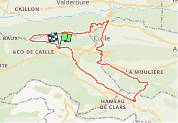
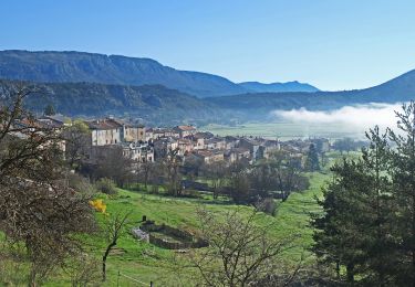
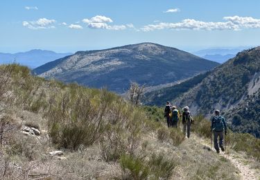
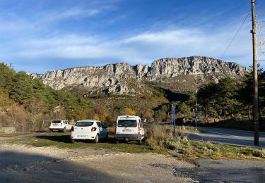
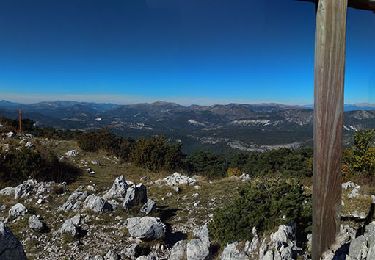
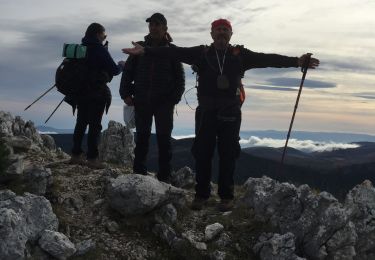
Randonnée Marche de 23 km à découvrir à Provence-Alpes-Côte d'Azur, Alpes-Maritimes, Séranon. Cette randonnée est proposée par jouans.
Description
Seranon Sommet du Bauroux Col Bas Caille Col Coustille Col Fessé La Mouliere La Clue Séranon trace réelle
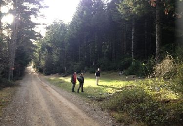
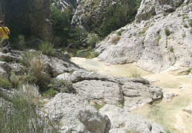
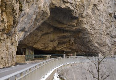
Notre sortie du 03/04/2024
Localisation
Pays :
France
Région :
Provence-Alpes-Côte d'Azur
Département/Province :
Alpes-Maritimes
Commune :
Séranon
Localité :
Unknown
Départ:(Dec)
Départ:(UTM)
314931 ; 4849276 (32T) N.
Commentaires
Randonnées à proximité
![Randonnée Marche Mons - tour du Mt Lachens - Photo](https://media.geolcdn.com/t/375/260/ext.jpg?maxdim=2&url=https%3A%2F%2Fservices.sitytrail.com%2FGeolivesWS%2FDownloadMedia.ashx%3FTrailID%3D167544%26Media%3D20121228095006.jpg)
![Marche Marche](https://static1.geolcdn.com/sitytour/trail-icons/101.png)
tour du Mt Lachens
Marche
Moyen
(3)
Mons,
Provence-Alpes-Côte d'Azur,
Var,
France
![](/images/other/stat-length.png)
20 km | 32 km-effort
6h 53min
![](https://static1.geolcdn.com/siteimages/upload/files/16400158638029165_repeat_loop_refresh_sync_direction_icon.png)
Oui
![Randonnée Marche Escragnolles - Casade du Ray (Clars) depuis les Gallants - Photo](https://media.geolcdn.com/t/375/260/a42f38d6-7773-4eff-b635-6c5634fe1592.jpg&format=jpg&maxdim=2)
![Marche Marche](https://static1.geolcdn.com/sitytour/trail-icons/101.png)
Casade du Ray (Clars) depuis les Gallants
Marche
Très facile
(1)
Escragnolles,
Provence-Alpes-Côte d'Azur,
Alpes-Maritimes,
France
![](/images/other/stat-length.png)
938 m | 1,3 km-effort
20min
![](https://static1.geolcdn.com/siteimages/upload/files/16400158638029165_repeat_loop_refresh_sync_direction_icon.png)
Non
![Randonnée A pied Caille - Grand tour du haut Estéron - Etape 5 - Photo](https://media.geolcdn.com/t/375/260/e0be63bf-1b07-4796-9aef-aaad8742cfa1.jpeg&format=jpg&maxdim=2)
![A pied A pied](https://static1.geolcdn.com/sitytour/trail-icons/100.png)
Grand tour du haut Estéron - Etape 5
A pied
Difficile
Caille,
Provence-Alpes-Côte d'Azur,
Alpes-Maritimes,
France
![](/images/other/stat-length.png)
19,3 km | 32 km-effort
7h 13min
![](https://static1.geolcdn.com/siteimages/upload/files/16400158638029165_repeat_loop_refresh_sync_direction_icon.png)
Non
![Randonnée A pied Séranon - Crêtes du Bauroux - Photo](https://media.geolcdn.com/t/375/260/608405c7-47cb-4d38-8b04-423595896dc9.jpeg&format=jpg&maxdim=2)
![A pied A pied](https://static1.geolcdn.com/sitytour/trail-icons/100.png)
Crêtes du Bauroux
A pied
Facile
Séranon,
Provence-Alpes-Côte d'Azur,
Alpes-Maritimes,
France
![](/images/other/stat-length.png)
11,8 km | 19,3 km-effort
4h 23min
![](https://static1.geolcdn.com/siteimages/upload/files/16400158638029165_repeat_loop_refresh_sync_direction_icon.png)
Oui
![Randonnée Marche Séranon - Seranon <-> Caille - Photo](https://media.geolcdn.com/t/375/260/55d1be7e-e0ec-4c06-a993-d30288ee612d.jpg&format=jpg&maxdim=2)
![Marche Marche](https://static1.geolcdn.com/sitytour/trail-icons/101.png)
Seranon <-> Caille
Marche
Difficile
Séranon,
Provence-Alpes-Côte d'Azur,
Alpes-Maritimes,
France
![](/images/other/stat-length.png)
23 km | 37 km-effort
8h 21min
![](https://static1.geolcdn.com/siteimages/upload/files/16400158638029165_repeat_loop_refresh_sync_direction_icon.png)
Oui
![Randonnée Marche Séranon - L' Audibergue - Photo](https://media.geolcdn.com/t/375/260/694faa16-0c4d-4369-98df-0f42e2c06721.jpg&format=jpg&maxdim=2)
![Marche Marche](https://static1.geolcdn.com/sitytour/trail-icons/101.png)
L' Audibergue
Marche
Moyen
Séranon,
Provence-Alpes-Côte d'Azur,
Alpes-Maritimes,
France
![](/images/other/stat-length.png)
21 km | 32 km-effort
5h 12min
![](https://static1.geolcdn.com/siteimages/upload/files/16400158638029165_repeat_loop_refresh_sync_direction_icon.png)
Oui
![Randonnée Marche Valderoure - Sommet du Beauroux : panoramique et champignons - Photo](https://media.geolcdn.com/t/375/260/8fa259f9-6634-40ba-a2d9-875549b2bc85.jpg&format=jpg&maxdim=2)
![Marche Marche](https://static1.geolcdn.com/sitytour/trail-icons/101.png)
Sommet du Beauroux : panoramique et champignons
Marche
Difficile
Valderoure,
Provence-Alpes-Côte d'Azur,
Alpes-Maritimes,
France
![](/images/other/stat-length.png)
13,2 km | 21 km-effort
3h 12min
![](https://static1.geolcdn.com/siteimages/upload/files/16400158638029165_repeat_loop_refresh_sync_direction_icon.png)
Oui
![Randonnée Marche Caille - Crête de Bauroux - Photo](https://media.geolcdn.com/t/375/260/40a7bb4b-aee8-4e1e-a5d7-44ff2086a2b1.jpg&format=jpg&maxdim=2)
![Marche Marche](https://static1.geolcdn.com/sitytour/trail-icons/101.png)
Crête de Bauroux
Marche
Moyen
Caille,
Provence-Alpes-Côte d'Azur,
Alpes-Maritimes,
France
![](/images/other/stat-length.png)
11,7 km | 19,4 km-effort
6h 54min
![](https://static1.geolcdn.com/siteimages/upload/files/16400158638029165_repeat_loop_refresh_sync_direction_icon.png)
Non
![Randonnée Marche Séranon - SERANON - LES 2 SERANONS - Photo](https://media.geolcdn.com/t/375/260/548cad4f-68ae-4391-9f31-45bc8cd6f580.jpg&format=jpg&maxdim=2)
![Marche Marche](https://static1.geolcdn.com/sitytour/trail-icons/101.png)
SERANON - LES 2 SERANONS
Marche
Moyen
Séranon,
Provence-Alpes-Côte d'Azur,
Alpes-Maritimes,
France
![](/images/other/stat-length.png)
11,9 km | 16,3 km-effort
5h 29min
![](https://static1.geolcdn.com/siteimages/upload/files/16400158638029165_repeat_loop_refresh_sync_direction_icon.png)
Oui