![](/images/other/stat-length.png)
![Randonnée Marche Bar - De Bar à la Chapelle de Chastres et retour - Photo](https://media.geolcdn.com/t/1900/400/72d0587a-e414-4a1e-8c49-22bb65953843.jpeg&format=pjpeg&maxdim=2)
De Bar à la Chapelle de Chastres et retour
Jean Laversanne
Utilisateur
![Longueur](/images/other/stat-length.png)
Longueur
2,3 km
![Altitude max](https://static1.geolcdn.com/siteimages/upload/files/1508320355ic_sort_altitude_max_24dp.png)
Altitude max
323 m
![Dénivelé positif](https://static1.geolcdn.com/siteimages/upload/files/1508320355ic_sort_den_pos_24dp.png)
Dénivelé positif
79 m
![Km-Effort](/images/other/stat-length.png)
Km-Effort
3,4 km
![Altitude min](https://static1.geolcdn.com/siteimages/upload/files/1508320355ic_sort_altitude_min_24dp.png)
Altitude min
265 m
![Dénivelé négatif](https://static1.geolcdn.com/siteimages/upload/files/1508320355ic_sort_den_neg_24dp.png)
Dénivelé négatif
78 m
![Boucle](https://static1.geolcdn.com/siteimages/upload/files/16400158638029165_repeat_loop_refresh_sync_direction_icon.png)
Boucle
Oui
Date de création :
2024-04-02 14:13:17.0
Dernière modification :
2024-04-02 15:15:09.223
![Marche](https://static1.geolcdn.com/sitytour/trail-icons/101.png)
45m
Difficulté : Facile
![V.T.T.](https://static1.geolcdn.com/sitytour/trail-icons/202.png)
13m
Difficulté : Facile
![Scannez ce code QR pour ouvrir la randonnée dans l'application SityTrail](https://capi.geolives.com/qq0zvz2zws4bq2lad0pu/sitytour/trails/4002109/qr.png?size=200)
Application GPS de randonnée GRATUITE
À propos
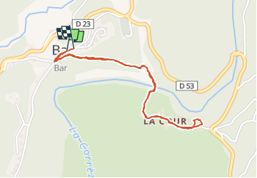
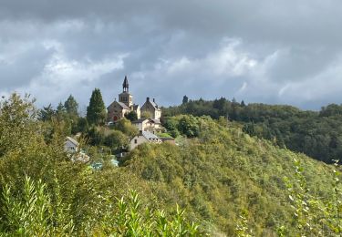
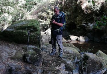
Randonnée Marche de 2,3 km à découvrir à Nouvelle-Aquitaine, Corrèze, Bar. Cette randonnée est proposée par Jean Laversanne.
Description
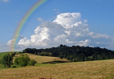
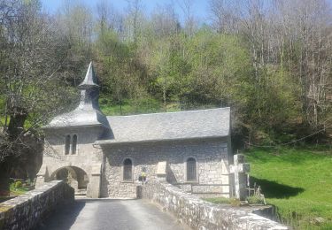
Jolie petite promenade qui fait traverser la rivière Corrèze. Depuis Bar ça descend pour remonter jusqu’à la Chapelle et retour
Localisation
Pays :
France
Région :
Nouvelle-Aquitaine
Département/Province :
Corrèze
Commune :
Bar
Localité :
Unknown
Départ:(Dec)
Départ:(UTM)
407048 ; 5021935 (31T) N.
Commentaires
Randonnées à proximité
![Randonnée Marche Saint-Priest-de-Gimel - Granite et belles pierres - Saint Priest de Gimel - Pays de Tulle - Photo](https://media.geolcdn.com/t/375/260/ext.jpg?maxdim=2&url=https%3A%2F%2Fservices.sitytrail.com%2FGeolivesWS%2FDownloadMedia.ashx%3FTrailID%3D318099%26Media%3D17558_3.jpg)
![Marche Marche](https://static1.geolcdn.com/sitytour/trail-icons/101.png)
Granite et belles pierres - Saint Priest de Gimel - Pays de Tulle
Marche
Moyen
(1)
Saint-Priest-de-Gimel,
Nouvelle-Aquitaine,
Corrèze,
France
![](/images/other/stat-length.png)
5,3 km | 6,6 km-effort
1h 15min
![](https://static1.geolcdn.com/siteimages/upload/files/16400158638029165_repeat_loop_refresh_sync_direction_icon.png)
Oui
![Randonnée Marche Saint-Priest-de-Gimel - Fred st priest de gimel - Photo](https://media.geolcdn.com/t/375/260/793d0483-98d2-46e6-843a-b599c51ab2e6.jpg&format=jpg&maxdim=2)
![Marche Marche](https://static1.geolcdn.com/sitytour/trail-icons/101.png)
Fred st priest de gimel
Marche
Moyen
(1)
Saint-Priest-de-Gimel,
Nouvelle-Aquitaine,
Corrèze,
France
![](/images/other/stat-length.png)
8,1 km | 11 km-effort
2h 40min
![](https://static1.geolcdn.com/siteimages/upload/files/16400158638029165_repeat_loop_refresh_sync_direction_icon.png)
Oui
![Randonnée V.T.T. Orliac-de-Bar - Orliac Aiguepanade - Photo](https://media.geolcdn.com/t/375/260/ext.jpg?maxdim=2&url=https%3A%2F%2Fstatic1.geolcdn.com%2Fsiteimages%2Fupload%2Ffiles%2F1524743154velo.jpg)
![V.T.T. V.T.T.](https://static1.geolcdn.com/sitytour/trail-icons/202.png)
Orliac Aiguepanade
V.T.T.
Moyen
(1)
Orliac-de-Bar,
Nouvelle-Aquitaine,
Corrèze,
France
![](/images/other/stat-length.png)
39 km | 51 km-effort
3h 0min
![](https://static1.geolcdn.com/siteimages/upload/files/16400158638029165_repeat_loop_refresh_sync_direction_icon.png)
Oui
![Randonnée V.T.T. Corrèze - Entre les rivières Corrèze et Menaude - Corrèze - Photo](https://media.geolcdn.com/t/375/260/ext.jpg?maxdim=2&url=https%3A%2F%2Fservices.sitytrail.com%2FGeolivesWS%2FDownloadMedia.ashx%3FTrailID%3D317958%26Media%3D17394_4.jpg)
![V.T.T. V.T.T.](https://static1.geolcdn.com/sitytour/trail-icons/202.png)
Entre les rivières Corrèze et Menaude - Corrèze
V.T.T.
Moyen
Corrèze,
Nouvelle-Aquitaine,
Corrèze,
France
![](/images/other/stat-length.png)
14,5 km | 21 km-effort
1h 19min
![](https://static1.geolcdn.com/siteimages/upload/files/16400158638029165_repeat_loop_refresh_sync_direction_icon.png)
Oui
![Randonnée Marche Corrèze - Entre les rivières Corrèze et Menaude - Corrèze - Photo](https://media.geolcdn.com/t/375/260/ext.jpg?maxdim=2&url=https%3A%2F%2Fservices.sitytrail.com%2FGeolivesWS%2FDownloadMedia.ashx%3FTrailID%3D317957%26Media%3D17394_4.jpg)
![Marche Marche](https://static1.geolcdn.com/sitytour/trail-icons/101.png)
Entre les rivières Corrèze et Menaude - Corrèze
Marche
Moyen
(2)
Corrèze,
Nouvelle-Aquitaine,
Corrèze,
France
![](/images/other/stat-length.png)
14,5 km | 21 km-effort
3h 30min
![](https://static1.geolcdn.com/siteimages/upload/files/16400158638029165_repeat_loop_refresh_sync_direction_icon.png)
Oui
![Randonnée sport Corrèze - Sob Corrèze tulle - Photo](https://media.geolcdn.com/t/375/260/6fee5bd6-adb4-4dcb-bdf2-0e860f3915bf.jpg&format=jpg&maxdim=2)
Sob Corrèze tulle
sport
Très facile
Corrèze,
Nouvelle-Aquitaine,
Corrèze,
France
![](/images/other/stat-length.png)
27 km | 35 km-effort
Inconnu
![](https://static1.geolcdn.com/siteimages/upload/files/16400158638029165_repeat_loop_refresh_sync_direction_icon.png)
Non
![Randonnée Marche Corrèze - Chemin du Paradis - Photo](https://media.geolcdn.com/t/375/260/a39228ff-4764-4b5b-b554-e3abbb584607.jpg&format=jpg&maxdim=2)
![Marche Marche](https://static1.geolcdn.com/sitytour/trail-icons/101.png)
Chemin du Paradis
Marche
Moyen
Corrèze,
Nouvelle-Aquitaine,
Corrèze,
France
![](/images/other/stat-length.png)
13,3 km | 0 m-effort
4h 58min
![](https://static1.geolcdn.com/siteimages/upload/files/16400158638029165_repeat_loop_refresh_sync_direction_icon.png)
Non
![Randonnée Marche Corrèze - Corrèze,1 - Photo](https://media.geolcdn.com/t/375/260/2dd96811-a9f4-4eeb-af6c-6484e44d0dbb.jpg&format=jpg&maxdim=2)
![Marche Marche](https://static1.geolcdn.com/sitytour/trail-icons/101.png)
Corrèze,1
Marche
Très difficile
Corrèze,
Nouvelle-Aquitaine,
Corrèze,
France
![](/images/other/stat-length.png)
13,6 km | 19,5 km-effort
3h 53min
![](https://static1.geolcdn.com/siteimages/upload/files/16400158638029165_repeat_loop_refresh_sync_direction_icon.png)
Oui
![Randonnée Marche Gimel-les-Cascades - chemin de la gour - Photo](https://media.geolcdn.com/t/375/260/fd995069-5dfe-4ce1-a1f2-eb4f583a729e.jpg&format=jpg&maxdim=2)
![Marche Marche](https://static1.geolcdn.com/sitytour/trail-icons/101.png)
chemin de la gour
Marche
Très facile
Gimel-les-Cascades,
Nouvelle-Aquitaine,
Corrèze,
France
![](/images/other/stat-length.png)
5,6 km | 8,2 km-effort
2h 38min
![](https://static1.geolcdn.com/siteimages/upload/files/16400158638029165_repeat_loop_refresh_sync_direction_icon.png)
Oui