![](/images/other/stat-length.png)
![Randonnée Marche Loupiac - Loupiac. Les coteaux. - Photo](https://media.geolcdn.com/t/1900/400/f2129390-37e4-44db-941f-7256aa8ef486.jpg&format=pjpeg&maxdim=2)
Loupiac. Les coteaux.
bedous
Utilisateur
![Longueur](/images/other/stat-length.png)
Longueur
14 km
![Altitude max](https://static1.geolcdn.com/siteimages/upload/files/1508320355ic_sort_altitude_max_24dp.png)
Altitude max
101 m
![Dénivelé positif](https://static1.geolcdn.com/siteimages/upload/files/1508320355ic_sort_den_pos_24dp.png)
Dénivelé positif
278 m
![Km-Effort](/images/other/stat-length.png)
Km-Effort
17,7 km
![Altitude min](https://static1.geolcdn.com/siteimages/upload/files/1508320355ic_sort_altitude_min_24dp.png)
Altitude min
8 m
![Dénivelé négatif](https://static1.geolcdn.com/siteimages/upload/files/1508320355ic_sort_den_neg_24dp.png)
Dénivelé négatif
278 m
![Boucle](https://static1.geolcdn.com/siteimages/upload/files/16400158638029165_repeat_loop_refresh_sync_direction_icon.png)
Boucle
Oui
Date de création :
2024-03-21 07:15:50.202
Dernière modification :
2024-03-21 14:39:25.375
![Marche](https://static1.geolcdn.com/sitytour/trail-icons/101.png)
4h01
Difficulté : Difficile
![Scannez ce code QR pour ouvrir la randonnée dans l'application SityTrail](https://capi.geolives.com/qq0zvz2zws4bq2lad0pu/sitytour/trails/3988554/qr.png?size=200)
Application GPS de randonnée GRATUITE
À propos
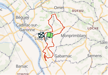
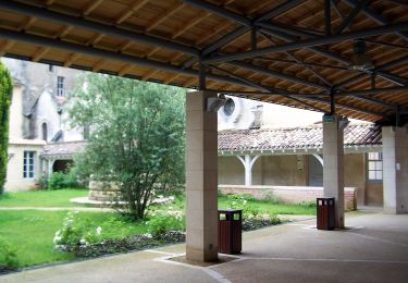
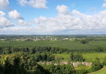
Randonnée Marche de 14 km à découvrir à Nouvelle-Aquitaine, Gironde, Loupiac. Cette randonnée est proposée par bedous.
Description
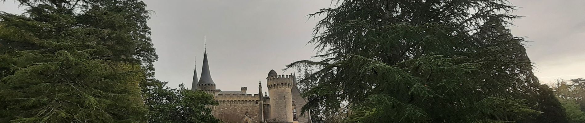
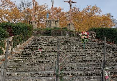
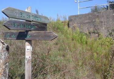
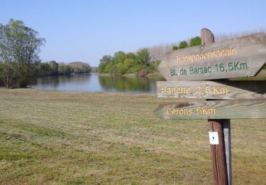
Randonnée, entre les vignes, sur les coteaux au dessus de Loupiac. Trés belles vues sur la Garonne. Visite de la ruine du château du Cros.
Localisation
Pays :
France
Région :
Nouvelle-Aquitaine
Département/Province :
Gironde
Commune :
Loupiac
Localité :
Unknown
Départ:(Dec)
Départ:(UTM)
714513 ; 4944743 (30T) N.
Commentaires
Randonnées à proximité
![Randonnée Marche Verdelais - Verdelais boucle n1 1h30 7km - Photo](https://media.geolcdn.com/t/375/260/ext.jpg?maxdim=2&url=https%3A%2F%2Fservices.sitytrail.com%2FGeolivesWS%2FDownloadMedia.ashx%3FTrailID%3D40628%26Media%3Dimage8.jpg)
![Marche Marche](https://static1.geolcdn.com/sitytour/trail-icons/101.png)
Verdelais boucle n1 1h30 7km
Marche
Très facile
(1)
Verdelais,
Nouvelle-Aquitaine,
Gironde,
France
![](/images/other/stat-length.png)
7,1 km | 8,8 km-effort
Inconnu
![](https://static1.geolcdn.com/siteimages/upload/files/16400158638029165_repeat_loop_refresh_sync_direction_icon.png)
Oui
![Randonnée Marche Podensac - Environs de Podensac - Photo](https://media.geolcdn.com/t/375/260/204dae07-dea2-44b4-a55c-a3f158503ca2.jpg&format=jpg&maxdim=2)
![Marche Marche](https://static1.geolcdn.com/sitytour/trail-icons/101.png)
Environs de Podensac
Marche
Difficile
Podensac,
Nouvelle-Aquitaine,
Gironde,
France
![](/images/other/stat-length.png)
12,9 km | 14 km-effort
3h 10min
![](https://static1.geolcdn.com/siteimages/upload/files/16400158638029165_repeat_loop_refresh_sync_direction_icon.png)
Oui
![Randonnée Marche Omet - Laroque - Photo](https://media.geolcdn.com/t/375/260/2918ad7b-0710-4b41-9b98-11e25d750081.jpg&format=jpg&maxdim=2)
![Marche Marche](https://static1.geolcdn.com/sitytour/trail-icons/101.png)
![Randonnée Marche Verdelais - Verdelais - Photo](https://media.geolcdn.com/t/375/260/ac506b0f-5859-4b40-94f2-5df41beb3f87.jpg&format=jpg&maxdim=2)
![Marche Marche](https://static1.geolcdn.com/sitytour/trail-icons/101.png)
Verdelais
Marche
Moyen
Verdelais,
Nouvelle-Aquitaine,
Gironde,
France
![](/images/other/stat-length.png)
10 km | 12 km-effort
3h 6min
![](https://static1.geolcdn.com/siteimages/upload/files/16400158638029165_repeat_loop_refresh_sync_direction_icon.png)
Non
![Randonnée A pied Cérons - Boucle locale de Cérons - Photo](https://media.geolcdn.com/t/375/260/0cb637ee-2c72-4b29-98b2-63dc8718bd3c.jpeg&format=jpg&maxdim=2)
![A pied A pied](https://static1.geolcdn.com/sitytour/trail-icons/100.png)
Boucle locale de Cérons
A pied
Facile
Cérons,
Nouvelle-Aquitaine,
Gironde,
France
![](/images/other/stat-length.png)
9 km | 9,8 km-effort
2h 14min
![](https://static1.geolcdn.com/siteimages/upload/files/16400158638029165_repeat_loop_refresh_sync_direction_icon.png)
Oui
![Randonnée A pied Loupiac - Monprimblanc et Loupiac : boucle locale - Photo](https://media.geolcdn.com/t/375/260/252b1336-069e-4cad-9573-2b7af99298fc.jpeg&format=jpg&maxdim=2)
![A pied A pied](https://static1.geolcdn.com/sitytour/trail-icons/100.png)
Monprimblanc et Loupiac : boucle locale
A pied
Facile
Loupiac,
Nouvelle-Aquitaine,
Gironde,
France
![](/images/other/stat-length.png)
10,5 km | 13,1 km-effort
2h 59min
![](https://static1.geolcdn.com/siteimages/upload/files/16400158638029165_repeat_loop_refresh_sync_direction_icon.png)
Non
![Randonnée A pied Barsac - Boucle locale de Barsac - Photo](https://media.geolcdn.com/t/375/260/aa6a797b-3dd2-4ea5-8850-cf566be6458d.jpeg&format=jpg&maxdim=2)
![A pied A pied](https://static1.geolcdn.com/sitytour/trail-icons/100.png)
Boucle locale de Barsac
A pied
Facile
Barsac,
Nouvelle-Aquitaine,
Gironde,
France
![](/images/other/stat-length.png)
17,6 km | 18,9 km-effort
4h 18min
![](https://static1.geolcdn.com/siteimages/upload/files/16400158638029165_repeat_loop_refresh_sync_direction_icon.png)
Oui
![Randonnée A pied Verdelais - Boucle locale de Verdelais - Photo](https://media.geolcdn.com/t/375/260/1483325e-e526-4e1b-bde7-bab75ad5ace7.jpeg&format=jpg&maxdim=2)
![A pied A pied](https://static1.geolcdn.com/sitytour/trail-icons/100.png)
Boucle locale de Verdelais
A pied
Facile
Verdelais,
Nouvelle-Aquitaine,
Gironde,
France
![](/images/other/stat-length.png)
3,4 km | 4,6 km-effort
1h 2min
![](https://static1.geolcdn.com/siteimages/upload/files/16400158638029165_repeat_loop_refresh_sync_direction_icon.png)
Oui
![Randonnée Marche Sainte-Croix-du-Mont - Circuit Ste. Croix du mont / Verdelais / St. Maixant - Photo](https://media.geolcdn.com/t/375/260/aad8da9f-fe2d-4390-8a4e-2ffa2a94545a.jpg&format=jpg&maxdim=2)
![Marche Marche](https://static1.geolcdn.com/sitytour/trail-icons/101.png)
Circuit Ste. Croix du mont / Verdelais / St. Maixant
Marche
Moyen
Sainte-Croix-du-Mont,
Nouvelle-Aquitaine,
Gironde,
France
![](/images/other/stat-length.png)
16,2 km | 20 km-effort
5h 6min
![](https://static1.geolcdn.com/siteimages/upload/files/16400158638029165_repeat_loop_refresh_sync_direction_icon.png)
Oui