![](/images/other/stat-length.png)
De Fraire à Thy-le-Bauduin
Desrumaux
Utilisateur GUIDE
![Longueur](/images/other/stat-length.png)
Longueur
14,2 km
![Altitude max](https://static1.geolcdn.com/siteimages/upload/files/1508320355ic_sort_altitude_max_24dp.png)
Altitude max
279 m
![Dénivelé positif](https://static1.geolcdn.com/siteimages/upload/files/1508320355ic_sort_den_pos_24dp.png)
Dénivelé positif
210 m
![Km-Effort](/images/other/stat-length.png)
Km-Effort
17 km
![Altitude min](https://static1.geolcdn.com/siteimages/upload/files/1508320355ic_sort_altitude_min_24dp.png)
Altitude min
186 m
![Dénivelé négatif](https://static1.geolcdn.com/siteimages/upload/files/1508320355ic_sort_den_neg_24dp.png)
Dénivelé négatif
215 m
![Boucle](https://static1.geolcdn.com/siteimages/upload/files/16400158638029165_repeat_loop_refresh_sync_direction_icon.png)
Boucle
Oui
Date de création :
2015-03-22 00:00:00.0
Dernière modification :
2015-03-22 00:00:00.0
![Marche](https://static1.geolcdn.com/sitytour/trail-icons/101.png)
3h42
Difficulté : Facile
![Scannez ce code QR pour ouvrir la randonnée dans l'application SityTrail](https://capi.geolives.com/qq0zvz2zws4bq2lad0pu/sitytour/trails/398616/qr.png?size=200)
Application GPS de randonnée GRATUITE
À propos
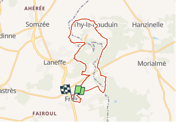
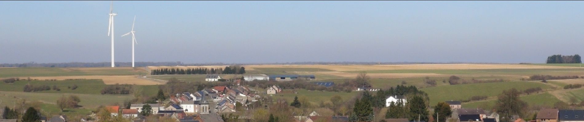
Randonnée Marche de 14,2 km à découvrir à Wallonie, Namur, Walcourt. Cette randonnée est proposée par Desrumaux.
Description
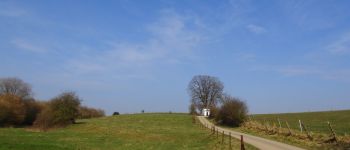
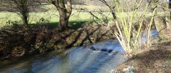
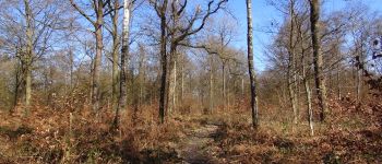
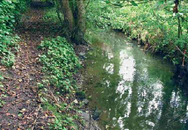
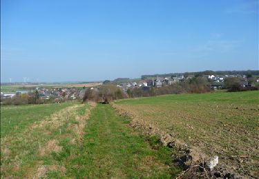
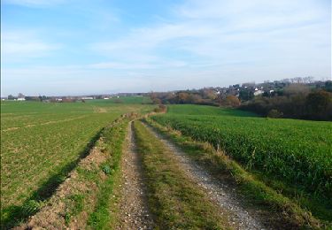
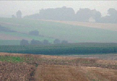
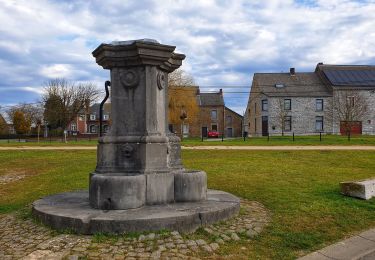
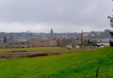
C’est par bois et campagne que cette jolie balade vous emmènera du village de Fraire au village de Thy-le-Bauduin dans la belle région de l’Entre-Sambre et Meuse.Départ : Eglise de Fraire ou de Thy-le-Bauduin
Localisation
Pays :
Belgique
Région :
Wallonie
Département/Province :
Namur
Commune :
Walcourt
Localité :
Fraire
Départ:(Dec)
Départ:(UTM)
607506 ; 5568677 (31U) N.
Commentaires
Randonnées à proximité
![Randonnée Marche Florennes - RB-Na-15_Hanzinelle - Photo](https://media.geolcdn.com/t/375/260/ext.jpg?maxdim=2&url=https%3A%2F%2Fservices.sitytrail.com%2FGeolivesWS%2FDownloadMedia.ashx%3FTrailID%3D179641%26Media%3Dcd0eccee-617e-4840-aac3-bf752b2b2900.jpg)
![Marche Marche](https://static1.geolcdn.com/sitytour/trail-icons/101.png)
RB-Na-15_Hanzinelle
Marche
Facile
(7)
Florennes,
Wallonie,
Namur,
Belgique
![](/images/other/stat-length.png)
23 km | 27 km-effort
5h 59min
![](https://static1.geolcdn.com/siteimages/upload/files/16400158638029165_repeat_loop_refresh_sync_direction_icon.png)
Oui
![Randonnée Marche Walcourt - Promenade à Chastrès - Photo](https://media.geolcdn.com/t/375/260/ext.jpg?maxdim=2&url=https%3A%2F%2Fservices.sitytrail.com%2FGeolivesWS%2FDownloadMedia.ashx%3FTrailID%3D117187%26Media%3D3da6a3b3-b81a-4fdc-a255-5d93ffb1cd0b.JPG)
![Marche Marche](https://static1.geolcdn.com/sitytour/trail-icons/101.png)
Promenade à Chastrès
Marche
Très facile
(1)
Walcourt,
Wallonie,
Namur,
Belgique
![](/images/other/stat-length.png)
4,7 km | 6 km-effort
1h 10min
![](https://static1.geolcdn.com/siteimages/upload/files/16400158638029165_repeat_loop_refresh_sync_direction_icon.png)
Oui
![Randonnée Marche Walcourt - De Laneffe à Fraire par bois et campagnes - Photo](https://media.geolcdn.com/t/375/260/ext.jpg?maxdim=2&url=https%3A%2F%2Fservices.sitytrail.com%2FGeolivesWS%2FDownloadMedia.ashx%3FTrailID%3D95170%26Media%3Ddbcce443-4e55-417a-979c-b5ffbc4c1513.JPG)
![Marche Marche](https://static1.geolcdn.com/sitytour/trail-icons/101.png)
De Laneffe à Fraire par bois et campagnes
Marche
Facile
(1)
Walcourt,
Wallonie,
Namur,
Belgique
![](/images/other/stat-length.png)
12,9 km | 15,5 km-effort
3h 0min
![](https://static1.geolcdn.com/siteimages/upload/files/16400158638029165_repeat_loop_refresh_sync_direction_icon.png)
Oui
![Randonnée Marche Florennes - RB-Na-15_Hanzinelle_via-racc - Photo](https://media.geolcdn.com/t/375/260/ext.jpg?maxdim=2&url=https%3A%2F%2Fservices.sitytrail.com%2FGeolivesWS%2FDownloadMedia.ashx%3FTrailID%3D213765%26Media%3Dbdd90a99-a997-460a-a12d-eae6fea055d6.jpg)
![Marche Marche](https://static1.geolcdn.com/sitytour/trail-icons/101.png)
RB-Na-15_Hanzinelle_via-racc
Marche
Très facile
(3)
Florennes,
Wallonie,
Namur,
Belgique
![](/images/other/stat-length.png)
13,8 km | 16,5 km-effort
3h 27min
![](https://static1.geolcdn.com/siteimages/upload/files/16400158638029165_repeat_loop_refresh_sync_direction_icon.png)
Oui
![Randonnée Marche Florennes - D'Hanzinelle à Thy-le-Bauduin par la vallée de la Thyria - Photo](https://media.geolcdn.com/t/375/260/ext.jpg?maxdim=2&url=https%3A%2F%2Fstatic1.geolcdn.com%2Fsiteimages%2Fupload%2Ffiles%2F1553511878bg_sport_marche.png)
![Marche Marche](https://static1.geolcdn.com/sitytour/trail-icons/101.png)
D'Hanzinelle à Thy-le-Bauduin par la vallée de la Thyria
Marche
Facile
(2)
Florennes,
Wallonie,
Namur,
Belgique
![](/images/other/stat-length.png)
13,5 km | 16,7 km-effort
3h 20min
![](https://static1.geolcdn.com/siteimages/upload/files/16400158638029165_repeat_loop_refresh_sync_direction_icon.png)
Oui
![Randonnée Marche Florennes - De Saint-Aubin à Hemptinne par la vallée de l'Eau d'Yves - Photo](https://media.geolcdn.com/t/375/260/ext.jpg?maxdim=2&url=https%3A%2F%2Fstatic1.geolcdn.com%2Fsiteimages%2Fupload%2Ffiles%2F1553511878bg_sport_marche.png)
![Marche Marche](https://static1.geolcdn.com/sitytour/trail-icons/101.png)
De Saint-Aubin à Hemptinne par la vallée de l'Eau d'Yves
Marche
Très facile
(4)
Florennes,
Wallonie,
Namur,
Belgique
![](/images/other/stat-length.png)
8,1 km | 9,5 km-effort
Inconnu
![](https://static1.geolcdn.com/siteimages/upload/files/16400158638029165_repeat_loop_refresh_sync_direction_icon.png)
Oui
![Randonnée Marche Philippeville - Balade à Jamagne - Photo](https://media.geolcdn.com/t/375/260/ce171ec7-b1dd-4723-988d-0840c5fff04b.jpeg&format=jpg&maxdim=2)
![Marche Marche](https://static1.geolcdn.com/sitytour/trail-icons/101.png)
Balade à Jamagne
Marche
Facile
Philippeville,
Wallonie,
Namur,
Belgique
![](/images/other/stat-length.png)
5 km | 5,9 km-effort
1h 20min
![](https://static1.geolcdn.com/siteimages/upload/files/16400158638029165_repeat_loop_refresh_sync_direction_icon.png)
Oui
![Randonnée Marche Florennes - Balade à Hanzinelle - Photo](https://media.geolcdn.com/t/375/260/5e2f06ad-fa6b-4c70-85bb-439da43a9613.jpeg&format=jpg&maxdim=2)
![Marche Marche](https://static1.geolcdn.com/sitytour/trail-icons/101.png)
Balade à Hanzinelle
Marche
Moyen
Florennes,
Wallonie,
Namur,
Belgique
![](/images/other/stat-length.png)
8,3 km | 10,4 km-effort
2h 22min
![](https://static1.geolcdn.com/siteimages/upload/files/16400158638029165_repeat_loop_refresh_sync_direction_icon.png)
Oui
![Randonnée Marche Walcourt - Balade à Yves-Gomezée - Walcourt - Photo](https://media.geolcdn.com/t/375/260/ce6fe3bc-56a4-4a73-8c7c-fe084ffe21fc.jpg&format=jpg&maxdim=2)
![Marche Marche](https://static1.geolcdn.com/sitytour/trail-icons/101.png)
Balade à Yves-Gomezée - Walcourt
Marche
Difficile
Walcourt,
Wallonie,
Namur,
Belgique
![](/images/other/stat-length.png)
10,8 km | 13,2 km-effort
2h 59min
![](https://static1.geolcdn.com/siteimages/upload/files/16400158638029165_repeat_loop_refresh_sync_direction_icon.png)
Oui