![](/images/other/stat-length.png)
![Randonnée Marche Chusclan - CHUSCLAN - Fontaine du Renard - GICON - VENEJAN - Photo](https://media.geolcdn.com/t/1900/400/f20695c6-1441-4e27-84cc-14bf71fed7cc.jpg&format=pjpeg&maxdim=2)
CHUSCLAN - Fontaine du Renard - GICON - VENEJAN
GOIOLIRIBES
Utilisateur
![Longueur](/images/other/stat-length.png)
![Altitude max](https://static1.geolcdn.com/siteimages/upload/files/1508320355ic_sort_altitude_max_24dp.png)
![Dénivelé positif](https://static1.geolcdn.com/siteimages/upload/files/1508320355ic_sort_den_pos_24dp.png)
![Km-Effort](/images/other/stat-length.png)
![Altitude min](https://static1.geolcdn.com/siteimages/upload/files/1508320355ic_sort_altitude_min_24dp.png)
![Dénivelé négatif](https://static1.geolcdn.com/siteimages/upload/files/1508320355ic_sort_den_neg_24dp.png)
![Boucle](https://static1.geolcdn.com/siteimages/upload/files/16400158638029165_repeat_loop_refresh_sync_direction_icon.png)
![Marche](https://static1.geolcdn.com/sitytour/trail-icons/101.png)
6h04
Difficulté : Très difficile
![Scannez ce code QR pour ouvrir la randonnée dans l'application SityTrail](https://capi.geolives.com/qq0zvz2zws4bq2lad0pu/sitytour/trails/3980727/qr.png?size=200)
Application GPS de randonnée GRATUITE
À propos
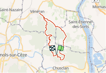
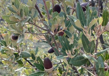
Randonnée Marche de 15,3 km à découvrir à Occitanie, Gard, Chusclan. Cette randonnée est proposée par GOIOLIRIBES.
Description
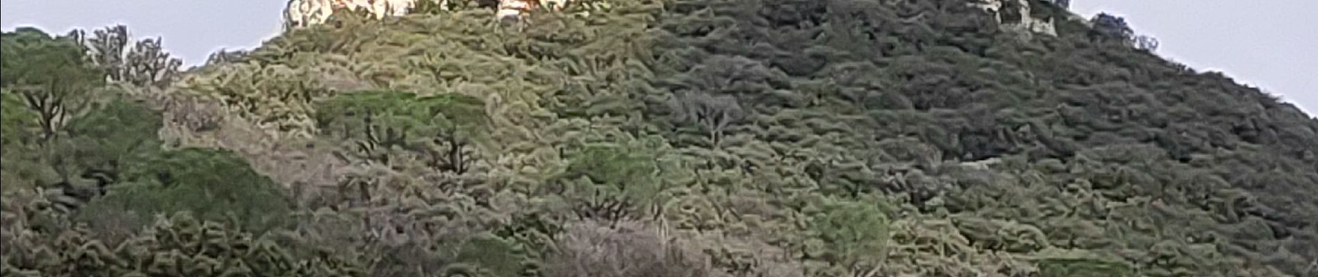
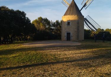
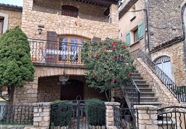
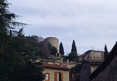
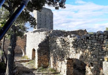
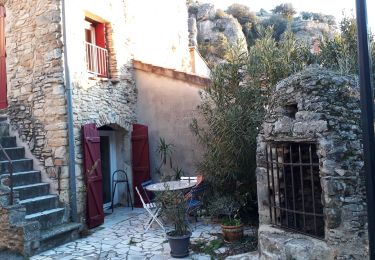
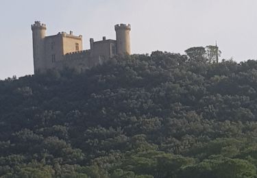
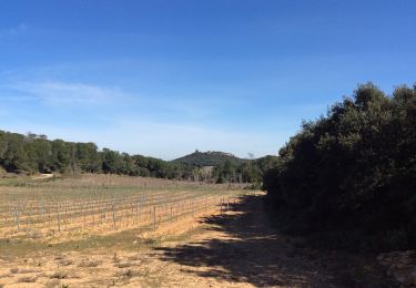
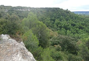
Départ du parking de la fontaine en contrebas, parallèle à la route goudronnée et direction château de GICON. Très beau site à ne pas rater ainsi que la grotte naturelle sous le château. Pause déjeuner à Vénéjan sur l'aire de repos avec table en bois, face au moulin à vent et à la Chapelle . Retour sur Chusclan avec point de vue sur le château de JONQUIER et sa chapelle St Marc. Retour Fontaine du Renard.
Localisation
Commentaires
Randonnées à proximité
![Randonnée Marche Vénéjan - 30 venejean - Photo](https://media.geolcdn.com/t/375/260/f6c98e11-8c67-41e0-a6c1-80e9f56badee.jpg&format=jpg&maxdim=2)
![Marche Marche](https://static1.geolcdn.com/sitytour/trail-icons/101.png)
![Randonnée Marche Vénéjan - Chateau de Gicon - Photo](https://media.geolcdn.com/t/375/260/478713ff-ebfa-46d4-9fd4-c06d8b132c40.jpg&format=jpg&maxdim=2)
![Marche Marche](https://static1.geolcdn.com/sitytour/trail-icons/101.png)
Marche
![](/images/other/stat-length.png)
![](https://static1.geolcdn.com/siteimages/upload/files/16400158638029165_repeat_loop_refresh_sync_direction_icon.png)
![Randonnée Marche Vénéjan - Venejean - Photo](https://media.geolcdn.com/t/375/260/923e9ad0-2620-4b33-8f21-0dd4c4b2f10c.jpg&format=jpg&maxdim=2)
![Marche Marche](https://static1.geolcdn.com/sitytour/trail-icons/101.png)
![Randonnée Marche Vénéjan - Vénéjean Chateau de Gicon - Photo](https://media.geolcdn.com/t/375/260/7c0d3735-7470-4d8f-91ae-cb78d57469aa.jpg&format=jpg&maxdim=2)
![Marche Marche](https://static1.geolcdn.com/sitytour/trail-icons/101.png)
Marche
![](/images/other/stat-length.png)
![](https://static1.geolcdn.com/siteimages/upload/files/16400158638029165_repeat_loop_refresh_sync_direction_icon.png)
![Randonnée Marche Chusclan - Venejan_041121 - Photo](https://media.geolcdn.com/t/375/260/4cfa55b5-1d84-4de3-9c6d-6ae353305679.jpg&format=jpg&maxdim=2)
![Marche Marche](https://static1.geolcdn.com/sitytour/trail-icons/101.png)
Marche
![](/images/other/stat-length.png)
![](https://static1.geolcdn.com/siteimages/upload/files/16400158638029165_repeat_loop_refresh_sync_direction_icon.png)
![Randonnée Marche Mornas - Forteresse de Mornas - Photo](https://media.geolcdn.com/t/375/260/fa246c95-5d87-42ab-8960-91721908c8e7.jpg&format=jpg&maxdim=2)
![Marche Marche](https://static1.geolcdn.com/sitytour/trail-icons/101.png)
Marche
![](/images/other/stat-length.png)
![](https://static1.geolcdn.com/siteimages/upload/files/16400158638029165_repeat_loop_refresh_sync_direction_icon.png)
![Randonnée Marche Vénéjan - Randonnée Venejean, dent de Marcoule le 29 10 2019 - Photo](https://media.geolcdn.com/t/375/260/a8011249-4838-423e-8df2-038a277f96ca.jpg&format=jpg&maxdim=2)
![Marche Marche](https://static1.geolcdn.com/sitytour/trail-icons/101.png)
Marche
![](/images/other/stat-length.png)
![](https://static1.geolcdn.com/siteimages/upload/files/16400158638029165_repeat_loop_refresh_sync_direction_icon.png)
![Randonnée Marche Chusclan - PF-Chusclan - Dent de Marcoule et Château de Gicon - Photo](https://media.geolcdn.com/t/375/260/f10873c5-07cb-49fe-9595-b037cf2e17a6.jpg&format=jpg&maxdim=2)
![Marche Marche](https://static1.geolcdn.com/sitytour/trail-icons/101.png)
Marche
![](/images/other/stat-length.png)
![](https://static1.geolcdn.com/siteimages/upload/files/16400158638029165_repeat_loop_refresh_sync_direction_icon.png)
![Randonnée V.T.T. Bagnols-sur-Cèze - Rando VTT du plateau de Lacau 35km - Photo](https://media.geolcdn.com/t/375/260/ext.jpg?maxdim=2&url=https%3A%2F%2Fservices.sitytrail.com%2FGeolivesWS%2FDownloadMedia.ashx%3FTrailID%3D632644%26Media%3Dfix__20160918110742.jpg)
![V.T.T. V.T.T.](https://static1.geolcdn.com/sitytour/trail-icons/202.png)
V.T.T.
![](/images/other/stat-length.png)
![](https://static1.geolcdn.com/siteimages/upload/files/16400158638029165_repeat_loop_refresh_sync_direction_icon.png)