![](/images/other/stat-length.png)
![Randonnée Unknown - 2024-03-10_20h12m07_mare-nostrum-gravel-etape-4-port-de-bouc-la-seyne - Photo](https://media.geolcdn.com/t/1900/400/ext.pjpeg?maxdim=2&url=https%3A%2F%2Fsecurestorage.geolives.com%2Fsitytour%2Ftrail-bg%2Fdefault.jpg)
2024-03-10_20h12m07_mare-nostrum-gravel-etape-4-port-de-bouc-la-seyne
Patriste
Utilisateur
![Longueur](/images/other/stat-length.png)
![Altitude max](https://static1.geolcdn.com/siteimages/upload/files/1508320355ic_sort_altitude_max_24dp.png)
![Dénivelé positif](https://static1.geolcdn.com/siteimages/upload/files/1508320355ic_sort_den_pos_24dp.png)
![Km-Effort](/images/other/stat-length.png)
![Altitude min](https://static1.geolcdn.com/siteimages/upload/files/1508320355ic_sort_altitude_min_24dp.png)
![Dénivelé négatif](https://static1.geolcdn.com/siteimages/upload/files/1508320355ic_sort_den_neg_24dp.png)
![Boucle](https://static1.geolcdn.com/siteimages/upload/files/16400158638029165_repeat_loop_refresh_sync_direction_icon.png)
![Scannez ce code QR pour ouvrir la randonnée dans l'application SityTrail](https://capi.geolives.com/qq0zvz2zws4bq2lad0pu/sitytour/trails/3976569/qr.png?size=200)
Application GPS de randonnée GRATUITE
À propos
Randonnée de 140 km à découvrir à France. Cette randonnée est proposée par Patriste.
Description
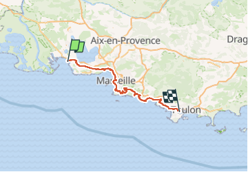
Quatrième étape de mon Mare Nostrum Gravel de Cerbère à Menton.
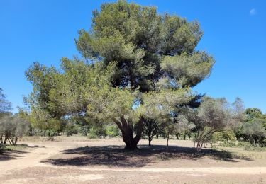
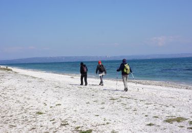
Passage près de la mer mais aussi incursions dans les massifs littoraux.
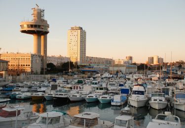
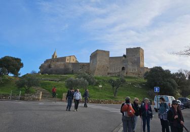
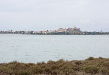
Programme du jour : Martigues, collines de la Nerthe, Marseille, Marseilleveyre et le canal de Marseille à la Campagne Pastré, les calanques jusqu'à Cassis, Col de Sormiou, Col des Baumettes, Col des Escourtines, Col de Morgiou, Col de Sugiton, Col de la Gineste, Col de la Gardiole, Port-Miou, route des crêtes jusqu'à La Ciotat, Six-Fours, etc.
Compte-rendu complet et photos sur www.lecyclerit.com.
Localisation
Commentaires
Randonnées à proximité
![Randonnée A pied Port-de-Bouc - La Presqu’ile - Le sentier du littoral - Photo](https://media.geolcdn.com/t/375/260/7fd51f05-a6e7-42de-ab91-8a11cdb4314b.jpeg&format=jpg&maxdim=2)
![A pied A pied](https://static1.geolcdn.com/sitytour/trail-icons/100.png)
A pied
![](/images/other/stat-length.png)
![](https://static1.geolcdn.com/siteimages/upload/files/16400158638029165_repeat_loop_refresh_sync_direction_icon.png)
![Randonnée A pied Port-de-Bouc - Forêt de Castillon Etangs de Pourra et d’Engrenier - Photo](https://media.geolcdn.com/t/375/260/b4485374-af03-4dfc-85d7-4833d4297133.jpeg&format=jpg&maxdim=2)
![A pied A pied](https://static1.geolcdn.com/sitytour/trail-icons/100.png)
A pied
![](/images/other/stat-length.png)
![](https://static1.geolcdn.com/siteimages/upload/files/16400158638029165_repeat_loop_refresh_sync_direction_icon.png)
![Randonnée Marche Martigues - Parc de Figuerolles 26.5.24 - Photo](https://media.geolcdn.com/t/375/260/cfe36c57-0ab2-4f94-9dae-8a49ceb2c9ba.jpg&format=jpg&maxdim=2)
![Marche Marche](https://static1.geolcdn.com/sitytour/trail-icons/101.png)
Marche
![](/images/other/stat-length.png)
![](https://static1.geolcdn.com/siteimages/upload/files/16400158638029165_repeat_loop_refresh_sync_direction_icon.png)
![Randonnée Marche Martigues - le parc de Figuerolles - Photo](https://media.geolcdn.com/t/375/260/5cd4b284-43d0-4749-a83d-d42e7a468467.jpg&format=jpg&maxdim=2)
![Marche Marche](https://static1.geolcdn.com/sitytour/trail-icons/101.png)
Marche
![](/images/other/stat-length.png)
![](https://static1.geolcdn.com/siteimages/upload/files/16400158638029165_repeat_loop_refresh_sync_direction_icon.png)
![Randonnée A pied Martigues - Boucle de Figuerolles - Photo](https://media.geolcdn.com/t/375/260/95277df0-03ce-438e-8003-6258ba4d95b2.jpeg&format=jpg&maxdim=2)
![A pied A pied](https://static1.geolcdn.com/sitytour/trail-icons/100.png)
A pied
![](/images/other/stat-length.png)
![](https://static1.geolcdn.com/siteimages/upload/files/16400158638029165_repeat_loop_refresh_sync_direction_icon.png)
![Marche Marche](https://static1.geolcdn.com/sitytour/trail-icons/101.png)
Marche
![](/images/other/stat-length.png)
![](https://static1.geolcdn.com/siteimages/upload/files/16400158638029165_repeat_loop_refresh_sync_direction_icon.png)
![Randonnée Marche Port-de-Bouc - St Mitre les Remparts - les étangs - Photo](https://media.geolcdn.com/t/375/260/ext.jpg?maxdim=2&url=https%3A%2F%2Fstatic1.geolcdn.com%2Fsiteimages%2Fupload%2Ffiles%2F1553511878bg_sport_marche.png)
![Marche Marche](https://static1.geolcdn.com/sitytour/trail-icons/101.png)
Marche
![](/images/other/stat-length.png)
![](https://static1.geolcdn.com/siteimages/upload/files/16400158638029165_repeat_loop_refresh_sync_direction_icon.png)
![Randonnée Marche Fos-sur-Mer - fos - Photo](https://media.geolcdn.com/t/375/260/6d059558-ef6b-4db5-a834-874a5bc7375a.jpg&format=jpg&maxdim=2)
![Marche Marche](https://static1.geolcdn.com/sitytour/trail-icons/101.png)
Marche
![](/images/other/stat-length.png)
![](https://static1.geolcdn.com/siteimages/upload/files/16400158638029165_repeat_loop_refresh_sync_direction_icon.png)
![A pied A pied](https://static1.geolcdn.com/sitytour/trail-icons/100.png)
A pied
![](/images/other/stat-length.png)
![](https://static1.geolcdn.com/siteimages/upload/files/16400158638029165_repeat_loop_refresh_sync_direction_icon.png)