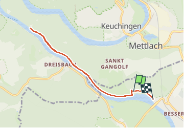
![](/images/other/stat-length.png)
![Randonnée Marche Mercy - Méandres côté rive droite de la Sarre - Photo](https://media.geolcdn.com/t/1900/400/2b4c95b3-097a-458c-86c4-e30aa32a28b5.jpg&format=pjpeg&maxdim=2)
Méandres côté rive droite de la Sarre
dudu42
Utilisateur GUIDE
![Longueur](/images/other/stat-length.png)
![Altitude max](https://static1.geolcdn.com/siteimages/upload/files/1508320355ic_sort_altitude_max_24dp.png)
![Dénivelé positif](https://static1.geolcdn.com/siteimages/upload/files/1508320355ic_sort_den_pos_24dp.png)
![Km-Effort](/images/other/stat-length.png)
![Altitude min](https://static1.geolcdn.com/siteimages/upload/files/1508320355ic_sort_altitude_min_24dp.png)
![Dénivelé négatif](https://static1.geolcdn.com/siteimages/upload/files/1508320355ic_sort_den_neg_24dp.png)
![Boucle](https://static1.geolcdn.com/siteimages/upload/files/16400158638029165_repeat_loop_refresh_sync_direction_icon.png)
![Marche](https://static1.geolcdn.com/sitytour/trail-icons/101.png)
1h49
Difficulté : Facile
![Scannez ce code QR pour ouvrir la randonnée dans l'application SityTrail](https://capi.geolives.com/qq0zvz2zws4bq2lad0pu/sitytour/trails/3964718/qr.png?size=200)
Application GPS de randonnée GRATUITE
À propos
Randonnée Marche de 7,4 km à découvrir à Sarre, Landkreis Merzig-Wadern, Mercy. Cette randonnée est proposée par dudu42.
Description
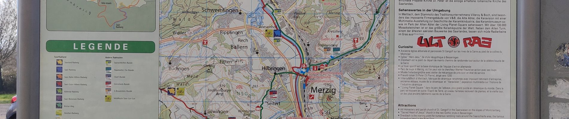
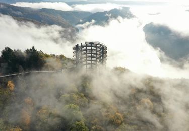
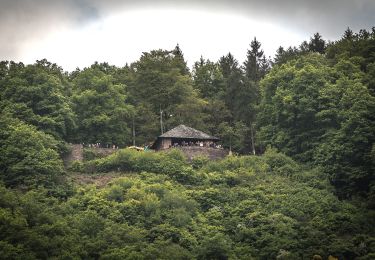
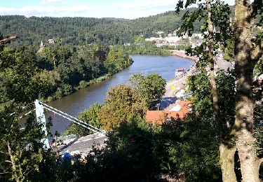
Route côté rive gauche, plutôt pour du vélo malgré la présence de voiture jusqu'au gîte. Intéressant si on veut accéder à la plateforme de vue panoramique de Cloef.
Chemin de terre serpentant entre la Sarre et la colline boisée côté rive droite.
Peu de monde a cette époque (hiver en semaine)
Ensoleillée contrairement a la rive gauche a l' ombre.
Localisation
Commentaires
Randonnées à proximité
![Randonnée Marche Mettlach - Randonnée au dessus de la boucle de la Sarre - Photo](https://media.geolcdn.com/t/375/260/1ec4c99f-6e1e-49de-a821-8974cc08752c.jpg&format=jpg&maxdim=2)
![Marche Marche](https://static1.geolcdn.com/sitytour/trail-icons/101.png)
Marche
![](/images/other/stat-length.png)
![](https://static1.geolcdn.com/siteimages/upload/files/16400158638029165_repeat_loop_refresh_sync_direction_icon.png)
![Randonnée A pied Mettlach - Verbindungsweg zum Europäischen Fernwanderweg E3 - Photo](https://media.geolcdn.com/t/375/260/6576b88e-784e-49f5-988b-1f07b71a267c.jpeg&format=jpg&maxdim=2)
![A pied A pied](https://static1.geolcdn.com/sitytour/trail-icons/100.png)
A pied
![](/images/other/stat-length.png)
![](https://static1.geolcdn.com/siteimages/upload/files/16400158638029165_repeat_loop_refresh_sync_direction_icon.png)
![Randonnée A pied Mettlach - Mettlacher Tafeltour - Photo](https://media.geolcdn.com/t/375/260/be1b4c4e-a01f-40a8-9b6f-5f7a12924389.jpeg&format=jpg&maxdim=2)
![A pied A pied](https://static1.geolcdn.com/sitytour/trail-icons/100.png)
A pied
![](/images/other/stat-length.png)
![](https://static1.geolcdn.com/siteimages/upload/files/16400158638029165_repeat_loop_refresh_sync_direction_icon.png)
![Randonnée Marche Mettlach - méandres de la Sarre - Photo](https://media.geolcdn.com/t/375/260/b6277908-ea6f-4161-a4c7-8a54a55176bd.jpg&format=jpg&maxdim=2)
![Marche Marche](https://static1.geolcdn.com/sitytour/trail-icons/101.png)
Marche
![](/images/other/stat-length.png)
![](https://static1.geolcdn.com/siteimages/upload/files/16400158638029165_repeat_loop_refresh_sync_direction_icon.png)
![Randonnée A pied Mettlach - Saarhölzbachpfad - Photo](https://media.geolcdn.com/t/375/260/473cd02d-a2c4-4895-ab94-fc459810fd29.jpeg&format=jpg&maxdim=2)
![A pied A pied](https://static1.geolcdn.com/sitytour/trail-icons/100.png)
A pied
![](/images/other/stat-length.png)
![](https://static1.geolcdn.com/siteimages/upload/files/16400158638029165_repeat_loop_refresh_sync_direction_icon.png)
![Randonnée A pied Mercy - Promenade Circulaire de Waldwisse - Photo](https://media.geolcdn.com/t/375/260/304183d3-a3ad-4982-9320-a29f04ab0abc.jpeg&format=jpg&maxdim=2)
![A pied A pied](https://static1.geolcdn.com/sitytour/trail-icons/100.png)
A pied
![](/images/other/stat-length.png)
![](https://static1.geolcdn.com/siteimages/upload/files/16400158638029165_repeat_loop_refresh_sync_direction_icon.png)
![Randonnée A pied Mettlach - Cloefpfad - Photo](https://media.geolcdn.com/t/375/260/6b1b72fd-3d4d-4f64-ac2a-6de33017ed68.jpeg&format=jpg&maxdim=2)
![A pied A pied](https://static1.geolcdn.com/sitytour/trail-icons/100.png)
A pied
![](/images/other/stat-length.png)
![](https://static1.geolcdn.com/siteimages/upload/files/16400158638029165_repeat_loop_refresh_sync_direction_icon.png)
![Randonnée Marche Mettlach - boucle de la sarre, mettlach - Photo](https://media.geolcdn.com/t/375/260/ext.jpg?maxdim=2&url=https%3A%2F%2Fservices.sitytrail.com%2FGeolivesWS%2FDownloadMedia.ashx%3FTrailID%3D470508%26Media%3Dfix__20150910165237.jpg)
![Marche Marche](https://static1.geolcdn.com/sitytour/trail-icons/101.png)
Marche
![](/images/other/stat-length.png)
![](https://static1.geolcdn.com/siteimages/upload/files/16400158638029165_repeat_loop_refresh_sync_direction_icon.png)
![Randonnée Marche Mercy - Allemagne - Mercy - Wolfspark - Photo](https://media.geolcdn.com/t/375/260/1a9e6a8e-dd3a-4f6c-b6f4-0dae58311254.jpg&format=jpg&maxdim=2)
![Marche Marche](https://static1.geolcdn.com/sitytour/trail-icons/101.png)
Marche
![](/images/other/stat-length.png)
![](https://static1.geolcdn.com/siteimages/upload/files/16400158638029165_repeat_loop_refresh_sync_direction_icon.png)