Randonnée Marche Dambach - Traingle jaune liason  GR 53 Wittschloessel -  disque jaune Wineck - Photo

Traingle jaune liason GR 53 Wittschloessel - disque jaune Wineck

© OpenStreetMap contributors
Longueur
Longueur
704 m
Altitude max
Altitude max
376 m
Dénivelé positif
Dénivelé positif
1 m
Km-Effort
Km-Effort  
797 m
Altitude min
Altitude min
346 m
Dénivelé négatif
Dénivelé négatif
25 m
Boucle
Boucle
Non
Date de création :
2024-02-27 22:09:24.999
Dernière modification :
2024-02-27 22:24:43.746

(0 Avis)

Marche
Marche
10m
Difficulté : Facile

Scannez ce code QR pour ouvrir la randonnée dans l'application SityTrail

Application GPS de randonnée GRATUITE

Logo SityTrail SityTrail

IGN / Instituts géographiques

Télécharger SityTrail sur l'App Store Télécharger SityTrail sur Google Play

Logo SityTrail SityTrail World

Le monde est à vous

Télécharger SityTrail sur l'App Store Télécharger SityTrail sur Google Play Télécharger SityTrail sur Huawei AppGallery

À propos

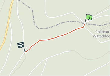
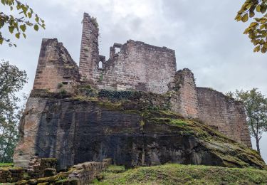
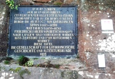
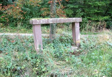
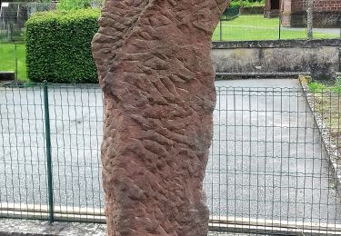
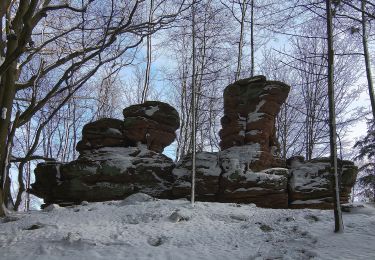
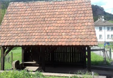
Randonnée Marche de 704 m à découvrir à Grand Est, Bas-Rhin, Dambach. Cette randonnée est proposée par Dominique Baudelocque .
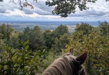
Profil altimétrique

Localisation

Pays :
France
Région :
Grand Est
Département/Province :
Bas-Rhin
Commune :
Dambach
Localité :
Unknown
Départ:(UTM)
403261 ; 5430845 (32U) N.

Randonnées à proximité

Randonnée A pied Sturzelbronn - Autour des moines de Sturzelbronn - Photo
A pied
GUIDE+

A pied

Facile
Sturzelbronn, Grand Est, Moselle, France
10,9 km | 14,8 km-effort
3h 22min
Oui
Randonnée A pied Lembach - Anneau bleu - Photo
A pied
GUIDE+

A pied

Facile
Lembach, Grand Est, Bas-Rhin, France
3,7 km | 5,4 km-effort
1h 14min
Oui
Randonnée A pied Niedersteinbach - Losange jaune - Photo
A pied
GUIDE+

A pied

Facile
Niedersteinbach, Grand Est, Bas-Rhin, France
3,5 km | 5,1 km-effort
1h 9min
Non
Randonnée A pied Niedersteinbach - Anneau bleu - Photo
A pied
GUIDE+

A pied

Facile
Niedersteinbach, Grand Est, Bas-Rhin, France
3,9 km | 6,8 km-effort
1h 32min
Oui
Randonnée A pied Niedersteinbach - Anneau jaune - Photo
A pied
GUIDE+

A pied

Facile
Niedersteinbach, Grand Est, Bas-Rhin, France
3,4 km | 4,9 km-effort
1h 6min
Oui
Randonnée A pied Obersteinbach - Anneau jaune - Photo
A pied
GUIDE+

A pied

Facile
Obersteinbach, Grand Est, Bas-Rhin, France
3,8 km | 6,2 km-effort
1h 25min
Oui
Randonnée A pied Niederbronn-les-Bains - Disque rouge - Photo
A pied
GUIDE+

A pied

Facile
Niederbronn-les-Bains, Grand Est, Bas-Rhin, France
5 km | 6,4 km-effort
1h 27min
Non
Randonnée A pied Obersteinbach - Triangle rouge - Photo
A pied
GUIDE+

A pied

Moyen
Obersteinbach, Grand Est, Bas-Rhin, France
14,1 km | 21 km-effort
4h 45min
Non
Randonnée A pied Sturzelbronn - Sentier paysager passe-frontière n°3 - Photo
A pied
GUIDE+

A pied

Facile
Sturzelbronn, Grand Est, Moselle, France
10 km | 13,8 km-effort
3h 8min
Oui


Fermer
Mes abonnements