![](/images/other/stat-length.png)
20240227-Poses
doudet
Utilisateur
![Longueur](/images/other/stat-length.png)
Longueur
13,1 km
![Altitude max](https://static1.geolcdn.com/siteimages/upload/files/1508320355ic_sort_altitude_max_24dp.png)
Altitude max
17 m
![Dénivelé positif](https://static1.geolcdn.com/siteimages/upload/files/1508320355ic_sort_den_pos_24dp.png)
Dénivelé positif
71 m
![Km-Effort](/images/other/stat-length.png)
Km-Effort
14,1 km
![Altitude min](https://static1.geolcdn.com/siteimages/upload/files/1508320355ic_sort_altitude_min_24dp.png)
Altitude min
1 m
![Dénivelé négatif](https://static1.geolcdn.com/siteimages/upload/files/1508320355ic_sort_den_neg_24dp.png)
Dénivelé négatif
71 m
![Boucle](https://static1.geolcdn.com/siteimages/upload/files/16400158638029165_repeat_loop_refresh_sync_direction_icon.png)
Boucle
Oui
Date de création :
2024-02-27 12:41:18.744
Dernière modification :
2024-02-28 14:40:28.024
![Marche](https://static1.geolcdn.com/sitytour/trail-icons/101.png)
2h49
Difficulté : Facile
![Scannez ce code QR pour ouvrir la randonnée dans l'application SityTrail](https://capi.geolives.com/qq0zvz2zws4bq2lad0pu/sitytour/trails/3964025/qr.png?size=200)
Application GPS de randonnée GRATUITE
À propos
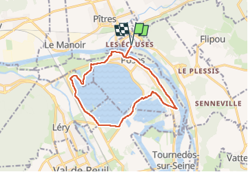
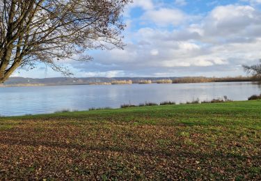
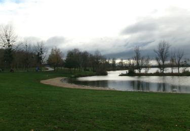
Randonnée Marche de 13,1 km à découvrir à Normandie, Eure, Amfreville-sous-les-Monts. Cette randonnée est proposée par doudet.
Description
Boucle A-R au départ de la Guinguette chez Dédé
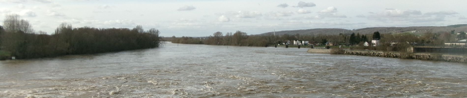
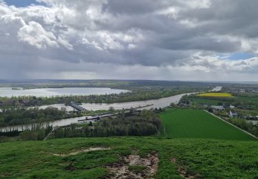
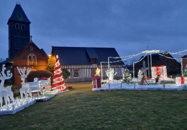
Localisation
Pays :
France
Région :
Normandie
Département/Province :
Eure
Commune :
Amfreville-sous-les-Monts
Localité :
Unknown
Départ:(Dec)
Départ:(UTM)
371953 ; 5463715 (31U) N.
Commentaires
Randonnées à proximité
![Randonnée Trail Les Damps - Autour du parcours sportif 2019 - Photo](https://media.geolcdn.com/t/375/260/ext.jpg?maxdim=2&url=https%3A%2F%2Fstatic1.geolcdn.com%2Fsiteimages%2Fupload%2Ffiles%2F1524743154running.jpg)
![Trail Trail](https://static1.geolcdn.com/sitytour/trail-icons/104.png)
Autour du parcours sportif 2019
Trail
Très facile
(1)
Les Damps,
Normandie,
Eure,
France
![](/images/other/stat-length.png)
10,9 km | 12,5 km-effort
Inconnu
![](https://static1.geolcdn.com/siteimages/upload/files/16400158638029165_repeat_loop_refresh_sync_direction_icon.png)
Oui
![Randonnée Marche Ymare - Ymare - Photo](https://media.geolcdn.com/t/375/260/ext.jpg?maxdim=2&url=https%3A%2F%2Fstatic1.geolcdn.com%2Fsiteimages%2Fupload%2Ffiles%2F1553511878bg_sport_marche.png)
![Marche Marche](https://static1.geolcdn.com/sitytour/trail-icons/101.png)
Ymare
Marche
Très facile
(1)
Ymare,
Normandie,
Seine-Maritime,
France
![](/images/other/stat-length.png)
8,9 km | 10,6 km-effort
2h 0min
![](https://static1.geolcdn.com/siteimages/upload/files/16400158638029165_repeat_loop_refresh_sync_direction_icon.png)
Oui
![Randonnée Marche Amfreville-sous-les-Monts - Côte des Deux amants (107) - Photo](https://media.geolcdn.com/t/375/260/ext.jpg?maxdim=2&url=https%3A%2F%2Fstatic1.geolcdn.com%2Fsiteimages%2Fupload%2Ffiles%2F1553511878bg_sport_marche.png)
![Marche Marche](https://static1.geolcdn.com/sitytour/trail-icons/101.png)
Côte des Deux amants (107)
Marche
Très difficile
(1)
Amfreville-sous-les-Monts,
Normandie,
Eure,
France
![](/images/other/stat-length.png)
8,4 km | 12 km-effort
2h 32min
![](https://static1.geolcdn.com/siteimages/upload/files/16400158638029165_repeat_loop_refresh_sync_direction_icon.png)
Oui
![Randonnée Marche Pont-Saint-Pierre - 27-03-Flipou Pont Saint Pierre 14km-486-478- - Photo](https://media.geolcdn.com/t/375/260/5f192092-f3eb-4914-a0dc-a7ccf7ccb6ff.jpg&format=jpg&maxdim=2)
![Marche Marche](https://static1.geolcdn.com/sitytour/trail-icons/101.png)
27-03-Flipou Pont Saint Pierre 14km-486-478-
Marche
Difficile
(1)
Pont-Saint-Pierre,
Normandie,
Eure,
France
![](/images/other/stat-length.png)
13,7 km | 18,8 km-effort
4h 21min
![](https://static1.geolcdn.com/siteimages/upload/files/16400158638029165_repeat_loop_refresh_sync_direction_icon.png)
Oui
![Randonnée Marche Pont-Saint-Pierre - 20240409-Flipou - Photo](https://media.geolcdn.com/t/375/260/88d68366-9846-42f8-8298-7e7b63133a02.jpg&format=jpg&maxdim=2)
![Marche Marche](https://static1.geolcdn.com/sitytour/trail-icons/101.png)
20240409-Flipou
Marche
Moyen
Pont-Saint-Pierre,
Normandie,
Eure,
France
![](/images/other/stat-length.png)
12,4 km | 15,3 km-effort
3h 52min
![](https://static1.geolcdn.com/siteimages/upload/files/16400158638029165_repeat_loop_refresh_sync_direction_icon.png)
Oui
![Randonnée Marche Quévreville-la-Poterie - 20240104-Quevreville la Potterie - Photo](https://media.geolcdn.com/t/375/260/0b8d8346-6b3b-4e80-8d5c-b85557b11606.jpg&format=jpg&maxdim=2)
![Marche Marche](https://static1.geolcdn.com/sitytour/trail-icons/101.png)
20240104-Quevreville la Potterie
Marche
Moyen
Quévreville-la-Poterie,
Normandie,
Seine-Maritime,
France
![](/images/other/stat-length.png)
9,2 km | 11,2 km-effort
2h 43min
![](https://static1.geolcdn.com/siteimages/upload/files/16400158638029165_repeat_loop_refresh_sync_direction_icon.png)
Oui
![Randonnée Marche Quévreville-la-Poterie - 20231219-quevreville noel - Photo](https://media.geolcdn.com/t/375/260/9039af00-539b-4ef5-83fe-9bd657e6d749.jpg&format=jpg&maxdim=2)
![Marche Marche](https://static1.geolcdn.com/sitytour/trail-icons/101.png)
20231219-quevreville noel
Marche
Moyen
Quévreville-la-Poterie,
Normandie,
Seine-Maritime,
France
![](/images/other/stat-length.png)
10,3 km | 12,6 km-effort
2h 55min
![](https://static1.geolcdn.com/siteimages/upload/files/16400158638029165_repeat_loop_refresh_sync_direction_icon.png)
Oui
![Randonnée Marche Les Damps - 20231212-Les Damps - Photo](https://media.geolcdn.com/t/375/260/9b98702f-b952-4d47-95e5-e5dc435553fd.jpg&format=jpg&maxdim=2)
![Marche Marche](https://static1.geolcdn.com/sitytour/trail-icons/101.png)
20231212-Les Damps
Marche
Moyen
Les Damps,
Normandie,
Eure,
France
![](/images/other/stat-length.png)
9,5 km | 11,1 km-effort
2h 39min
![](https://static1.geolcdn.com/siteimages/upload/files/16400158638029165_repeat_loop_refresh_sync_direction_icon.png)
Oui
![Marche Marche](https://static1.geolcdn.com/sitytour/trail-icons/101.png)
20231121-poses cool
Marche
Facile
Poses,
Normandie,
Eure,
France
![](/images/other/stat-length.png)
9,6 km | 10,3 km-effort
2h 37min
![](https://static1.geolcdn.com/siteimages/upload/files/16400158638029165_repeat_loop_refresh_sync_direction_icon.png)
Oui