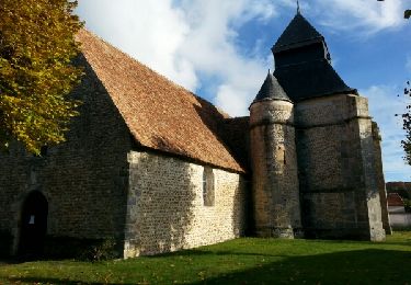
Randonnée Marche Charpont - Charpnot 2 - Photo
 gglai
gglai

Utilisateur

© OpenStreetMap contributors
Longueur
Longueur
12,4 km
Altitude max
Altitude max
143 m
Dénivelé positif
Dénivelé positif
182 m
Km-Effort
Km-Effort  
14,8 km
Altitude min
Altitude min
82 m
Dénivelé négatif
Dénivelé négatif
183 m
Boucle
Boucle
Oui
Date de création :
2024-02-19 12:34:04.378
Dernière modification :
2024-02-19 16:00:59.534

(0 Avis)

Marche
Marche
3h26
Difficulté : Facile

Scannez ce code QR pour ouvrir la randonnée dans l'application SityTrail

Application GPS de randonnée GRATUITE

Logo SityTrail SityTrail

IGN / Instituts géographiques

Télécharger SityTrail sur l'App Store Télécharger SityTrail sur Google Play

Logo SityTrail SityTrail World

Le monde est à vous

Télécharger SityTrail sur l'App Store Télécharger SityTrail sur Google Play Télécharger SityTrail sur Huawei AppGallery

À propos

Randonnée Marche de 12,4 km à découvrir à Centre-Val de Loire, Eure-et-Loir, Charpont. Cette randonnée est proposée par gglai.

Profil altimétrique

Localisation

Pays :
France
Région :
Centre-Val de Loire
Département/Province :
Eure-et-Loir
Commune :
Charpont
Localité :
Unknown
Départ:(Dec)
Départ:(UTM)
385649 ; 5395643 (31U) N.

Randonnées à proximité

Randonnée Marche Mézières-en-Drouais - Rando_Ecluzelles_12km - Photo
Marche
Robert28

Marche

Facile
(1)
Mézières-en-Drouais, Centre-Val de Loire, Eure-et-Loir, France
11,4 km | 13,3 km-effort
2h 33min
Oui
Randonnée Marche Mézières-en-Drouais - Ecluzelles 18.34 - Photo
Marche
togolo28

Marche

Moyen
(1)
Mézières-en-Drouais, Centre-Val de Loire, Eure-et-Loir, France
18,3 km | 21 km-effort
4h 33min
Oui
Randonnée Marche Mézières-en-Drouais - Lac d'Ecluzelles - Photo
Marche
000682.8168c3e717214839ad624ddb9a952c3d.0716

Marche

Facile
Mézières-en-Drouais, Centre-Val de Loire, Eure-et-Loir, France
4,8 km | 5,2 km-effort
45min
Oui
Randonnée Marche Mézières-en-Drouais - Mézières 28 5km4 - Photo
Marche
picouleau220345

Marche

Très facile
Mézières-en-Drouais, Centre-Val de Loire, Eure-et-Loir, France
5,3 km | 5,7 km-effort
1h 42min
Oui
Randonnée Marche Mézières-en-Drouais - les balcons de l étang d Ecluzelles - Photo
Marche
Francky28

Marche

Difficile
Mézières-en-Drouais, Centre-Val de Loire, Eure-et-Loir, France
12,6 km | 14,6 km-effort
3h 19min
Oui
Randonnée Marche Mézières-en-Drouais - rando du 9 /10/22 - Photo
Marche
mimimartine

Marche

Difficile
Mézières-en-Drouais, Centre-Val de Loire, Eure-et-Loir, France
14,7 km | 16,7 km-effort
3h 31min
Oui
Randonnée Marche La Chapelle-Forainvilliers - Mérangle Ouerre - Photo
Marche
adubarry

Marche

Facile
La Chapelle-Forainvilliers, Centre-Val de Loire, Eure-et-Loir, France
9,6 km | 10,9 km-effort
2h 28min
Oui
Randonnée Moto Dreux - Crispy Dreux Tenere - Photo
Moto
LaetRoss

Moto

Facile
Dreux, Centre-Val de Loire, Eure-et-Loir, France
113 km | 127 km-effort
5h 49min
Non
Randonnée Autre activité Dreux - Haute-Normandie - Ligne 00C - Rouen - Orléans (Section de Rouen à Dreux) - Photo
Autre activité
mich54

Autre activité

Très facile
Dreux, Centre-Val de Loire, Eure-et-Loir, France
111 km | 124 km-effort
5min
Non


Fermer
Mes abonnements