![](/images/other/stat-length.png)
![Randonnée Marche Mandrevillars - Echenans et son fort - Photo](https://media.geolcdn.com/t/1900/400/f507e7d6-76e6-4d94-8c38-4bcdb3990215.jpg&format=pjpeg&maxdim=2)
Echenans et son fort
Bart2015
Utilisateur
![Longueur](/images/other/stat-length.png)
![Altitude max](https://static1.geolcdn.com/siteimages/upload/files/1508320355ic_sort_altitude_max_24dp.png)
![Dénivelé positif](https://static1.geolcdn.com/siteimages/upload/files/1508320355ic_sort_den_pos_24dp.png)
![Km-Effort](/images/other/stat-length.png)
![Altitude min](https://static1.geolcdn.com/siteimages/upload/files/1508320355ic_sort_altitude_min_24dp.png)
![Dénivelé négatif](https://static1.geolcdn.com/siteimages/upload/files/1508320355ic_sort_den_neg_24dp.png)
![Boucle](https://static1.geolcdn.com/siteimages/upload/files/16400158638029165_repeat_loop_refresh_sync_direction_icon.png)
![Marche](https://static1.geolcdn.com/sitytour/trail-icons/101.png)
4h27
Difficulté : Très difficile
![Scannez ce code QR pour ouvrir la randonnée dans l'application SityTrail](https://capi.geolives.com/qq0zvz2zws4bq2lad0pu/sitytour/trails/3947724/qr.png?size=200)
Application GPS de randonnée GRATUITE
À propos
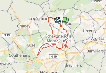
Randonnée Marche de 14,8 km à découvrir à Bourgogne-Franche-Comté, Haute-Saône, Mandrevillars. Cette randonnée est proposée par Bart2015.
Description
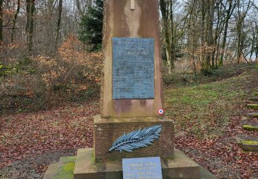
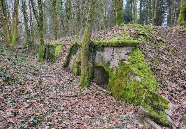
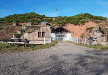
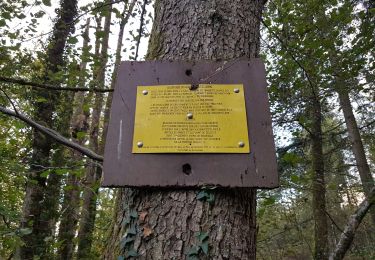
Randonnée pour découvrir le fort d'Echenans sous Mont Vaudois et ses environs. Elle nous replonge 150 ans en arrière après la la guerre de 1870 quand l'Allemagne annexe l'Alsace et une partie de la Lorraine. Le fort est visitable, se renseigner avant de partir ...
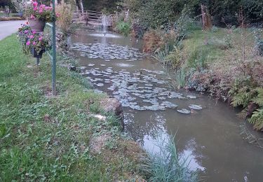
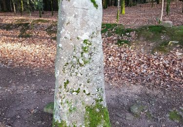
Bonne rando ...
Remarque : éviter de faire cette rando après de fortes pluies, le retour après le fort risque d'être très boueux et donc glissant.
Localisation
Commentaires
Randonnées à proximité
![Randonnée Marche Héricourt - La Pierre Plate - Héricourt - Photo](https://media.geolcdn.com/t/375/260/ext.jpg?maxdim=2&url=https%3A%2F%2Fservices.sitytrail.com%2FGeolivesWS%2FDownloadMedia.ashx%3FTrailID%3D109965%26Media%3D5044_1.jpg)
![Marche Marche](https://static1.geolcdn.com/sitytour/trail-icons/101.png)
Marche
![](/images/other/stat-length.png)
![](https://static1.geolcdn.com/siteimages/upload/files/16400158638029165_repeat_loop_refresh_sync_direction_icon.png)
![Randonnée Vélo électrique Essert - VTT - Essert - Salbert - Vétrigne - Miotte - Citadelle Belfort - Essert - Photo](https://media.geolcdn.com/t/375/260/9ea3754c-f673-4e19-890f-f64e417a9f4d.jpg&format=jpg&maxdim=2)
![Vélo électrique Vélo électrique](https://static1.geolcdn.com/sitytour/trail-icons/205.png)
Vélo électrique
![](/images/other/stat-length.png)
![](https://static1.geolcdn.com/siteimages/upload/files/16400158638029165_repeat_loop_refresh_sync_direction_icon.png)
![Randonnée Vélo électrique Châlonvillars - VTT - Châlonvillars - Etobon - Ronchamp - Plancher-Bas - Malsaucy - Photo](https://media.geolcdn.com/t/375/260/0af5e710-b661-426e-a32c-4cb272df7c44.jpg&format=jpg&maxdim=2)
![Vélo électrique Vélo électrique](https://static1.geolcdn.com/sitytour/trail-icons/205.png)
Vélo électrique
![](/images/other/stat-length.png)
![](https://static1.geolcdn.com/siteimages/upload/files/16400158638029165_repeat_loop_refresh_sync_direction_icon.png)
![Randonnée Marche Banvillars - Banvillars - forts du Hauts Bois et du Bois d'Oye - Photo](https://media.geolcdn.com/t/375/260/88f0967b-6ffd-4876-9f84-18be058a8f3f.jpg&format=jpg&maxdim=2)
![Marche Marche](https://static1.geolcdn.com/sitytour/trail-icons/101.png)
Marche
![](/images/other/stat-length.png)
![](https://static1.geolcdn.com/siteimages/upload/files/16400158638029165_repeat_loop_refresh_sync_direction_icon.png)
![Randonnée Marche Châlonvillars - Châlonvillars - Fort du Salbert - Evette-Salbert - Photo](https://media.geolcdn.com/t/375/260/30a56d40-1ac0-4227-a497-f489c67ce1fe.jpg&format=jpg&maxdim=2)
![Marche Marche](https://static1.geolcdn.com/sitytour/trail-icons/101.png)
Marche
![](/images/other/stat-length.png)
![](https://static1.geolcdn.com/siteimages/upload/files/16400158638029165_repeat_loop_refresh_sync_direction_icon.png)
![Randonnée V.T.T. Châlonvillars - Châlonvillars - Fort Giromagny en passant au milieu des étangs - Photo](https://media.geolcdn.com/t/375/260/4cf742f1-48e3-4bef-b8af-82a52a583623.jpg&format=jpg&maxdim=2)
![V.T.T. V.T.T.](https://static1.geolcdn.com/sitytour/trail-icons/202.png)
V.T.T.
![](/images/other/stat-length.png)
![](https://static1.geolcdn.com/siteimages/upload/files/16400158638029165_repeat_loop_refresh_sync_direction_icon.png)
![Randonnée V.T.T. Châlonvillars - Châlonvillars - Menhir - Mandrevillars - Fort Essert et du Salbert - Photo](https://media.geolcdn.com/t/375/260/0d0bf6fd-2dc2-4259-800b-34db6b624b81.jpg&format=jpg&maxdim=2)
![V.T.T. V.T.T.](https://static1.geolcdn.com/sitytour/trail-icons/202.png)
V.T.T.
![](/images/other/stat-length.png)
![](https://static1.geolcdn.com/siteimages/upload/files/16400158638029165_repeat_loop_refresh_sync_direction_icon.png)
![Randonnée Marche Châlonvillars - Châlonvillars - le mehnir - Mandrevillars - Photo](https://media.geolcdn.com/t/375/260/b30d40ec-93d6-4f7b-887c-caef10825b9c.jpg&format=jpg&maxdim=2)
![Marche Marche](https://static1.geolcdn.com/sitytour/trail-icons/101.png)
Marche
![](/images/other/stat-length.png)
![](https://static1.geolcdn.com/siteimages/upload/files/16400158638029165_repeat_loop_refresh_sync_direction_icon.png)
![Randonnée Marche Châlonvillars - Châlonvillars - Mandrevillars - Photo](https://media.geolcdn.com/t/375/260/e4fd3b0e-8b31-475e-ba79-3ca96152b87a.jpg&format=jpg&maxdim=2)
![Marche Marche](https://static1.geolcdn.com/sitytour/trail-icons/101.png)
Marche
![](/images/other/stat-length.png)
![](https://static1.geolcdn.com/siteimages/upload/files/16400158638029165_repeat_loop_refresh_sync_direction_icon.png)