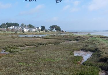
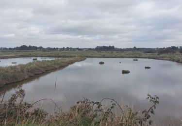
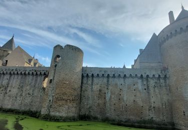
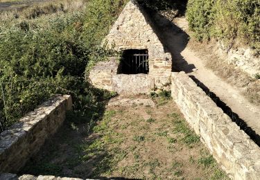
![](/images/other/stat-length.png)
![Randonnée Marche Sarzeau - PR_56_Sarzeau_EA_05_Circuit1b_Au-Coeur-De-La-Foret_20240202 - Photo](https://media.geolcdn.com/t/1900/400/8e54e8bd-ca94-4a5c-b265-446ad8267cc7.jpg&format=pjpeg&maxdim=2)
PR_56_Sarzeau_EA_05_Circuit1b_Au-Coeur-De-La-Foret_20240202
patrickdanilo
Utilisateur
![Longueur](/images/other/stat-length.png)
Longueur
12,3 km
![Altitude max](https://static1.geolcdn.com/siteimages/upload/files/1508320355ic_sort_altitude_max_24dp.png)
Altitude max
22 m
![Dénivelé positif](https://static1.geolcdn.com/siteimages/upload/files/1508320355ic_sort_den_pos_24dp.png)
Dénivelé positif
70 m
![Km-Effort](/images/other/stat-length.png)
Km-Effort
13,2 km
![Altitude min](https://static1.geolcdn.com/siteimages/upload/files/1508320355ic_sort_altitude_min_24dp.png)
Altitude min
3 m
![Dénivelé négatif](https://static1.geolcdn.com/siteimages/upload/files/1508320355ic_sort_den_neg_24dp.png)
Dénivelé négatif
70 m
![Boucle](https://static1.geolcdn.com/siteimages/upload/files/16400158638029165_repeat_loop_refresh_sync_direction_icon.png)
Boucle
Oui
Date de création :
2024-02-02 08:13:31.994
Dernière modification :
2024-02-03 11:12:07.266
![Marche](https://static1.geolcdn.com/sitytour/trail-icons/101.png)
3h00
Difficulté : Très facile
![Scannez ce code QR pour ouvrir la randonnée dans l'application SityTrail](https://capi.geolives.com/qq0zvz2zws4bq2lad0pu/sitytour/trails/3936290/qr.png?size=200)
Application GPS de randonnée GRATUITE
À propos
Randonnée Marche de 12,3 km à découvrir à Bretagne, Morbihan, Sarzeau. Cette randonnée est proposée par patrickdanilo.
Description
Randonnée Marche de 12 km à découvrir à Bretagne, Morbihan, Sarzeau. Cette randonnée est proposée par patrickdanilo.
Note: 05/20
Localisation
Pays :
France
Région :
Bretagne
Département/Province :
Morbihan
Commune :
Sarzeau
Localité :
Unknown
Départ:(Dec)
Départ:(UTM)
521011 ; 5266041 (30T) N.
Commentaires
Randonnées à proximité
![Randonnée Marche Saint-Armel - Tour du Golfe du Morbihan - 04 - St Armel, Le Hézo - Photo](https://media.geolcdn.com/t/375/260/ext.jpg?maxdim=2&url=https%3A%2F%2Fservices.sitytrail.com%2FGeolivesWS%2FDownloadMedia.ashx%3FTrailID%3D109034%26Media%3D3000_2.jpg)
![Marche Marche](https://static1.geolcdn.com/sitytour/trail-icons/101.png)
Tour du Golfe du Morbihan - 04 - St Armel, Le Hézo
Marche
Difficile
(1)
Saint-Armel,
Bretagne,
Morbihan,
France
![](/images/other/stat-length.png)
16,6 km | 17,6 km-effort
4h 0min
![](https://static1.geolcdn.com/siteimages/upload/files/16400158638029165_repeat_loop_refresh_sync_direction_icon.png)
Non
![Randonnée Marche Saint-Armel - Île TASCON- Le Passage 56 - Photo](https://media.geolcdn.com/t/375/260/ext.jpg?maxdim=2&url=https%3A%2F%2Fstatic1.geolcdn.com%2Fsiteimages%2Fupload%2Ffiles%2F1553511878bg_sport_marche.png)
![Marche Marche](https://static1.geolcdn.com/sitytour/trail-icons/101.png)
Île TASCON- Le Passage 56
Marche
Facile
(1)
Saint-Armel,
Bretagne,
Morbihan,
France
![](/images/other/stat-length.png)
11,5 km | 12,1 km-effort
2h 31min
![](https://static1.geolcdn.com/siteimages/upload/files/16400158638029165_repeat_loop_refresh_sync_direction_icon.png)
Oui
![Randonnée Marche Saint-Armel - St Armel en passant par l'Ile de Tason (Boucle) - Photo](https://media.geolcdn.com/t/375/260/ext.jpg?maxdim=2&url=https%3A%2F%2Fstatic1.geolcdn.com%2Fsiteimages%2Fupload%2Ffiles%2F1553511878bg_sport_marche.png)
![Marche Marche](https://static1.geolcdn.com/sitytour/trail-icons/101.png)
St Armel en passant par l'Ile de Tason (Boucle)
Marche
Moyen
(3)
Saint-Armel,
Bretagne,
Morbihan,
France
![](/images/other/stat-length.png)
20 km | 22 km-effort
4h 49min
![](https://static1.geolcdn.com/siteimages/upload/files/16400158638029165_repeat_loop_refresh_sync_direction_icon.png)
Oui
![Randonnée Marche Sarzeau - PR_56_Sarzeau_HA_08_Circuit1b_Les-Parcs-Ostreicoles_20240407 - Photo](https://media.geolcdn.com/t/375/260/aeca3880-48e4-4511-b52f-e7eaa46b5ea1.jpg&format=jpg&maxdim=2)
![Marche Marche](https://static1.geolcdn.com/sitytour/trail-icons/101.png)
PR_56_Sarzeau_HA_08_Circuit1b_Les-Parcs-Ostreicoles_20240407
Marche
Très facile
Sarzeau,
Bretagne,
Morbihan,
France
![](/images/other/stat-length.png)
8,2 km | 9,2 km-effort
2h 5min
![](https://static1.geolcdn.com/siteimages/upload/files/16400158638029165_repeat_loop_refresh_sync_direction_icon.png)
Oui
![Randonnée Marche Saint-Armel - PR_56_St-Armel_AA_01_Circuit1b_Le-Marais-Salant-De-Lasne_20231222 - Photo](https://media.geolcdn.com/t/375/260/0843618c-a073-4181-b237-858d69aa3eda.jpg&format=jpg&maxdim=2)
![Marche Marche](https://static1.geolcdn.com/sitytour/trail-icons/101.png)
PR_56_St-Armel_AA_01_Circuit1b_Le-Marais-Salant-De-Lasne_20231222
Marche
Très facile
Saint-Armel,
Bretagne,
Morbihan,
France
![](/images/other/stat-length.png)
12,6 km | 13,4 km-effort
2h 39min
![](https://static1.geolcdn.com/siteimages/upload/files/16400158638029165_repeat_loop_refresh_sync_direction_icon.png)
Oui
![Randonnée Marche Sarzeau - PR_56_Sarzeau_CA_03_Circuit1b_Sur-les-Pas-De-Nos-Ducs_20230916 - Photo](https://media.geolcdn.com/t/375/260/f91c2520-2d98-4139-afeb-9f72041e1576.jpg&format=jpg&maxdim=2)
![Marche Marche](https://static1.geolcdn.com/sitytour/trail-icons/101.png)
PR_56_Sarzeau_CA_03_Circuit1b_Sur-les-Pas-De-Nos-Ducs_20230916
Marche
Très facile
Sarzeau,
Bretagne,
Morbihan,
France
![](/images/other/stat-length.png)
12,2 km | 13,4 km-effort
3h 2min
![](https://static1.geolcdn.com/siteimages/upload/files/16400158638029165_repeat_loop_refresh_sync_direction_icon.png)
Oui
![Randonnée Marche Saint-Armel - 56-St-Colombier-Ludré-Duer-10km - Photo](https://media.geolcdn.com/t/375/260/c2aa7389-5bb1-4e56-b286-fd0da927b69c.jpg&format=jpg&maxdim=2)
![Marche Marche](https://static1.geolcdn.com/sitytour/trail-icons/101.png)
56-St-Colombier-Ludré-Duer-10km
Marche
Facile
Saint-Armel,
Bretagne,
Morbihan,
France
![](/images/other/stat-length.png)
9,6 km | 10,3 km-effort
2h 58min
![](https://static1.geolcdn.com/siteimages/upload/files/16400158638029165_repeat_loop_refresh_sync_direction_icon.png)
Oui
![Randonnée Marche Le Hézo - PR_56_Le-Hezo_AA_01_Circuit1b_Des-Fontaines_20220123 - Photo](https://media.geolcdn.com/t/375/260/403af69a-b17f-42c9-9a72-bda61f80f37e.jpg&format=jpg&maxdim=2)
![Marche Marche](https://static1.geolcdn.com/sitytour/trail-icons/101.png)
PR_56_Le-Hezo_AA_01_Circuit1b_Des-Fontaines_20220123
Marche
Très facile
Le Hézo,
Bretagne,
Morbihan,
France
![](/images/other/stat-length.png)
9,7 km | 10,6 km-effort
2h 11min
![](https://static1.geolcdn.com/siteimages/upload/files/16400158638029165_repeat_loop_refresh_sync_direction_icon.png)
Oui
![Randonnée Marche Sarzeau - SARZEAU - Photo](https://media.geolcdn.com/t/375/260/d5ba530d-3700-4b98-940c-95a55e7bd59e.jpg&format=jpg&maxdim=2)
![Marche Marche](https://static1.geolcdn.com/sitytour/trail-icons/101.png)