![](/images/other/stat-length.png)
![Randonnée Marche Solliès-Ville - La Valette Le Coudon et le Petit Coudon par Sollies Ville - Photo](https://media.geolcdn.com/t/1900/400/ext.pjpeg?maxdim=2&url=https%3A%2F%2Fmedia.geolcdn.com%2Ff%2F8d0b62d4-add6-4f08-bd83-ea639af30448.jpg)
La Valette Le Coudon et le Petit Coudon par Sollies Ville
Yot
Utilisateur
![Longueur](/images/other/stat-length.png)
Longueur
9,9 km
![Altitude max](https://static1.geolcdn.com/siteimages/upload/files/1508320355ic_sort_altitude_max_24dp.png)
Altitude max
658 m
![Dénivelé positif](https://static1.geolcdn.com/siteimages/upload/files/1508320355ic_sort_den_pos_24dp.png)
Dénivelé positif
549 m
![Km-Effort](/images/other/stat-length.png)
Km-Effort
17,3 km
![Altitude min](https://static1.geolcdn.com/siteimages/upload/files/1508320355ic_sort_altitude_min_24dp.png)
Altitude min
251 m
![Dénivelé négatif](https://static1.geolcdn.com/siteimages/upload/files/1508320355ic_sort_den_neg_24dp.png)
Dénivelé négatif
549 m
![Boucle](https://static1.geolcdn.com/siteimages/upload/files/16400158638029165_repeat_loop_refresh_sync_direction_icon.png)
Boucle
Oui
Date de création :
2024-01-23 10:07:09.17
Dernière modification :
2024-01-25 19:20:04.149
![Marche](https://static1.geolcdn.com/sitytour/trail-icons/101.png)
3h33
Difficulté : Difficile
![Scannez ce code QR pour ouvrir la randonnée dans l'application SityTrail](https://capi.geolives.com/qq0zvz2zws4bq2lad0pu/sitytour/trails/3926197/qr.png?size=200)
Application GPS de randonnée GRATUITE
À propos
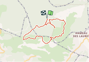
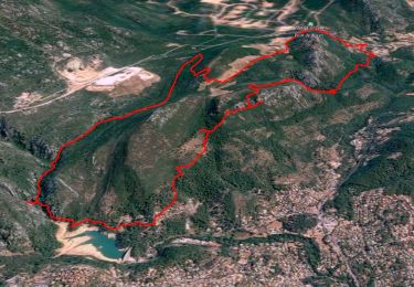
Randonnée Marche de 9,9 km à découvrir à Provence-Alpes-Côte d'Azur, Var, Solliès-Ville. Cette randonnée est proposée par Yot.
Description
Pendant le parcours, grande descente, bien pentue et selon le temps très glissante: assez dangereuse, prévoir de bonnes chaussures.
Localisation
Pays :
France
Région :
Provence-Alpes-Côte d'Azur
Département/Province :
Var
Commune :
Solliès-Ville
Localité :
Unknown
Départ:(Dec)
Départ:(UTM)
256435 ; 4784420 (32T) N.
Commentaires
Randonnées à proximité
![Randonnée Marche Solliès-Toucas - Les Morières - les bidoufles - Valbelle - la Garoute - la Baume des Lumes - La grotte des lumes - Photo](https://media.geolcdn.com/t/375/260/ext.jpg?maxdim=2&url=https%3A%2F%2Fmedia.geolcdn.com%2Ff%2F3e6ddcf9-f59d-47f4-a0ee-582c12a1d8d8.jpg)
![Marche Marche](https://static1.geolcdn.com/sitytour/trail-icons/101.png)
Les Morières - les bidoufles - Valbelle - la Garoute - la Baume des Lumes - L...
Marche
Facile
(1)
Solliès-Toucas,
Provence-Alpes-Côte d'Azur,
Var,
France
![](/images/other/stat-length.png)
12,6 km | 16,7 km-effort
6h 0min
![](https://static1.geolcdn.com/siteimages/upload/files/16400158638029165_repeat_loop_refresh_sync_direction_icon.png)
Oui
![Randonnée Marche Toulon - Faron versant Nord - Photo](https://media.geolcdn.com/t/375/260/ext.jpg?maxdim=2&url=https%3A%2F%2Fmedia.geolcdn.com%2Ff%2F40a1f88d-10a7-4595-84a1-0086eecb7f84.jpg)
![Marche Marche](https://static1.geolcdn.com/sitytour/trail-icons/101.png)
Faron versant Nord
Marche
Très difficile
(1)
Toulon,
Provence-Alpes-Côte d'Azur,
Var,
France
![](/images/other/stat-length.png)
9,9 km | 17,5 km-effort
6h 38min
![](https://static1.geolcdn.com/siteimages/upload/files/16400158638029165_repeat_loop_refresh_sync_direction_icon.png)
Oui
![Randonnée Marche Solliès-Toucas - Valaury - Apier - Matheron - Photo](https://media.geolcdn.com/t/375/260/ext.jpg?maxdim=2&url=https%3A%2F%2Fmedia.geolcdn.com%2Ff%2Ff02c0563-7d49-437f-98bb-e34f8a550dee.jpg)
![Marche Marche](https://static1.geolcdn.com/sitytour/trail-icons/101.png)
Valaury - Apier - Matheron
Marche
Moyen
(1)
Solliès-Toucas,
Provence-Alpes-Côte d'Azur,
Var,
France
![](/images/other/stat-length.png)
13,1 km | 19,5 km-effort
5h 0min
![](https://static1.geolcdn.com/siteimages/upload/files/16400158638029165_repeat_loop_refresh_sync_direction_icon.png)
Oui
![Randonnée Marche La Valette-du-Var - Le tour du Coudon - Confinement 04 2021 - Photo](https://media.geolcdn.com/t/375/260/ext.jpg?maxdim=2&url=https%3A%2F%2Fmedia.geolcdn.com%2Ff%2Fc1a593ce-5178-4a51-a2b4-9401a3556db4.jpg)
![Marche Marche](https://static1.geolcdn.com/sitytour/trail-icons/101.png)
Le tour du Coudon - Confinement 04 2021
Marche
Difficile
(1)
La Valette-du-Var,
Provence-Alpes-Côte d'Azur,
Var,
France
![](/images/other/stat-length.png)
11,9 km | 19,4 km-effort
5h 0min
![](https://static1.geolcdn.com/siteimages/upload/files/16400158638029165_repeat_loop_refresh_sync_direction_icon.png)
Oui
![Randonnée Marche Solliès-Toucas - couvent St Hubert Valaury - Photo](https://media.geolcdn.com/t/375/260/ext.jpg?maxdim=2&url=https%3A%2F%2Fservices.sitytrail.com%2FGeolivesWS%2FDownloadMedia.ashx%3FTrailID%3D361125%26Media%3Dfix__20141108152604.jpg)
![Marche Marche](https://static1.geolcdn.com/sitytour/trail-icons/101.png)
couvent St Hubert Valaury
Marche
Très facile
(2)
Solliès-Toucas,
Provence-Alpes-Côte d'Azur,
Var,
France
![](/images/other/stat-length.png)
12,5 km | 19,2 km-effort
4h 30min
![](https://static1.geolcdn.com/siteimages/upload/files/16400158638029165_repeat_loop_refresh_sync_direction_icon.png)
Oui
![Randonnée Marche La Valette-du-Var - Tourris - Source ripelle - Mont combe - Barrage - Olivières - Carriere aux fourmis - Grottes de sable - Chateau de Tourris - Photo](https://media.geolcdn.com/t/375/260/ext.jpg?maxdim=2&url=https%3A%2F%2Fmedia.geolcdn.com%2Ff%2F79fe425d-11d9-4d0f-acb5-646a4a616c9e.jpg)
![Marche Marche](https://static1.geolcdn.com/sitytour/trail-icons/101.png)
Tourris - Source ripelle - Mont combe - Barrage - Olivières - Carriere aux fo...
Marche
Facile
La Valette-du-Var,
Provence-Alpes-Côte d'Azur,
Var,
France
![](/images/other/stat-length.png)
11,8 km | 18,8 km-effort
7h 0min
![](https://static1.geolcdn.com/siteimages/upload/files/16400158638029165_repeat_loop_refresh_sync_direction_icon.png)
Oui
![Randonnée Marche La Valette-du-Var - Le Revest - Tourris - Confinement 04 2021 - Photo](https://media.geolcdn.com/t/375/260/ext.jpg?maxdim=2&url=https%3A%2F%2Fmedia.geolcdn.com%2Ff%2Fed75aaac-3d73-40cf-a26a-b9d52cf8e68b.jpg)
![Marche Marche](https://static1.geolcdn.com/sitytour/trail-icons/101.png)
Le Revest - Tourris - Confinement 04 2021
Marche
Moyen
La Valette-du-Var,
Provence-Alpes-Côte d'Azur,
Var,
France
![](/images/other/stat-length.png)
12,1 km | 19,1 km-effort
6h 0min
![](https://static1.geolcdn.com/siteimages/upload/files/16400158638029165_repeat_loop_refresh_sync_direction_icon.png)
Oui
![Randonnée Marche La Valette-du-Var - Boucle: Tourris - Grottes de sables - Carrière aux fourmis - Ruines des olivières - Tourris - Photo](https://media.geolcdn.com/t/375/260/ext.jpg?maxdim=2&url=https%3A%2F%2Fmedia.geolcdn.com%2Ff%2F4045ce0f-416f-4086-8e1e-133cbdbd7e41.jpg)
![Marche Marche](https://static1.geolcdn.com/sitytour/trail-icons/101.png)
Boucle: Tourris - Grottes de sables - Carrière aux fourmis - Ruines des oliv...
Marche
Facile
La Valette-du-Var,
Provence-Alpes-Côte d'Azur,
Var,
France
![](/images/other/stat-length.png)
11,9 km | 16,8 km-effort
5h 30min
![](https://static1.geolcdn.com/siteimages/upload/files/16400158638029165_repeat_loop_refresh_sync_direction_icon.png)
Oui
![Randonnée Marche Le Revest-les-Eaux - coudon - Photo](https://media.geolcdn.com/t/375/260/ext.jpg?maxdim=2&url=https%3A%2F%2Fstatic1.geolcdn.com%2Fsiteimages%2Fupload%2Ffiles%2F1553511878bg_sport_marche.png)
![Marche Marche](https://static1.geolcdn.com/sitytour/trail-icons/101.png)
coudon
Marche
Facile
(1)
Le Revest-les-Eaux,
Provence-Alpes-Côte d'Azur,
Var,
France
![](/images/other/stat-length.png)
9,2 km | 15,1 km-effort
3h 14min
![](https://static1.geolcdn.com/siteimages/upload/files/16400158638029165_repeat_loop_refresh_sync_direction_icon.png)
Oui