![](/images/other/stat-length.png)
![Randonnée Marche Sainte-Maxime - Le Déffend, Sainte Maxime - Photo](https://media.geolcdn.com/t/1900/400/7e838ddc-e797-4935-89e1-8eab9d75fa18.jpg&format=pjpeg&maxdim=2)
Le Déffend, Sainte Maxime
boulinevelyne
Utilisateur
![Longueur](/images/other/stat-length.png)
![Altitude max](https://static1.geolcdn.com/siteimages/upload/files/1508320355ic_sort_altitude_max_24dp.png)
![Dénivelé positif](https://static1.geolcdn.com/siteimages/upload/files/1508320355ic_sort_den_pos_24dp.png)
![Km-Effort](/images/other/stat-length.png)
![Altitude min](https://static1.geolcdn.com/siteimages/upload/files/1508320355ic_sort_altitude_min_24dp.png)
![Dénivelé négatif](https://static1.geolcdn.com/siteimages/upload/files/1508320355ic_sort_den_neg_24dp.png)
![Boucle](https://static1.geolcdn.com/siteimages/upload/files/16400158638029165_repeat_loop_refresh_sync_direction_icon.png)
![Marche](https://static1.geolcdn.com/sitytour/trail-icons/101.png)
2h34
Difficulté : Moyen
![Scannez ce code QR pour ouvrir la randonnée dans l'application SityTrail](https://capi.geolives.com/qq0zvz2zws4bq2lad0pu/sitytour/trails/3899637/qr.png?size=200)
Application GPS de randonnée GRATUITE
À propos
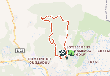
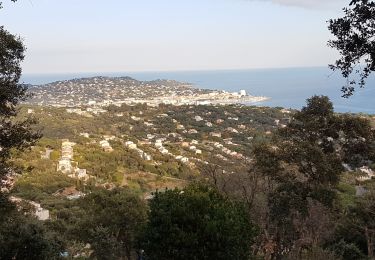
Randonnée Marche de 7,6 km à découvrir à Provence-Alpes-Côte d'Azur, Var, Sainte-Maxime. Cette randonnée est proposée par boulinevelyne.
Description
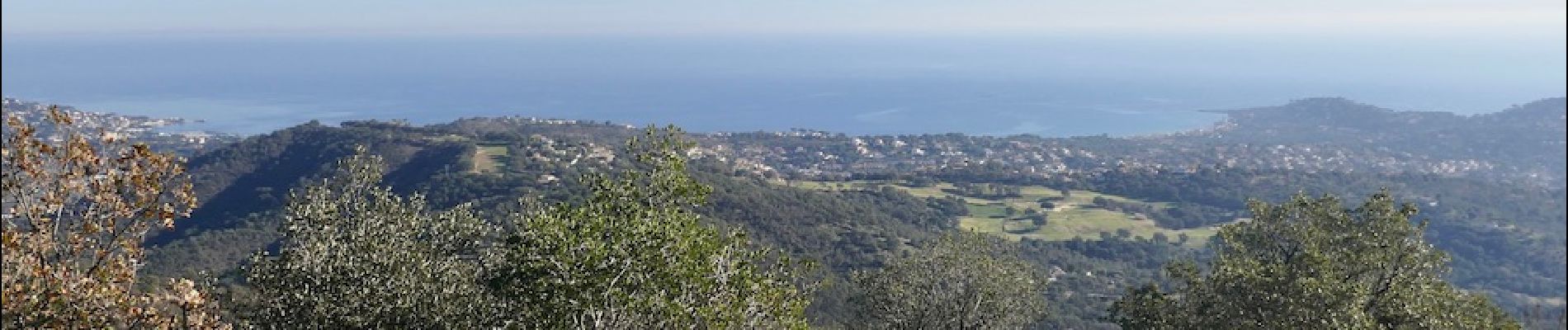
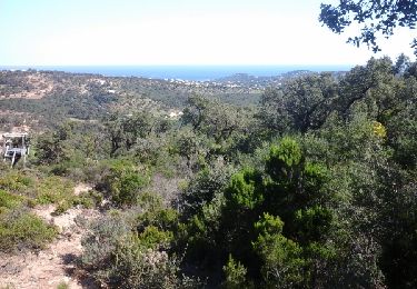
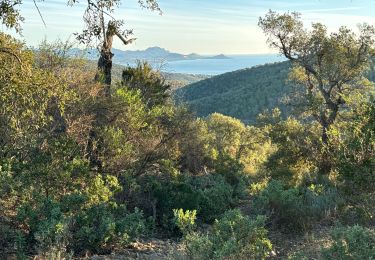
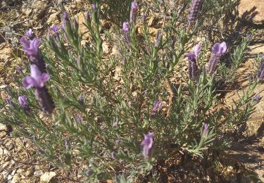
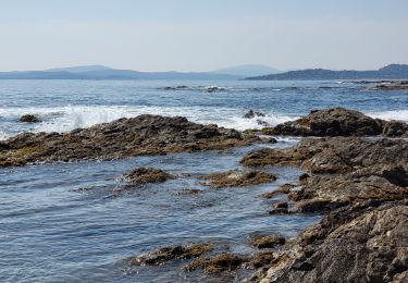
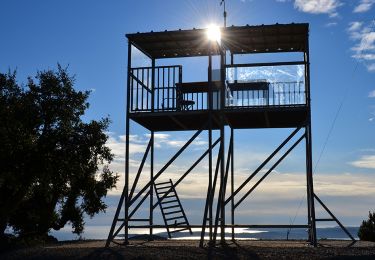
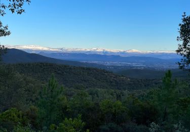
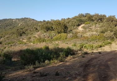
Cette boucle, bien balisée, est un classique des balades à Ste Maxime. Elle est sans vraie difficulté mais quand même,près du sommet, les sentiers sont très pentus, très caillouteux et très dégradés. Un minimum d'attention est nécessaire. Sinon, panoramas somptueux dans toutes les directions. Voir : [url]http://les-randos-du-grand.eklablog.com/sainte-maxime-le-deffend-a215151771[/url]
Localisation
Commentaires
Randonnées à proximité
![Randonnée Marche Sainte-Maxime - la baumette - Photo](https://media.geolcdn.com/t/375/260/ext.jpg?maxdim=2&url=https%3A%2F%2Fservices.sitytrail.com%2FGeolivesWS%2FDownloadMedia.ashx%3FTrailID%3D415513%26Media%3Dfix__20150406153617.jpg)
![Marche Marche](https://static1.geolcdn.com/sitytour/trail-icons/101.png)
Marche
![](/images/other/stat-length.png)
![](https://static1.geolcdn.com/siteimages/upload/files/16400158638029165_repeat_loop_refresh_sync_direction_icon.png)
![Randonnée Marche Roquebrune-sur-Argens - 200526 Les Issambres - Photo](https://media.geolcdn.com/t/375/260/ext.jpg?maxdim=2&url=https%3A%2F%2Fstatic1.geolcdn.com%2Fsiteimages%2Fupload%2Ffiles%2F1553511878bg_sport_marche.png)
![Marche Marche](https://static1.geolcdn.com/sitytour/trail-icons/101.png)
Marche
![](/images/other/stat-length.png)
![](https://static1.geolcdn.com/siteimages/upload/files/16400158638029165_repeat_loop_refresh_sync_direction_icon.png)
![Randonnée Marche Roquebrune-sur-Argens - Col du Bougnon : la Garonnette - Photo](https://media.geolcdn.com/t/375/260/0d614b7a-381f-42c2-94c2-191c569a24dd.jpg&format=jpg&maxdim=2)
![Marche Marche](https://static1.geolcdn.com/sitytour/trail-icons/101.png)
Marche
![](/images/other/stat-length.png)
![](https://static1.geolcdn.com/siteimages/upload/files/16400158638029165_repeat_loop_refresh_sync_direction_icon.png)
![Randonnée Marche Sainte-Maxime - Circuit du Deffend 12.3.23 - Photo](https://media.geolcdn.com/t/375/260/fbd7677e-0d08-4567-88d3-18eb53eac474.jpg&format=jpg&maxdim=2)
![Marche Marche](https://static1.geolcdn.com/sitytour/trail-icons/101.png)
Marche
![](/images/other/stat-length.png)
![](https://static1.geolcdn.com/siteimages/upload/files/16400158638029165_repeat_loop_refresh_sync_direction_icon.png)
![Randonnée Marche Roquebrune-sur-Argens - LES ISSAMBRES - BOUCLE PAR SAN PEIRE - Photo](https://media.geolcdn.com/t/375/260/5f778908-4959-4901-8cb5-a585b8ad3339.jpg&format=jpg&maxdim=2)
![Marche Marche](https://static1.geolcdn.com/sitytour/trail-icons/101.png)
Marche
![](/images/other/stat-length.png)
![](https://static1.geolcdn.com/siteimages/upload/files/16400158638029165_repeat_loop_refresh_sync_direction_icon.png)
![Marche Marche](https://static1.geolcdn.com/sitytour/trail-icons/101.png)
Marche
![](/images/other/stat-length.png)
![](https://static1.geolcdn.com/siteimages/upload/files/16400158638029165_repeat_loop_refresh_sync_direction_icon.png)
![Randonnée Marche Roquebrune-sur-Argens - Le Peigros depuis le Bougnon - Photo](https://media.geolcdn.com/t/375/260/c1a2f2b7-0d5f-4ce9-89af-be2b73b8855d.jpg&format=jpg&maxdim=2)
![Marche Marche](https://static1.geolcdn.com/sitytour/trail-icons/101.png)
Marche
![](/images/other/stat-length.png)
![](https://static1.geolcdn.com/siteimages/upload/files/16400158638029165_repeat_loop_refresh_sync_direction_icon.png)
![Randonnée Marche Sainte-Maxime - SAINTE-MAXIME - LE DEFFEND - Photo](https://media.geolcdn.com/t/375/260/80c9a7a1-680a-464d-bf77-c071b4380968.jpg&format=jpg&maxdim=2)
![Marche Marche](https://static1.geolcdn.com/sitytour/trail-icons/101.png)
Marche
![](/images/other/stat-length.png)
![](https://static1.geolcdn.com/siteimages/upload/files/16400158638029165_repeat_loop_refresh_sync_direction_icon.png)
![Randonnée Marche Grimaud - HAUTEURS DE BEAUVALLON - Photo](https://media.geolcdn.com/t/375/260/1e75db8a-1908-460a-a53b-da6349a4a58c.jpg&format=jpg&maxdim=2)
![Marche Marche](https://static1.geolcdn.com/sitytour/trail-icons/101.png)
Marche
![](/images/other/stat-length.png)
![](https://static1.geolcdn.com/siteimages/upload/files/16400158638029165_repeat_loop_refresh_sync_direction_icon.png)