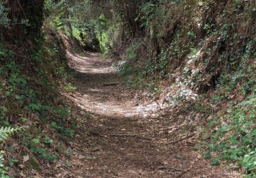
6,6 km | 7,2 km-effort
PA PORT MANEC'H
JEAN06910
Utilisateur
Longueur
11,3 km
Altitude max
43 m
Dénivelé positif
158 m
Km-Effort
13,6 km
Altitude min
0 m
Dénivelé négatif
191 m
Boucle
Non
Date de création :
2023-11-15 13:31:37.714
Dernière modification :
2023-11-15 16:04:38.494
2h23
Difficulté : Très facile
Application GPS de randonnée GRATUITE
À propos
Randonnée Marche de 11,3 km à découvrir à Bretagne, Finistère, Pont-Aven. Cette randonnée est proposée par JEAN06910.
Description
facile
Localisation
Pays :
France
Région :
Bretagne
Département/Province :
Finistère
Commune :
Pont-Aven
Localité :
Unknown
Départ:(Dec)
Départ:(UTM)
443616 ; 5300954 (30T) N.
Commentaires
Randonnées à proximité
Pont Aven boucle via chapelle St Mathieu/Nevez/Le Henan/Penanros
Marche
Très difficile
Pont-Aven,
Bretagne,
Finistère,
France
18,3 km | 21 km-effort
3h 3min
Oui
BOUCLE PONT AVEN / ROSBRAS / RIEC / PONT AVEN
Marche
Facile
Pont-Aven,
Bretagne,
Finistère,
France
21 km | 25 km-effort
8h 8min
Oui
Pont Aven -Belon
Bateau à moteur
Très facile
Pont-Aven,
Bretagne,
Finistère,
France
22 km | 23 km-effort
1h 56min
Oui
Le Bois d'amour - Nizon
Marche
Difficile
Pont-Aven,
Bretagne,
Finistère,
France
13 km | 15,6 km-effort
3h 15min
Oui
Pont Aven - Moëlan-sur-Mer
Marche
Facile
Pont-Aven,
Bretagne,
Finistère,
France
16,4 km | 19,1 km-effort
2h 38min
Non
Pont Aven - Port Manec'h
Marche
Facile
Pont-Aven,
Bretagne,
Finistère,
France
12,6 km | 15,2 km-effort
4h 29min
Non