Randonnée Marche Néfiach - Nefiach par le pic haut - Photo
 robertperello
robertperello

Utilisateur

© OpenStreetMap contributors
Longueur
Longueur
10,8 km
Altitude max
Altitude max
387 m
Dénivelé positif
Dénivelé positif
300 m
Km-Effort
Km-Effort  
14,8 km
Altitude min
Altitude min
105 m
Dénivelé négatif
Dénivelé négatif
300 m
Boucle
Boucle
Oui
Date de création :
2023-11-01 07:50:18.0
Dernière modification :
2023-11-01 13:24:56.675

(0 Avis)

Marche
Marche
3h40
Difficulté : Facile

Scannez ce code QR pour ouvrir la randonnée dans l'application SityTrail

Application GPS de randonnée GRATUITE

Logo SityTrail SityTrail

IGN / Instituts géographiques

Télécharger SityTrail sur l'App Store Télécharger SityTrail sur Google Play

Logo SityTrail SityTrail World

Le monde est à vous

Télécharger SityTrail sur l'App Store Télécharger SityTrail sur Google Play Télécharger SityTrail sur Huawei AppGallery

À propos

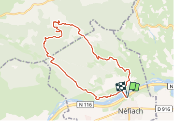
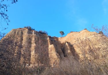
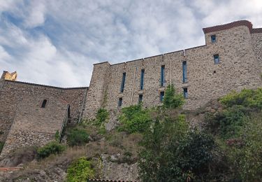
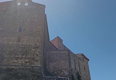
Randonnée Marche de 10,8 km à découvrir à Occitanie, Pyrénées-Orientales, Néfiach. Cette randonnée est proposée par robertperello.

Description

Pking après le cimetière avant l’a Têt

Profil altimétrique

Photos

Localisation

Pays :
France
Région :
Occitanie
Département/Province :
Pyrénées-Orientales
Commune :
Néfiach
Localité :
Unknown
Départ:(Dec)
Départ:(UTM)
472639 ; 4727077 (31T) N.

Randonnées à proximité

Randonnée Marche Ille-sur-Têt - ILLE TÊT 66 - PIC PEDROUS - CASESNOVES - Photo
Marche
jeff66

Marche

Moyen
(10)
Ille-sur-Têt, Occitanie, Pyrénées-Orientales, France
11 km | 15,3 km-effort
2h 22min
Oui
Randonnée A pied Corneilla-la-Rivière - Sentier Lambert Narach - Photo
A pied
PRO

A pied

Facile
Corneilla-la-Rivière, Occitanie, Pyrénées-Orientales, France
6,7 km | 11,4 km-effort
2h 35min
Non
Randonnée Marche Bélesta - Boucle du Pic Aubeill - Photo
Marche
bfrogneux

Marche

Facile
(1)
Bélesta, Occitanie, Pyrénées-Orientales, France
8 km | 10,9 km-effort
2h 24min
Oui
Randonnée Marche Cassagnes - pic d'abeille - Photo
Marche
randovivi

Marche

Très facile
(2)
Cassagnes, Occitanie, Pyrénées-Orientales, France
8,1 km | 10,8 km-effort
3h 0min
Oui
Randonnée Marche Millas - millas n'efface millas fait le 27 02 2023 - Photo
Marche
66Gribouille83

Marche

Moyen
Millas, Occitanie, Pyrénées-Orientales, France
8,3 km | 9 km-effort
2h 33min
Oui
Randonnée Marche Ille-sur-Têt - Ille st jules - Photo
Marche
66Gribouille83

Marche

Difficile
Ille-sur-Têt, Occitanie, Pyrénées-Orientales, France
11,2 km | 12,7 km-effort
3h 2min
Oui
Randonnée Marche Ille-sur-Têt - De Ille à rodés  - Photo
Marche
ombrabella

Marche

Très difficile
Ille-sur-Têt, Occitanie, Pyrénées-Orientales, France
16,3 km | 22 km-effort
4h 34min
Oui
Randonnée Marche Cassagnes - F66 Cassagnes pic Aubeill - Photo
Marche
ageo

Marche

Facile
Cassagnes, Occitanie, Pyrénées-Orientales, France
6,3 km | 8,4 km-effort
2h 20min
Non
Randonnée Marche Ille-sur-Têt - Ille belesta ille  - Photo
Marche
Erius

Marche

Moyen
Ille-sur-Têt, Occitanie, Pyrénées-Orientales, France
16,1 km | 22 km-effort
4h 17min
Oui


Fermer
Mes abonnements