![](/images/other/stat-length.png)
![Randonnée A pied Larajasse - Les trois villages - Photo](https://media.geolcdn.com/t/1900/400/ext.pjpeg?maxdim=2&url=https%3A%2F%2Fstatic1.geolcdn.com%2Fsiteimages%2Fupload%2Ffiles%2F1545311037marcheuse_200dpi.jpg)
Les trois villages
grange69
Utilisateur
![Longueur](/images/other/stat-length.png)
Longueur
21 km
![Altitude max](https://static1.geolcdn.com/siteimages/upload/files/1508320355ic_sort_altitude_max_24dp.png)
Altitude max
935 m
![Dénivelé positif](https://static1.geolcdn.com/siteimages/upload/files/1508320355ic_sort_den_pos_24dp.png)
Dénivelé positif
790 m
![Km-Effort](/images/other/stat-length.png)
Km-Effort
31 km
![Altitude min](https://static1.geolcdn.com/siteimages/upload/files/1508320355ic_sort_altitude_min_24dp.png)
Altitude min
633 m
![Dénivelé négatif](https://static1.geolcdn.com/siteimages/upload/files/1508320355ic_sort_den_neg_24dp.png)
Dénivelé négatif
788 m
![Boucle](https://static1.geolcdn.com/siteimages/upload/files/16400158638029165_repeat_loop_refresh_sync_direction_icon.png)
Boucle
Oui
Date de création :
2023-10-31 14:55:41.573
Dernière modification :
2024-02-20 18:10:01.016
![A pied](https://static1.geolcdn.com/sitytour/trail-icons/100.png)
7h08
Difficulté : Difficile
![Scannez ce code QR pour ouvrir la randonnée dans l'application SityTrail](https://capi.geolives.com/qq0zvz2zws4bq2lad0pu/sitytour/trails/3855441/qr.png?size=200)
Application GPS de randonnée GRATUITE
À propos
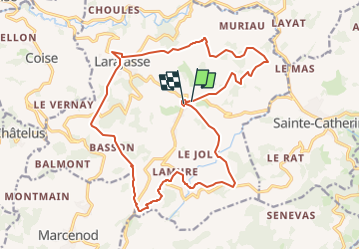
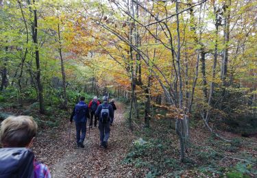
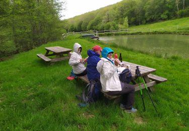
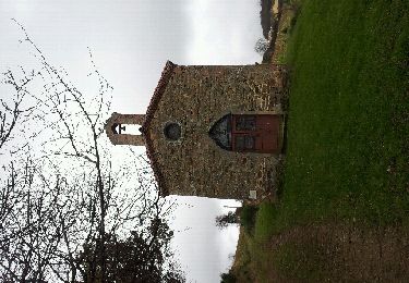
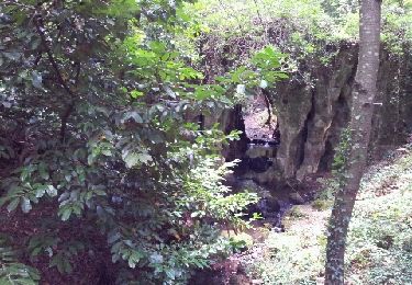
Randonnée A pied de 21 km à découvrir à Auvergne-Rhône-Alpes, Rhône, Larajasse. Cette randonnée est proposée par grange69.
Description
Départ du village de l'Aubépin ensuite direction St Pierre , le village de Larajasse , le Village de Lamure et retour à L'Aubépin.
Localisation
Pays :
France
Région :
Auvergne-Rhône-Alpes
Département/Province :
Rhône
Commune :
Larajasse
Localité :
Unknown
Départ:(Dec)
Départ:(UTM)
618900 ; 5051185 (31T) N.
Commentaires
Randonnées à proximité
![Randonnée Marche Sainte-Catherine - ste Catherine le Signal St André - Photo](https://media.geolcdn.com/t/375/260/ext.jpg?maxdim=2&url=https%3A%2F%2Fstatic1.geolcdn.com%2Fsiteimages%2Fupload%2Ffiles%2F1553511878bg_sport_marche.png)
![Marche Marche](https://static1.geolcdn.com/sitytour/trail-icons/101.png)
ste Catherine le Signal St André
Marche
Très difficile
(1)
Sainte-Catherine,
Auvergne-Rhône-Alpes,
Rhône,
France
![](/images/other/stat-length.png)
16,8 km | 24 km-effort
5h 27min
![](https://static1.geolcdn.com/siteimages/upload/files/16400158638029165_repeat_loop_refresh_sync_direction_icon.png)
Oui
![Randonnée Marche Marcenod - Marcenod - Photo](https://media.geolcdn.com/t/375/260/e494fe96-10db-4327-a5b0-85a327faee11.jpg&format=jpg&maxdim=2)
![Marche Marche](https://static1.geolcdn.com/sitytour/trail-icons/101.png)
Marcenod
Marche
Très facile
Marcenod,
Auvergne-Rhône-Alpes,
Loire,
France
![](/images/other/stat-length.png)
20 km | 29 km-effort
4h 50min
![](https://static1.geolcdn.com/siteimages/upload/files/16400158638029165_repeat_loop_refresh_sync_direction_icon.png)
Oui
![Randonnée Marche Riverie - Tour de Riverie - Photo](https://media.geolcdn.com/t/375/260/921cac9b-3a26-4e9e-996b-090d375df192.jpg&format=jpg&maxdim=2)
![Marche Marche](https://static1.geolcdn.com/sitytour/trail-icons/101.png)
Tour de Riverie
Marche
Très facile
Riverie,
Auvergne-Rhône-Alpes,
Rhône,
France
![](/images/other/stat-length.png)
5,5 km | 8,2 km-effort
3h 1min
![](https://static1.geolcdn.com/siteimages/upload/files/16400158638029165_repeat_loop_refresh_sync_direction_icon.png)
Oui
![Randonnée Marche nordique Saint-Martin-en-Haut - Quéser à St Symphonie sur Croise - Photo](https://media.geolcdn.com/t/375/260/ext.jpg?maxdim=2&url=https%3A%2F%2Fservices.sitytrail.com%2FGeolivesWS%2FDownloadMedia.ashx%3FTrailID%3D631037%26Media%3Dfix__20160913104438.jpg)
![Marche nordique Marche nordique](https://static1.geolcdn.com/sitytour/trail-icons/102.png)
Quéser à St Symphonie sur Croise
Marche nordique
Facile
Saint-Martin-en-Haut,
Auvergne-Rhône-Alpes,
Rhône,
France
![](/images/other/stat-length.png)
8,7 km | 11,3 km-effort
2h 38min
![](https://static1.geolcdn.com/siteimages/upload/files/16400158638029165_repeat_loop_refresh_sync_direction_icon.png)
Non
![Randonnée V.T.T. Saint-Martin-en-Haut - Balade VTT à St Martin En Haut - Photo](https://media.geolcdn.com/t/375/260/ext.jpg?maxdim=2&url=https%3A%2F%2Fservices.sitytrail.com%2FGeolivesWS%2FDownloadMedia.ashx%3FTrailID%3D317424%26Media%3D16653_3.jpg)
![V.T.T. V.T.T.](https://static1.geolcdn.com/sitytour/trail-icons/202.png)
Balade VTT à St Martin En Haut
V.T.T.
Difficile
Saint-Martin-en-Haut,
Auvergne-Rhône-Alpes,
Rhône,
France
![](/images/other/stat-length.png)
25 km | 35 km-effort
2h 30min
![](https://static1.geolcdn.com/siteimages/upload/files/16400158638029165_repeat_loop_refresh_sync_direction_icon.png)
Oui
![Randonnée Marche Châtelus - 42-Chatelus-St-Christo-19km-590m-dec23 - Photo](https://media.geolcdn.com/t/375/260/fbd15f82-68a5-412c-9e37-a2a4d157921f.jpg&format=jpg&maxdim=2)
![Marche Marche](https://static1.geolcdn.com/sitytour/trail-icons/101.png)
42-Chatelus-St-Christo-19km-590m-dec23
Marche
Difficile
Châtelus,
Auvergne-Rhône-Alpes,
Loire,
France
![](/images/other/stat-length.png)
18,7 km | 27 km-effort
6h 1min
![](https://static1.geolcdn.com/siteimages/upload/files/16400158638029165_repeat_loop_refresh_sync_direction_icon.png)
Oui
![Randonnée Marche Sainte-Catherine - sainte catherine - Photo](https://media.geolcdn.com/t/375/260/96ef73af-1523-418e-91a0-f0f135b9f92a.jpg&format=jpg&maxdim=2)
![Marche Marche](https://static1.geolcdn.com/sitytour/trail-icons/101.png)
sainte catherine
Marche
Moyen
Sainte-Catherine,
Auvergne-Rhône-Alpes,
Rhône,
France
![](/images/other/stat-length.png)
10,5 km | 14,3 km-effort
4h 42min
![](https://static1.geolcdn.com/siteimages/upload/files/16400158638029165_repeat_loop_refresh_sync_direction_icon.png)
Oui
![Randonnée Marche Sainte-Catherine - Ste Catherine - Photo](https://media.geolcdn.com/t/375/260/ext.jpg?maxdim=2&url=https%3A%2F%2Fservices.sitytrail.com%2FGeolivesWS%2FDownloadMedia.ashx%3FTrailID%3D162284%26Media%3D20121111115046.jpeg)
![Marche Marche](https://static1.geolcdn.com/sitytour/trail-icons/101.png)
Ste Catherine
Marche
Moyen
Sainte-Catherine,
Auvergne-Rhône-Alpes,
Rhône,
France
![](/images/other/stat-length.png)
18,6 km | 26 km-effort
4h 9min
![](https://static1.geolcdn.com/siteimages/upload/files/16400158638029165_repeat_loop_refresh_sync_direction_icon.png)
Oui
![Randonnée Marche Larajasse - larajasse - Photo](https://media.geolcdn.com/t/375/260/ext.jpg?maxdim=2&url=https%3A%2F%2Fservices.sitytrail.com%2FGeolivesWS%2FDownloadMedia.ashx%3FTrailID%3D152793%26Media%3D20120909164159.jpeg)
![Marche Marche](https://static1.geolcdn.com/sitytour/trail-icons/101.png)
larajasse
Marche
Moyen
Larajasse,
Auvergne-Rhône-Alpes,
Rhône,
France
![](/images/other/stat-length.png)
19,4 km | 28 km-effort
5h 18min
![](https://static1.geolcdn.com/siteimages/upload/files/16400158638029165_repeat_loop_refresh_sync_direction_icon.png)
Oui