![](/images/other/stat-length.png)
![Randonnée Marche Raeren - Raeren - Photo](https://media.geolcdn.com/t/1900/400/ext.pjpeg?maxdim=2&url=https%3A%2F%2Fstatic1.geolcdn.com%2Fsiteimages%2Fupload%2Ffiles%2F1553511878bg_sport_marche.png)
Raeren
mumu.larandonneuse
Utilisateur GUIDE
![Longueur](/images/other/stat-length.png)
Longueur
13,4 km
![Altitude max](https://static1.geolcdn.com/siteimages/upload/files/1508320355ic_sort_altitude_max_24dp.png)
Altitude max
373 m
![Dénivelé positif](https://static1.geolcdn.com/siteimages/upload/files/1508320355ic_sort_den_pos_24dp.png)
Dénivelé positif
196 m
![Km-Effort](/images/other/stat-length.png)
Km-Effort
16 km
![Altitude min](https://static1.geolcdn.com/siteimages/upload/files/1508320355ic_sort_altitude_min_24dp.png)
Altitude min
255 m
![Dénivelé négatif](https://static1.geolcdn.com/siteimages/upload/files/1508320355ic_sort_den_neg_24dp.png)
Dénivelé négatif
194 m
![Boucle](https://static1.geolcdn.com/siteimages/upload/files/16400158638029165_repeat_loop_refresh_sync_direction_icon.png)
Boucle
Oui
Date de création :
2023-10-26 14:41:28.173
Dernière modification :
2023-10-26 14:48:02.17
![Marche](https://static1.geolcdn.com/sitytour/trail-icons/101.png)
3h38
Difficulté : Moyen
![Scannez ce code QR pour ouvrir la randonnée dans l'application SityTrail](https://capi.geolives.com/qq0zvz2zws4bq2lad0pu/sitytour/trails/3850971/qr.png?size=200)
Application GPS de randonnée GRATUITE
À propos
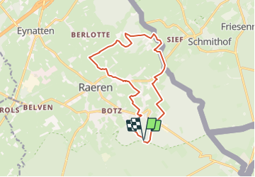
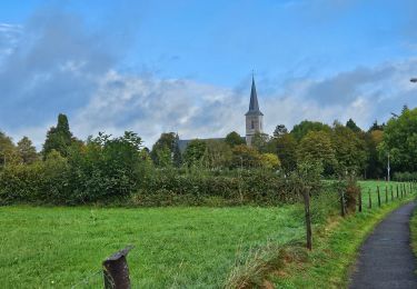
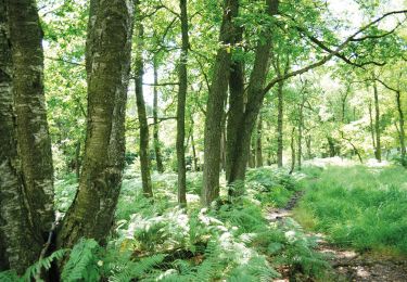
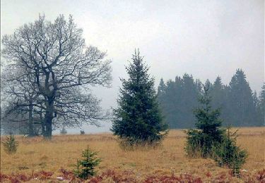
Randonnée Marche de 13,4 km à découvrir à Wallonie, Liège, Raeren. Cette randonnée est proposée par mumu.larandonneuse.
Description
Tracé points-noeuds pris sur l'app NodeMapp.
Suivre n° 9 14 31 71 36 74 8 63 69 64 66 47 44 59 98 77 61 60 9.
Départ du Château/Musée de Raeren
Localisation
Pays :
Belgique
Région :
Wallonie
Département/Province :
Liège
Commune :
Raeren
Localité :
Raeren
Départ:(Dec)
Départ:(UTM)
297468 ; 5615904 (32U) N.
Commentaires
Randonnées à proximité
![Randonnée Marche Eupen - RB-Lg-05_Barrage-d'Eupen - Photo](https://media.geolcdn.com/t/375/260/ext.jpg?maxdim=2&url=https%3A%2F%2Fservices.sitytrail.com%2FGeolivesWS%2FDownloadMedia.ashx%3FTrailID%3D179562%26Media%3D7980f674-60b2-4319-848f-6714eb887ad5.jpg)
![Marche Marche](https://static1.geolcdn.com/sitytour/trail-icons/101.png)
RB-Lg-05_Barrage-d'Eupen
Marche
Très difficile
(11)
Eupen,
Wallonie,
Liège,
Belgique
![](/images/other/stat-length.png)
21 km | 26 km-effort
5h 49min
![](https://static1.geolcdn.com/siteimages/upload/files/16400158638029165_repeat_loop_refresh_sync_direction_icon.png)
Oui
![Randonnée Marche Eupen - Barrage d'Eupen - Photo](https://media.geolcdn.com/t/375/260/90a093c8-ca4c-4f2d-8dba-28de0ca9565e.jpg&format=jpg&maxdim=2)
![Marche Marche](https://static1.geolcdn.com/sitytour/trail-icons/101.png)
Barrage d'Eupen
Marche
Moyen
(1)
Eupen,
Wallonie,
Liège,
Belgique
![](/images/other/stat-length.png)
12 km | 14,4 km-effort
3h 16min
![](https://static1.geolcdn.com/siteimages/upload/files/16400158638029165_repeat_loop_refresh_sync_direction_icon.png)
Oui
![Randonnée Marche Eupen - Barrage d'Eupen - Photo](https://media.geolcdn.com/t/375/260/aecf99e8-444d-43fd-940e-03b123a2fe72.jpg&format=jpg&maxdim=2)
![Marche Marche](https://static1.geolcdn.com/sitytour/trail-icons/101.png)
Barrage d'Eupen
Marche
Facile
(1)
Eupen,
Wallonie,
Liège,
Belgique
![](/images/other/stat-length.png)
14,2 km | 17,1 km-effort
3h 53min
![](https://static1.geolcdn.com/siteimages/upload/files/16400158638029165_repeat_loop_refresh_sync_direction_icon.png)
Oui
![Randonnée Marche Raeren - Raeren - Photo](https://media.geolcdn.com/t/375/260/423c8447-b257-4538-8bf5-b82f7fde1439.jpg&format=jpg&maxdim=2)
![Marche Marche](https://static1.geolcdn.com/sitytour/trail-icons/101.png)
![Randonnée Marche Raeren - Petergensfeld - Natura 2000, des sites qui valent le détour - Lg21 - Photo](https://media.geolcdn.com/t/375/260/ext.jpg?maxdim=2&url=https%3A%2F%2Fservices.sitytrail.com%2FGeolivesWS%2FDownloadMedia.ashx%3FTrailID%3D612568%26Media%3D681f47ef-4b07-41b4-ba43-227c6775122c.JPG)
![Marche Marche](https://static1.geolcdn.com/sitytour/trail-icons/101.png)
Petergensfeld - Natura 2000, des sites qui valent le détour - Lg21
Marche
Moyen
(4)
Raeren,
Wallonie,
Liège,
Belgique
![](/images/other/stat-length.png)
13,8 km | 16,1 km-effort
3h 26min
![](https://static1.geolcdn.com/siteimages/upload/files/16400158638029165_repeat_loop_refresh_sync_direction_icon.png)
Oui
![Randonnée Marche Eupen - RB-Lg-05_Barrage-d'Eupen_via-raccourci - Photo](https://media.geolcdn.com/t/375/260/ext.jpg?maxdim=2&url=https%3A%2F%2Fservices.sitytrail.com%2FGeolivesWS%2FDownloadMedia.ashx%3FTrailID%3D209405%26Media%3D2f0b60af-bd30-4227-95f2-7ed80e415229.jpg)
![Marche Marche](https://static1.geolcdn.com/sitytour/trail-icons/101.png)
RB-Lg-05_Barrage-d'Eupen_via-raccourci
Marche
Très difficile
(1)
Eupen,
Wallonie,
Liège,
Belgique
![](/images/other/stat-length.png)
18,5 km | 22 km-effort
5h 6min
![](https://static1.geolcdn.com/siteimages/upload/files/16400158638029165_repeat_loop_refresh_sync_direction_icon.png)
Oui
![Randonnée Marche Raeren - Venn trilogie (2eme étape) - Photo](https://media.geolcdn.com/t/375/260/27f84523-0a25-4d22-8ea7-8cee03cc185d.jpg&format=jpg&maxdim=2)
![Marche Marche](https://static1.geolcdn.com/sitytour/trail-icons/101.png)
Venn trilogie (2eme étape)
Marche
Facile
(1)
Raeren,
Wallonie,
Liège,
Belgique
![](/images/other/stat-length.png)
21 km | 25 km-effort
4h 15min
![](https://static1.geolcdn.com/siteimages/upload/files/16400158638029165_repeat_loop_refresh_sync_direction_icon.png)
Non
![Randonnée Marche Eupen - Eupen, par bois, prairies et chemins - Photo](https://media.geolcdn.com/t/375/260/ext.jpg?maxdim=2&url=https%3A%2F%2Fservices.sitytrail.com%2FGeolivesWS%2FDownloadMedia.ashx%3FTrailID%3D757615%26Media%3D20170521143224.jpg)
![Marche Marche](https://static1.geolcdn.com/sitytour/trail-icons/101.png)
Eupen, par bois, prairies et chemins
Marche
Facile
(1)
Eupen,
Wallonie,
Liège,
Belgique
![](/images/other/stat-length.png)
12,8 km | 15,5 km-effort
3h 24min
![](https://static1.geolcdn.com/siteimages/upload/files/16400158638029165_repeat_loop_refresh_sync_direction_icon.png)
Oui
![Randonnée Marche Eupen - 20250120 - Barrage Eupen 6.4 Km - Photo](https://media.geolcdn.com/t/375/260/e1fc0c94-0101-453e-bad2-8f407786fbf8.jpeg&format=jpg&maxdim=2)
![Marche Marche](https://static1.geolcdn.com/sitytour/trail-icons/101.png)
20250120 - Barrage Eupen 6.4 Km
Marche
Moyen
Eupen,
Wallonie,
Liège,
Belgique
![](/images/other/stat-length.png)
6,4 km | 7,9 km-effort
1h 42min
![](https://static1.geolcdn.com/siteimages/upload/files/16400158638029165_repeat_loop_refresh_sync_direction_icon.png)
Oui
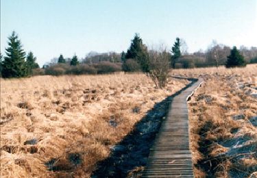
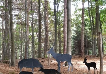
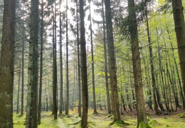
Une belle randonnée variée, campagnarde et boisée autour de Raeren.