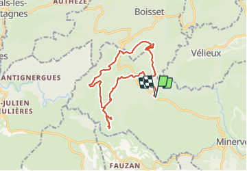
![](/images/other/stat-length.png)
![Randonnée Marche Minerve - Les dolmens de Vieulac - Photo](https://media.geolcdn.com/t/1900/400/196751be-1369-4baa-8673-7b511991989e.jpg&format=pjpeg&maxdim=2)
Les dolmens de Vieulac
Raymond DAVID
Utilisateur
![Longueur](/images/other/stat-length.png)
![Altitude max](https://static1.geolcdn.com/siteimages/upload/files/1508320355ic_sort_altitude_max_24dp.png)
![Dénivelé positif](https://static1.geolcdn.com/siteimages/upload/files/1508320355ic_sort_den_pos_24dp.png)
![Km-Effort](/images/other/stat-length.png)
![Altitude min](https://static1.geolcdn.com/siteimages/upload/files/1508320355ic_sort_altitude_min_24dp.png)
![Dénivelé négatif](https://static1.geolcdn.com/siteimages/upload/files/1508320355ic_sort_den_neg_24dp.png)
![Boucle](https://static1.geolcdn.com/siteimages/upload/files/16400158638029165_repeat_loop_refresh_sync_direction_icon.png)
![Marche](https://static1.geolcdn.com/sitytour/trail-icons/101.png)
5h00
Difficulté : Moyen
![Scannez ce code QR pour ouvrir la randonnée dans l'application SityTrail](https://capi.geolives.com/qq0zvz2zws4bq2lad0pu/sitytour/trails/3841361/qr.png?size=200)
Application GPS de randonnée GRATUITE
À propos
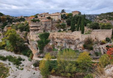
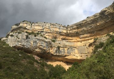
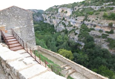
Randonnée Marche de 16,8 km à découvrir à Occitanie, Hérault, Minerve. Cette randonnée est proposée par Raymond DAVID .
Description
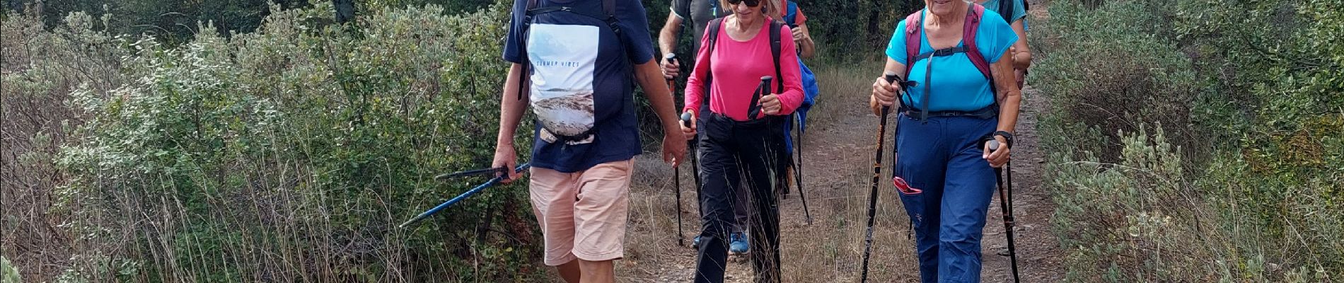
Randonnée plutôt physique.
Attention privilégier la route pour aller à Vieux-Bois plutôt que le grand chemin (clôture, barrières) bien que les propriétaires soient très sympa.
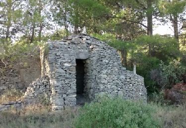
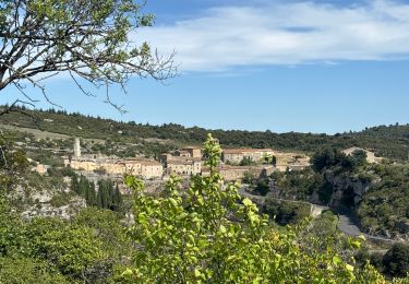
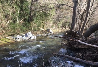
A voir la vue sur la Cessé, les dolmens et rechercher les canaules près des dolmens.
Ensuite revenir par Vieux-Bois.
Localisation
Commentaires
Randonnées à proximité
![Randonnée sport Minerve - Minerve bouclé Hérault - Photo](https://media.geolcdn.com/t/375/260/d578c921-3c99-4e11-b589-7310c0cb7ada.jpg&format=jpg&maxdim=2)
sport
![](/images/other/stat-length.png)
![](https://static1.geolcdn.com/siteimages/upload/files/16400158638029165_repeat_loop_refresh_sync_direction_icon.png)
![Randonnée V.T.T. Minerve - minerve - Photo](https://media.geolcdn.com/t/375/260/99c6c1a4-f768-4c35-9e57-edeb97d705f4.jpg&format=jpg&maxdim=2)
![V.T.T. V.T.T.](https://static1.geolcdn.com/sitytour/trail-icons/202.png)
![Randonnée A pied Minerve - Les Mégalithes de Minerve - Photo](https://media.geolcdn.com/t/375/260/09b6594c-9884-4989-80d8-c89c14cd8660.jpeg&format=jpg&maxdim=2)
![A pied A pied](https://static1.geolcdn.com/sitytour/trail-icons/100.png)
A pied
![](/images/other/stat-length.png)
![](https://static1.geolcdn.com/siteimages/upload/files/16400158638029165_repeat_loop_refresh_sync_direction_icon.png)
![Randonnée A pied Minerve - Minerve, option1 - Photo](https://media.geolcdn.com/t/375/260/37463d8e-775e-4e62-a289-ecda8d9218e0.jpg&format=jpg&maxdim=2)
![A pied A pied](https://static1.geolcdn.com/sitytour/trail-icons/100.png)
A pied
![](/images/other/stat-length.png)
![](https://static1.geolcdn.com/siteimages/upload/files/16400158638029165_repeat_loop_refresh_sync_direction_icon.png)
![Randonnée Marche Minerve - Minerve - Gorges du Briant par le GR77 - Photo](https://media.geolcdn.com/t/375/260/97caecbd-e9d5-44d1-935f-95f6684b4214.jpg&format=jpg&maxdim=2)
![Marche Marche](https://static1.geolcdn.com/sitytour/trail-icons/101.png)
Marche
![](/images/other/stat-length.png)
![](https://static1.geolcdn.com/siteimages/upload/files/16400158638029165_repeat_loop_refresh_sync_direction_icon.png)
![Randonnée Marche Minerve - Minerve gorges du Briant & de la Cesse 26_09_2020 - Photo](https://media.geolcdn.com/t/375/260/36f71672-d14a-4923-85ae-9412860a6ed5.jpg&format=jpg&maxdim=2)
![Marche Marche](https://static1.geolcdn.com/sitytour/trail-icons/101.png)
Marche
![](/images/other/stat-length.png)
![](https://static1.geolcdn.com/siteimages/upload/files/16400158638029165_repeat_loop_refresh_sync_direction_icon.png)
![Randonnée Marche Cesseras - La Cesse à Cesseras par la Balme rouge, Vieulac, le moulin d'Azam - Photo](https://media.geolcdn.com/t/375/260/dd3e4d89-25db-4ae9-b8d6-22251b05250b.jpg&format=jpg&maxdim=2)
![Marche Marche](https://static1.geolcdn.com/sitytour/trail-icons/101.png)
Marche
![](/images/other/stat-length.png)
![](https://static1.geolcdn.com/siteimages/upload/files/16400158638029165_repeat_loop_refresh_sync_direction_icon.png)
![Randonnée Marche Azillanet - la ramière boucle - Photo](https://media.geolcdn.com/t/375/260/ext.jpg?maxdim=2&url=https%3A%2F%2Fservices.sitytrail.com%2FGeolivesWS%2FDownloadMedia.ashx%3FTrailID%3D534553%26Media%3Dfix__20160304143605.jpg)
![Marche Marche](https://static1.geolcdn.com/sitytour/trail-icons/101.png)
Marche
![](/images/other/stat-length.png)
![](https://static1.geolcdn.com/siteimages/upload/files/16400158638029165_repeat_loop_refresh_sync_direction_icon.png)
![Randonnée Marche Siran - Centeilles - Photo](https://media.geolcdn.com/t/375/260/ext.jpg?maxdim=2&url=https%3A%2F%2Fservices.sitytrail.com%2FGeolivesWS%2FDownloadMedia.ashx%3FTrailID%3D493850%26Media%3Dfix__20151114151824.jpg)
![Marche Marche](https://static1.geolcdn.com/sitytour/trail-icons/101.png)