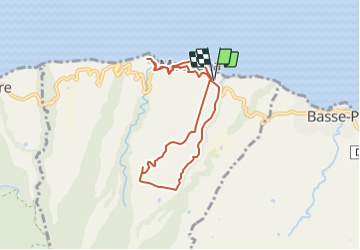
![](/images/other/stat-length.png)
![Randonnée Marche Macouba - Boucle de Macouba - Photo](https://media.geolcdn.com/t/1900/400/ext.pjpeg?maxdim=2&url=https%3A%2F%2Fstatic1.geolcdn.com%2Fsiteimages%2Fupload%2Ffiles%2F1553511878bg_sport_marche.png)
Boucle de Macouba
Lamartiniere
Utilisateur GUIDE
![Longueur](/images/other/stat-length.png)
![Altitude max](https://static1.geolcdn.com/siteimages/upload/files/1508320355ic_sort_altitude_max_24dp.png)
![Dénivelé positif](https://static1.geolcdn.com/siteimages/upload/files/1508320355ic_sort_den_pos_24dp.png)
![Km-Effort](/images/other/stat-length.png)
![Altitude min](https://static1.geolcdn.com/siteimages/upload/files/1508320355ic_sort_altitude_min_24dp.png)
![Dénivelé négatif](https://static1.geolcdn.com/siteimages/upload/files/1508320355ic_sort_den_neg_24dp.png)
![Boucle](https://static1.geolcdn.com/siteimages/upload/files/16400158638029165_repeat_loop_refresh_sync_direction_icon.png)
![Marche](https://static1.geolcdn.com/sitytour/trail-icons/101.png)
3h05
Difficulté : Difficile
![Scannez ce code QR pour ouvrir la randonnée dans l'application SityTrail](https://capi.geolives.com/qq0zvz2zws4bq2lad0pu/sitytour/trails/3837660/qr.png?size=200)
Application GPS de randonnée GRATUITE
À propos
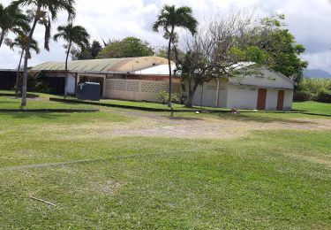
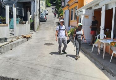
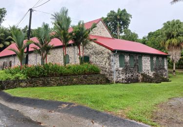
Randonnée Marche de 9,8 km à découvrir à Martinique, Inconnu, Macouba. Cette randonnée est proposée par Lamartiniere.
Description
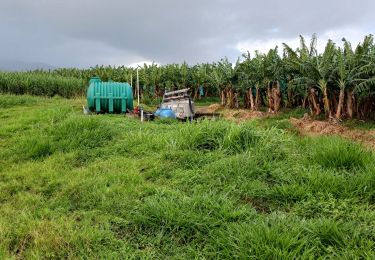
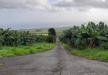
Demande d'autorisations de traverser les plantations .
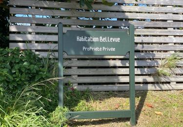
Celle de Maraud Des Grottes, plus pratique, pour rejoindre la D10, étant exclue du dispositif.
Cette randonnée sur exploitations agricoles de Basse-Pointe,
au Nord, nécessite obligatoirement des autorisations de
passages.
- Document d'assurance pour les associations en règle.
- Suivre les recommandations et les règles relatives à la sécurité et à l'hygiène (pas de détritus, etc.)
Localisation
Commentaires
Randonnées à proximité
![Randonnée Marche Basse-Pointe - Exploitations agricoles en boucle N°1 - Photo](https://media.geolcdn.com/t/375/260/25d4e89e-0741-47b9-9c1b-39c4a8472812.jpg&format=jpg&maxdim=2)
![Marche Marche](https://static1.geolcdn.com/sitytour/trail-icons/101.png)
Marche
![](/images/other/stat-length.png)
![](https://static1.geolcdn.com/siteimages/upload/files/16400158638029165_repeat_loop_refresh_sync_direction_icon.png)
![Randonnée Marche Basse-Pointe - Boucle de chalvet, Pécoule vers Chalvet. - Photo](https://media.geolcdn.com/t/375/260/1e4cabaa-63c0-46f7-b111-2c87348cf0ee.jpg&format=jpg&maxdim=2)
![Marche Marche](https://static1.geolcdn.com/sitytour/trail-icons/101.png)
Marche
![](/images/other/stat-length.png)
![](https://static1.geolcdn.com/siteimages/upload/files/16400158638029165_repeat_loop_refresh_sync_direction_icon.png)
![Randonnée Marche Basse-Pointe - Grande Boucle sur Basse pointe. - Photo](https://media.geolcdn.com/t/375/260/08174d61-6359-47a0-ac79-c9191649aa79.jpg&format=jpg&maxdim=2)
![Marche Marche](https://static1.geolcdn.com/sitytour/trail-icons/101.png)
Marche
![](/images/other/stat-length.png)
![](https://static1.geolcdn.com/siteimages/upload/files/16400158638029165_repeat_loop_refresh_sync_direction_icon.png)
![Randonnée Marche Basse-Pointe - Rondes des Habitations - Photo](https://media.geolcdn.com/t/375/260/5f89952c-65e5-4451-8506-589133283762.jpg&format=jpg&maxdim=2)
![Marche Marche](https://static1.geolcdn.com/sitytour/trail-icons/101.png)
Marche
![](/images/other/stat-length.png)
![](https://static1.geolcdn.com/siteimages/upload/files/16400158638029165_repeat_loop_refresh_sync_direction_icon.png)
![Randonnée Marche Grand'Rivière - Boucle Malakoff - Grand-Riviere - Photo](https://media.geolcdn.com/t/375/260/ac668fce-59c4-46c5-9559-31e72441e5de.jpg&format=jpg&maxdim=2)
![Marche Marche](https://static1.geolcdn.com/sitytour/trail-icons/101.png)
Marche
![](/images/other/stat-length.png)
![](https://static1.geolcdn.com/siteimages/upload/files/16400158638029165_repeat_loop_refresh_sync_direction_icon.png)
![Randonnée Marche Basse-Pointe - Boucle Habitations Gradis et Hackaert - Photo](https://media.geolcdn.com/t/375/260/4cf0b191-d0be-4326-ab51-5e44c3c72511.jpg&format=jpg&maxdim=2)
![Marche Marche](https://static1.geolcdn.com/sitytour/trail-icons/101.png)
Marche
![](/images/other/stat-length.png)
![](https://static1.geolcdn.com/siteimages/upload/files/16400158638029165_repeat_loop_refresh_sync_direction_icon.png)
![Randonnée sport Macouba - Boucle Macouba (habitation Bellevue) - Photo](https://media.geolcdn.com/t/375/260/3626c4e3-2e17-4d1d-84a9-6fddff1152eb.jpg&format=jpg&maxdim=2)
sport
![](/images/other/stat-length.png)
![](https://static1.geolcdn.com/siteimages/upload/files/16400158638029165_repeat_loop_refresh_sync_direction_icon.png)
![Randonnée Marche Macouba - Boucle Macouba 3 - Photo](https://media.geolcdn.com/t/375/260/3f6ece05-8d1d-40e9-a775-58018ef6d410.jpg&format=jpg&maxdim=2)
![Marche Marche](https://static1.geolcdn.com/sitytour/trail-icons/101.png)
Marche
![](/images/other/stat-length.png)
![](https://static1.geolcdn.com/siteimages/upload/files/16400158638029165_repeat_loop_refresh_sync_direction_icon.png)
![Randonnée Marche Grand'Rivière - PRÊCHEUR - PRÊCHEUR - Photo](https://media.geolcdn.com/t/375/260/0278fcc5-cf33-4ac9-8463-a9031b62d3ff.jpg&format=jpg&maxdim=2)
![Marche Marche](https://static1.geolcdn.com/sitytour/trail-icons/101.png)
Marche
![](/images/other/stat-length.png)
![](https://static1.geolcdn.com/siteimages/upload/files/16400158638029165_repeat_loop_refresh_sync_direction_icon.png)