Randonnée Marche Blandy - Le château fort aux cinq tours - Photo

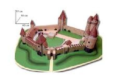
Le château fort aux cinq tours

Le mercredi c'est rando

© OpenStreetMap contributors
Longueur
Longueur
10,5 km
Altitude max
Altitude max
100 m
Dénivelé positif
Dénivelé positif
101 m
Km-Effort
Km-Effort  
11,8 km
Altitude min
Altitude min
62 m
Dénivelé négatif
Dénivelé négatif
101 m
Boucle
Boucle
Oui
Date de création :
2023-10-08 13:37:26.489
Dernière modification :
2023-10-08 13:38:51.165

(0 Avis)

Marche
Marche
2h41
Difficulté : Moyen

Scannez ce code QR pour ouvrir la randonnée dans l'application SityTrail

Application GPS de randonnée GRATUITE

Logo SityTrail SityTrail

IGN / Instituts géographiques

Télécharger SityTrail sur l'App Store Télécharger SityTrail sur Google Play

Logo SityTrail SityTrail World

Le monde est à vous

Télécharger SityTrail sur l'App Store Télécharger SityTrail sur Google Play Télécharger SityTrail sur Huawei AppGallery

À propos

Randonnée Marche de 10,5 km à découvrir à Île-de-France, Seine-et-Marne, Blandy. Cette randonnée est proposée par Randos du mercredi.

Description

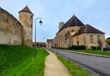
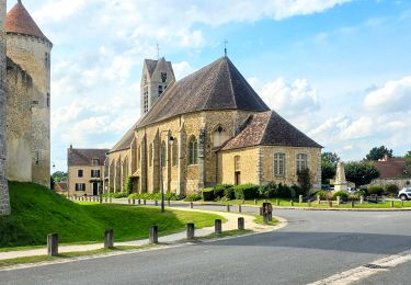
Cette randonnée à travers le val d’Ancœur vous permettra de découvrir ses paysages jalonnés d’un riche patrimoine, comme le château d’Aulnoy, la chapelle N.D. de Roiblay et le château fort de Blandy-les-Tours.

Profil altimétrique

Points d'intérêt

Point d'intérêt Blandy -  - Photo
CL48
BLANDY 
Point d'intérêt Blandy -  - Photo
CL48
BLANDY 
Point d'intérêt Blandy -  - Photo
CL48
BLANDY 
Point d'intérêt Champeaux -  - Photo
CL48
CHAMPEAUX 
Point d'intérêt Champeaux -  - Photo
CL48
CHAMPEAUX 
Point d'intérêt Champeaux -  - Photo
CL48
CHAMPEAUX 
Point d'intérêt Blandy -  - Photo
CL48
BLANDY 

Localisation

Pays :
France
Région :
Île-de-France
Département/Province :
Seine-et-Marne
Commune :
Blandy
Localité :
Unknown
Départ:(Dec)
Départ:(UTM)
483804 ; 5379374 (31U) N.

Randonnées à proximité

Randonnée Marche Blandy - JC 52 Eglises Médiévales de la Brie, La Collégiale de Champeaux - Photo
Marche

Marche

Difficile
(2)
Blandy, Île-de-France, Seine-et-Marne, France
20 km | 22 km-effort
5h 5min
Oui
Randonnée Marche Blandy - Boucle 23 km Blandy - St Merry - Bombon - Champeaux - Photo
Marche
GUIDE
chessyca

Marche

Moyen
Blandy, Île-de-France, Seine-et-Marne, France
23 km | 25 km-effort
5h 42min
Oui
Randonnée Marche Blandy - Boucle 21 km Blandy - Bombom - St Mery - Champeaux - Photo
Marche
GUIDE
chessyca

Marche

Facile
Blandy, Île-de-France, Seine-et-Marne, France
21 km | 23 km-effort
4h 44min
Oui
Randonnée Marche Blandy - Boucle autour de Blandy par Corinne  - Photo
Marche
GUIDE
chessyca

Marche

Facile
Blandy, Île-de-France, Seine-et-Marne, France
23 km | 25 km-effort
4h 53min
Oui
Randonnée Marche Blandy - JC 15 - 21 km Curiosités autour de Blandy  - Photo
Marche

Marche

Difficile
(1)
Blandy, Île-de-France, Seine-et-Marne, France
21 km | 24 km-effort
5h 27min
Oui
Randonnée Marche Saint-Méry - Boucle autour de Saint Mery 20 km - Photo
Marche
GUIDE
chessyca

Marche

Très facile
Saint-Méry, Île-de-France, Seine-et-Marne, France
21 km | 24 km-effort
4h 53min
Oui
Randonnée Marche Maincy - vaux le pénil - blandy les  tours  - Photo
Marche
DUGAEL

Marche

Très facile
Maincy, Île-de-France, Seine-et-Marne, France
21 km | 24 km-effort
5h 44min
Oui
Randonnée Marche Maincy - 3 chateaux - Photo
Marche
marianne guichoux

Marche

Moyen
Maincy, Île-de-France, Seine-et-Marne, France
26 km | 29 km-effort
6h 32min
Non
Randonnée Marche Maincy - Vaux-le-Vicomte  - Photo
Marche
floflo61

Marche

Moyen
Maincy, Île-de-France, Seine-et-Marne, France
5,8 km | 6,9 km-effort
1h 34min
Oui


Fermer
Mes abonnements