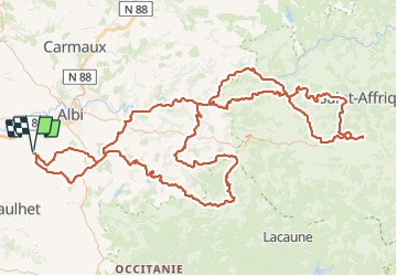
![](/images/other/stat-length.png)
![Randonnée Moto-cross Fénols - La route des seigneurs et chateaux Aveyronnais - Photo](https://media.geolcdn.com/t/1900/400/cc55bc8b-c631-4d92-a303-1c1fc25e23b1.jpg&format=pjpeg&maxdim=2)
La route des seigneurs et chateaux Aveyronnais
jpipacific
Utilisateur
![Longueur](/images/other/stat-length.png)
![Altitude max](https://static1.geolcdn.com/siteimages/upload/files/1508320355ic_sort_altitude_max_24dp.png)
![Dénivelé positif](https://static1.geolcdn.com/siteimages/upload/files/1508320355ic_sort_den_pos_24dp.png)
![Km-Effort](/images/other/stat-length.png)
![Altitude min](https://static1.geolcdn.com/siteimages/upload/files/1508320355ic_sort_altitude_min_24dp.png)
![Dénivelé négatif](https://static1.geolcdn.com/siteimages/upload/files/1508320355ic_sort_den_neg_24dp.png)
![Boucle](https://static1.geolcdn.com/siteimages/upload/files/16400158638029165_repeat_loop_refresh_sync_direction_icon.png)
![Moto-cross](https://static1.geolcdn.com/sitytour/trail-icons/406.png)
7h00
Difficulté : Facile
![Scannez ce code QR pour ouvrir la randonnée dans l'application SityTrail](https://capi.geolives.com/qq0zvz2zws4bq2lad0pu/sitytour/trails/3832121/qr.png?size=200)
Application GPS de randonnée GRATUITE
À propos
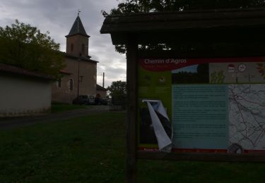
Randonnée Moto-cross de 269 km à découvrir à Occitanie, Tarn, Fénols. Cette randonnée est proposée par jpipacific.
Description
Magnifique route (uniquement asphalte) faite avec Honda Africa Twin CRF 1000 DCT.
Avec Christian en BMW 850 GS.
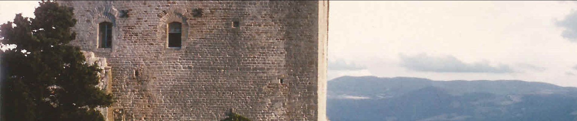
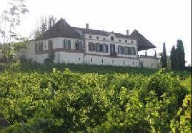
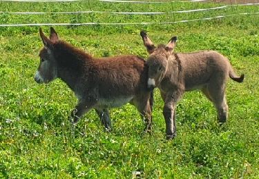
Des paysages très changeants tantôt au bord du Tarn, tantôt en crête, en sous bois, des petits villages, etc...Un régal.
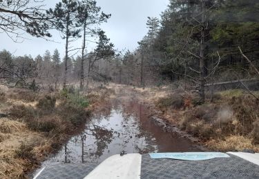
Les routes sont en très bon état.
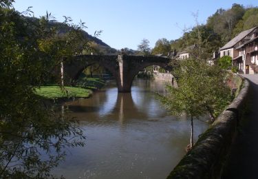
Route facile et le restaurant à Brousse le Château (Logis Hôtel le Relays du Chasteau) est à recommander. Pas trop cher et très bon.
Localisation
Commentaires
Randonnées à proximité
![Moto-cross Moto-cross](https://static1.geolcdn.com/sitytour/trail-icons/406.png)
Moto-cross
![](/images/other/stat-length.png)
![](https://static1.geolcdn.com/siteimages/upload/files/16400158638029165_repeat_loop_refresh_sync_direction_icon.png)
![Marche Marche](https://static1.geolcdn.com/sitytour/trail-icons/101.png)
Marche
![](/images/other/stat-length.png)
![](https://static1.geolcdn.com/siteimages/upload/files/16400158638029165_repeat_loop_refresh_sync_direction_icon.png)
![Randonnée Marche nordique Florentin - Sentier des colombes Florentin - Photo](https://media.geolcdn.com/t/375/260/bae8b8d3-bb4b-475b-a413-6e83538ce8b1.jpg&format=jpg&maxdim=2)
![Marche nordique Marche nordique](https://static1.geolcdn.com/sitytour/trail-icons/102.png)
Marche nordique
![](/images/other/stat-length.png)
![](https://static1.geolcdn.com/siteimages/upload/files/16400158638029165_repeat_loop_refresh_sync_direction_icon.png)
![Randonnée Marche Orban - SityTrail - 3061378 - orban-chemin-des-cretes - Photo](https://media.geolcdn.com/t/375/260/26a0c344-fd25-47d2-a26d-446f19e423e5.jpg&format=jpg&maxdim=2)
![Marche Marche](https://static1.geolcdn.com/sitytour/trail-icons/101.png)
Marche
![](/images/other/stat-length.png)
![](https://static1.geolcdn.com/siteimages/upload/files/16400158638029165_repeat_loop_refresh_sync_direction_icon.png)
![Randonnée 4x4 Fénols - Vabre Anglés Parc du haut Languedoc - Photo](https://media.geolcdn.com/t/375/260/efe61901-ab29-4794-b72e-2a76a5d8cb95.jpeg&format=jpg&maxdim=2)
![4x4 4x4](https://static1.geolcdn.com/sitytour/trail-icons/403.png)
4x4
![](/images/other/stat-length.png)
![](https://static1.geolcdn.com/siteimages/upload/files/16400158638029165_repeat_loop_refresh_sync_direction_icon.png)
![Randonnée V.T.T. Rouffiac - Circuit du Puech de Mourens - Rouffiac - Photo](https://media.geolcdn.com/t/375/260/ext.jpg?maxdim=2&url=https%3A%2F%2Fservices.sitytrail.com%2FGeolivesWS%2FDownloadMedia.ashx%3FTrailID%3D104295%26Media%3D7522_3.jpg)
![V.T.T. V.T.T.](https://static1.geolcdn.com/sitytour/trail-icons/202.png)
V.T.T.
![](/images/other/stat-length.png)
![](https://static1.geolcdn.com/siteimages/upload/files/16400158638029165_repeat_loop_refresh_sync_direction_icon.png)
![Randonnée Marche Rouffiac - Circuit du Puech de Mourens - Rouffiac - Photo](https://media.geolcdn.com/t/375/260/ext.jpg?maxdim=2&url=https%3A%2F%2Fservices.sitytrail.com%2FGeolivesWS%2FDownloadMedia.ashx%3FTrailID%3D104294%26Media%3D7522_3.jpg)
![Marche Marche](https://static1.geolcdn.com/sitytour/trail-icons/101.png)
Marche
![](/images/other/stat-length.png)
![](https://static1.geolcdn.com/siteimages/upload/files/16400158638029165_repeat_loop_refresh_sync_direction_icon.png)
![Marche Marche](https://static1.geolcdn.com/sitytour/trail-icons/101.png)
Marche
![](/images/other/stat-length.png)
![](https://static1.geolcdn.com/siteimages/upload/files/16400158638029165_repeat_loop_refresh_sync_direction_icon.png)
![Randonnée Marche Aussac - Aussac Fenols - Photo](https://media.geolcdn.com/t/375/260/7e85484a-811f-4fa2-9f42-bd4ceb8f983c.jpg&format=jpg&maxdim=2)
![Marche Marche](https://static1.geolcdn.com/sitytour/trail-icons/101.png)